Refine your search
Sale Section
- Art and Architecture (31)
- Bookbinding Tools & Accessories (16)
- Decorative and Topographical Prints (69)
- Early Printed Books and English Literature (84)
- General Literature and Illustrated Books (54)
- General Stock (51)
- Historical Documents and Ephemera (14)
- Maps and Charts (130)
- Military Books from the Collection of Bob Wyatt (49)
- Military, Aviation and Transport (23)
- Natural History Books and Prints (46)
- The Albizu Collection of Spanish Books & Manuscripts (50)
- The David Wilson Library of Natural History (Part II) (50)
- Travel, Exploration and British Topography (77)
- Vinyl Records (17)
Estimate
Category
- Books & Periodicals (448)
- Maps (124)
- Prints (109)
- Musical Instruments & Memorabilia (17)
- Watercolours (15)
- Arms, Armour & Militaria (13)
- Bank notes (4)
- Sporting Memorabilia & Equipment (4)
- Classic Cars, Motorcycles & Automobilia (3)
- Coins (3)
- Salvage & Architectural Antiques (3)
- Stamps (3)
- Collectables (2)
- Drawings & Pastels (2)
- Furniture (2)
- Kitchenalia (2)
- Photographs (2)
- Ceramics (1)
- Sculpture (1)
- Silver & Silver-plated items (1)
- Textiles (1)
- Tools (1)
Filtered by:
- Creator / Brand
- List
- Grid
A subscription to the Price Guide is required to view results for auctions ten days or older. Click here for more information

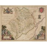
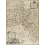
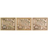
Middlesex. Smith (Joseph), The County of Middlesex Actually Survey'd and Delineated and Newly Corrected & Amended with many Additions..., 1714, la...
Moll (Herman). Atlas Manuale: Or a new sett of Maps of all parts of the earth, as well Asia, Africa and America as Europe wherein Geography is Rec...
* Monmouthshire. Blaeu (Johannes), Monumethensis comitatus. Vernacule Monmouth Shire, Amsterdam, circa 1645, engraved map with contemporary hand c...
Morden (Robert). A collection of eleven maps [1695 or later], eleven engraved maps, four with later hand colouring, occasional duplicates, each ap...
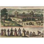
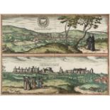
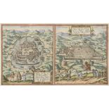
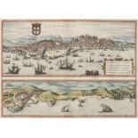
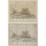
Nonsuch Palace. Braun, (Georg, and Hogenberg, Franz), Palatium Regium in Angliae Regno appellatum Nonciutz hoc est nusquam simile, circa 1582, eng...
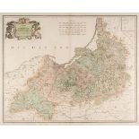
Northern Counties. Speed (John), The Countie of Westmorland and Kendale the cheif towne described, Henry Overton, circa 1743, hand coloured engrav...
Northern Europe. Lange (Johann Elias), Neue Karte den gegenwartigen Kriegs-Schauplatze..., 1788
Northern Europe. Lange (Johann Elias), Neue Karte den gegenwartigen Kriegs-Schauplatze zwischen den Russisch. Kayserl: und Königl: Schwedischen Ar...
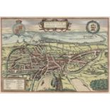
Norwich. Braun (Georg & Hogenberg Franz), Nordovicum Angliae Civitas, [1581], engraved city plan with bright contemporary hand colouring, 290 x 42...
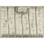
* Ogilby (John). The Continuation of the Road from London to the Lands End, Plate 2d, commencing at Andover com. Hants & extending to Crookhorn co...
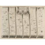
Ogilby (John). The Road from Bristol co. Glouc. to Banbury com Oxo. [1675 or later], uncoloured engraved strip road map, slight mount staining, 33...
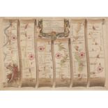
* Ogilby (John). The Road from London to Barstable in Devonshire, [1676 or later], hand coloured engraved strip road map, 'fox-hunting cartouche',...
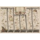
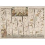
Ogilby (John). The Road from London to Rye in com. Sussex, circa 1676, hand coloured engraved strip road map, 300 x 450 mmQty: (1)NOTESThe road co...
Ogilby (John). The Road from London to St Davids in com Pembroke, [1676 or later], hand coloured engraved strip road map, laid on card, toned over...
Ogilby (John). The Road from London to the City of Bristol [and] The Continuation of the Road from London to Bristol, [1675 or later], two hand co...
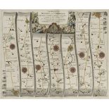
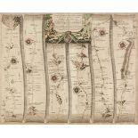
Ogilby (John). The Road from Oxford to Cambridge, circa 1675, hand coloured engraved strip road map, decorative cartouche showing a surveyor using...
Owen (John & Bowen Emanuel). Britannia Depicta or Ogilby Improv'd; being a Correct Coppy of Mr Ogilby's Actual Survey of all ye Direct & Principal...
Oxford. Braun (Georg & Hogenberg Franz), Oxonium Nobile Anglie oppidum..., [on sheet with] Vindesorium Celeberrimum Angliae Castrum..., [1572 - 16...
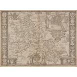
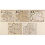
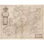
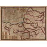
Oxfordshire. A mixed collection of 26 maps, 17th - 19th century, engraved county maps, road maps and town plans including examples by Kitchin, Jan...
* Oxfordshire. Blaeu (Johannes), Oxonium comitatus vulgo Oxford Shire, circa 1645, engraved map with bright contemporary hand colouring, large dec...
Oxfordshire. Blaeu (Johannes), Oxonium Comitatus vulgo Oxford Shire, Amsterdam, circa 1648, engraved map with contemporary hand colouring, heighte...
Oxfordshire. Speed (John), Oxfordshire described with ye Citie and the Armes of the Colledges of ye famous University, Thomas Bassett & Richard Ch...
Oxfordshire. Speed (John), Oxfordshire described with ye Citie and the Amres of the Colledges of yt famous University, John Sudbury & George Humbl...
Pembroke. Saxton (Christopher), Penbrok Comitat qui inter Meridionales Cambriae ... Ano. Dni. 1578, circa 1579, hand coloured engraved map, large ...
Peru. Braun (Georg & Hogenberg Franz), Mexico Regia et Celebris Hispaniae Novae Civitates [on sheet with] Cusco Regni Peru in Novo orbe Caput, Col...
* Poland. Albrizzi Girolamo/Tirion Isaac), Regno di Polonia, circa 1740, five engraved maps, four with hand colouring, in a variety of states with...
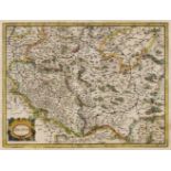
* Poland. Blaeu ( Willem Janszoon), Polonia Regnum et Silesia Ducatus, circa 1635, engraved map with contemporary outline colouring, decorative ca...
Poland. Blaeu (Johannes), Palatinatus Posnaniensis, in Maiori Polonia Primarii..., circa 1670
Poland. Blaeu (Johannes), Palatinatus Posnaniensis, in Maiori Polonia Primarii nova delineatio. per G. F. M. Amsterdam, circa 1670, engraved map w...
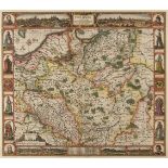
Poland. Danckerts (Justus), Regni Poloniae et Ducatus Lithuaniae, Voliniae, Podoliae, Ucraniae, Prussiae et Curlandiae..., Amsterdam circa 1700, e...
Poland. De L'Isle (Guillaume), La Pologne Dresee sur ce qu'en ont donne Starvolsk..., circa 1730
Poland. De L'Isle (Guillaume), La Pologne Dressée sur ce qu'en ont donné Starovolsk, Beauplan, Hartnoch et autres Auteurs..., J. Covens & C. Morti...
Poland. Mercator (Gerard & Hondius H.), Polonia, circa 1640, hand coloured engraved map, strapwork cartouche, central fold strengthened on verso, ...
Poland. Visscher (Nicholas), Haec Tabula nova Poloniae et Silesiae, Amsterdam, 1630, hand-coloured 'carte des figures' map engraved by A. Goos, wi...
* Poland. Von Reilly (Franz Johann Joseph), Karte von dem Konigreiche Preussen ..., Vienna, circa 1796, map engraved by Anton Benedieti with conte...
Poland/Pomerania. Jansson (Jan), Nova Illustrissimi ducta Pomeraniae tabula, Amsterdam, circa 1630, engraved map with contemporary outline colouri...
Poland/Pomerania. Seutter (Matthaus), Ducatus Pomeraniae cum magna Maris Balthici et Provinciarum ad Nexarum Parte..., Augsburg, 1725 - 1740, engr...
Poland/Silesia. Blaeu (Johannes), Ducatus Silesiae Glogani vera Delineatio..., Amsterdam, circa 1640, uncoloured engraved map, slight creasing, so...
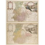
* Poland/Silesia. Homann (Johann Baptist, heirs of), Pricipatus Silesiae Wratislaviensis..., Nuremberg, circa 1750, two engraved maps with contemp...
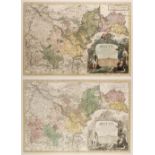
* Poland/Silesia. Homann (Johann Baptist, heirs of), Principatus Silesiae Bregensis..., Nuremberg, circa 1750, two engraved maps with contemporary...
* Poland/Silesia. Homann (J. B., heirs of), Principatus Silesiae Karnoviensis..., circa 1750
* Poland/Silesia. Homann (Johann Baptist, heirs of), Principatus Silesiae Karnoviensis..., Nuremberg, circa 1750, two engraved maps with contempor...
* Poland/Silesia. Ortelius (Abraham), Silesiae typus A Martino Helwigio Nissense descriptus et Nobili doctoque viro Domino Nicolao Rhedingero..., ...
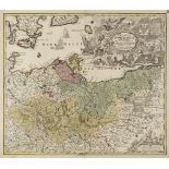
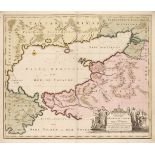
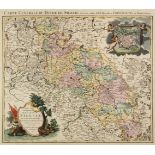
Pomerania . Le Rouge (George Louis), Duché de Pomeranie contenant les Duchées de Stettin, de Wolgats, de Bardt, de Cassubie, de Vandalie, la Princ...
Portugal. Braun (Georg & Hogenberg Franz), Lisbona Olisipo..., vulgo Lisbona Florentissimum Portugalliae Emporiu. [on sheet with] Cascale Lusitani...
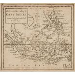
Prevost d'Exiles (Abbe Antoine Francois). Historische Beschryving der Reizen of Nieuwe en Volkome Verzameling Van de Allerwaardigste en Zeldzaamst...
Prussia. Le Rouge (George Louis), Le Royaume de Prusse suivant les nouvelles observations, Paris, 1742, engraved map with contemporary outline col...
* Russia. Hondius (Henricus/Jansson Jan), Novissima Russiae Tabula Authore Isaaco Massa, Amsterdam, circa 1658, engraved map with contemporary out...
Sea Chart. Mortier (Pierre), Carte Generale des costes de L'Europe sur L'Ocean comprises depuis Dronthem en Norvege jusques au Détroit de Gibralte...
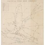
Sea charts. A large collection of approximately 180 charts, mostly early-mid 20th century, printed sea charts, many with annotations and notes, in...
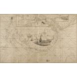
Sea charts. Collins (Captain Greenville), Untitled chart of the East coast of England, circa 1700, large uncoloured engraved chart, running from D...
Sea of Azof. Visscher (Nicolas), Nouvelle Carte Geographique de la Mer d'Asof ou de Zabache & des Palus Meotides, Amsterdam, circa 1700, engraved ...
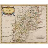
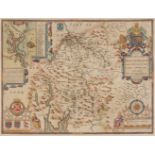
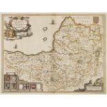
Shropshire. Speed (John), Shropshyre described, The Sittuations of Shrowesbury shewed with the Ames of thos Earles and other memorable things obse...
Silesia/Poland. Covens & Mortier (publishers), Sup.s et Inferioris Ducatus Silesiae..., circa 1741
Silesia/Poland. Covens J. & Mortier P. (publishers), Sup.s et Inferioris Ducatus Silesiae in suos XVII Minores..., Amsterdam, 1741, engraved map w...
* Somerset. Blaeu (Johannes), Somersettensis Comitatus. Somerset-Shire, Amsterdam, circa 1645, engraved map with contemporary outline colouring, d...
Somerset. Speed (John), Somerset -Shire described and in to Hundreds devided with the plott of the famous and most wholsom waters and citie of the...
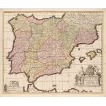
Spain. Visscher (Nicolas), Hispaniae et Portugalliae Regna, circa 1690, engraved map with contemporary hand colouring, large decorative uncoloured...
* Staffordshire. Speed (John), Stafford Countie and Towne with the ancient Citie Lichfeild described..., John Sudbury & George Humble, circa 1627,...
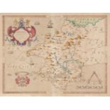
Surrey. Blome (Richard), A Mapp of Surrey with its Hundreds, circa 1673, hand coloured engraved map, 260 x 310 mm, mounted, together with Cumberla...
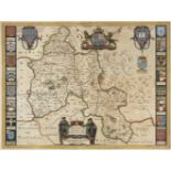
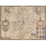
Surrey. Speed (John), Surrey Described and Divided into Hundreds, John Sudbury & George Humble, [1616], engraved map with early hand colouring, in...
![* Wales. Blome (Richard), A Generall Mapp of South Wales..., [1673]](https://portal-images.azureedge.net/auctions-2020/srdom10154/images/d2db4d86-9f32-416e-83f0-ac1e010569c4.jpg?w=155&h=155)
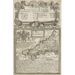
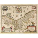
* Wales. Blome (Richard), A Generall Mapp of South Wales wherein are the Countyes of Glamorgan, Carmardan, Pembrok, Cardigan, Brecknock, Radnor, [...
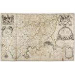
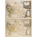
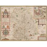
Warburton (John & Overton P.). The Counties of Essex, Middlesex & Hertfordshire actualy Survey'd by Several hands Corrected and Amended & Humbly D...
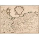
* Warsaw. Tardieu (Pierre), Varsovie, circa 1790, hand coloured engraved city plan orientated to the south-west, key below map identifying 64 loca...
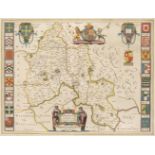
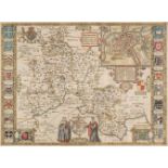
Warwickshire. Speed (John), The Counti of Warwick The Shire Towne and Citie of Coventre described, John Sudbury & George Humble, circa 1627, hand ...