Refine your search
Sale Section
- Antiquarian Literature, Pamphlets and Broadsides (69)
- Art (15)
- Autographs (25)
- Bookcases (1)
- British Topography (7)
- Decorative Prints (41)
- General Literature (9)
- Gogmagog Press and Concrete Poetry from the library of Alan & Joan Tuc (31)
- Historical Documents, Manuscripts and Ephemera (27)
- Illustrated Books (9)
- Juvenile Antiquarian (3)
- Maps and Topographical Views (107)
- Military and Aviation (26)
- Modern First Editions and Literary Autographs (96)
- Motoring and Transport (22)
- Natural History (23)
- Original Artwork (14)
- Posters (5)
- Private Press (17)
- Quantity Lots (61)
- Toys (5)
- Travel (12)
Estimate
Category
- Books & Periodicals (360)
- Maps (98)
- Prints (86)
- Arms, Armour & Militaria (14)
- Classic Cars, Motorcycles & Automobilia (12)
- Entertainment Memorabilia (8)
- Watercolours (8)
- Collectables (6)
- Oil, Acrylic paintings & Mixed Media (5)
- Photographs (4)
- Sporting Memorabilia & Equipment (4)
- Stamps (4)
- Drawings & Pastels (3)
- Salvage & Architectural Antiques (3)
- Ceramics (2)
- Furniture (2)
- Models, Toys, Dolls & Games (2)
- Bank notes (1)
- Coins (1)
- Musical Instruments & Memorabilia (1)
- Vintage Fashion (1)
Filtered by:
- Item Type
- List
- Grid
A subscription to the Price Guide is required to view results for auctions ten days or older. Click here for more information
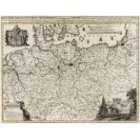

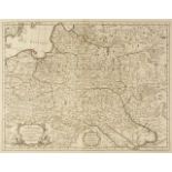
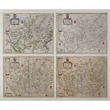
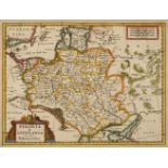
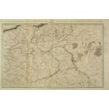
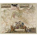
Germany/Prussia. Halma (Francois), Regni Borussiae et Electoratus Brandeburgici.., circa 1700
Germany/Prussia. Halma (Francois), Regni Borussiae et Electoratus Brandeburgici, Ceterarumque, Quae Friderici, Regis Boruss. sceptro reguntur, nec...
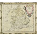
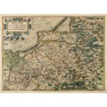
* Gloucestershire. Speed (John), Glocestershire contrived thirty thre severall hundreds and those againe into foure principall devisions. The citi...
Greenwood (C. & J.). A collection of eleven county maps, circa 1830, engraved maps, eight with contemporary hand colouring, some toning and staini...
![Hevelius (Johannes). Cepheus, published Dantzig, [1687],](https://portal-images.azureedge.net/auctions-2020/srdom10149/images/c086aa4e-ca23-443c-b3eb-abd600c66f98.jpg?w=155&h=155)
Hevelius (Johannes). Cepheus, published Dantzig, [1687], hand coloured engraved constellation map originally published in 'Firmamentum Sobiescianu...
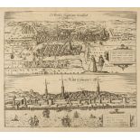
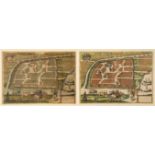
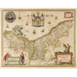
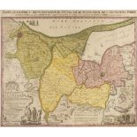
Konigsberg & Riga. Braun (Georg & Hogenberg Franz), Die Furtsliche Hauptt Statt Konigssberk...,
Königsberg [and] Riga. Braun (Georg & Hogenberg Franz), Die Furtsliche Hauptt Statt Konigssberk in Preussen [and] Riga percommode ad Duna Amnem Si...
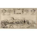
Latvia; Riga. Aveline (Antoine), Profil de la ville de Riga capitale de province de Livonie..., Paris, circa 1710, engraved panorama of Riga with ...
Lubin/Poland. Covens (Johannes & Mortier Cornelius), Lublin, Amsterdam, [1721], uncoloured engraved city plan with key plate below the image, 305 ...
Lviv/Ukraine. Braun (Georg & Hogenberg Franz), Leopolis Russuae Australis Urbs..., circa 1618
Lviv/Ukraine. Braun (Georg & Hogenberg Franz), Leopolis Russuae Australis Urbs primaria emporium mercium Orientalium celeberrimum, Cologne, circa ...
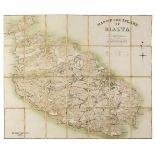
Malta. Woodward (Captain E. M., surveyor), Map of the Island of Malta, London: Intelligence Division, The War office, circa 1895, colour lithograp...
* Maps and prints. A collection of six engraved maps and prints, mostly 19th century, including Brion de la Tour (Louis). L'Angleterre divisée en ...
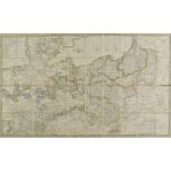
Maps. A mixed collection of approximately 100 maps, 18th & 19th century, engraved and lithographic British and foreign maps, including examples by...
Maps. A mixed collection of approximately ninety maps of British counties and regions, mostly 19th century, engraved maps of British counties and ...
Marienburg/Malbork, Northern Poland. Von Pufendorf (Samuel Baron), ...,Marienburgensis..., 1696
Marienburg/Malbork , Northern Poland. Von Pufendorf (Samuel Baron), Delineatio Geometrica Arcis et Civitatis Marienburgensis in Bolrussia..., Nure...
* Moscow. (Braun ( Georg, & Hogenberg, Franz), Moscauw, Moscovia, Urbs regionis eiusde nominis metropolitica, duplo maior, circa 1575, engraved ci...
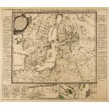
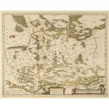
Northern Europe. Lange (Johann Elias), Neue Karte den gegenwartigen Kriegs-Schauplatze..., 1788
Northern Europe. Lange (Johann Elias), Neue Karte den gegenwartigen Kriegs-Schauplatze zwischen den Russisch. Kayserl: und Königl: Schwedischen Ar...
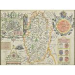
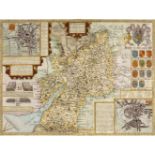
* Nottinghamshire. Speed (John), The Countie of Nottingham described, the Shire Townes situation and the Earls there of observed, John Sudbury & G...
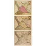
Nowa Marchia/Poland. Sotzmann (D. F.), Special Karte von der Neumark..., published Simon Schropp & Comp, Berlin, 1811, engraved map with contempor...
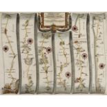
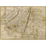
Ogilby (John). The Road from London to Newhaven com Sussex..., continued from Newhaven to New Shoreham com Sussex, circa 1680, hand coloured engra...
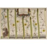
Ogilby (John). The Road from London to St Davids in com. Pembroke, circa 1675, hand coloured engraved strip road map, 305 x 450 mm, mounted (Qty: ...
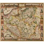
* Poland. Allard (Hugo), Nova Totius Regni Poloniae, Magniq. Ducatus Lithuaniae, cum suis Palatinatibus ac Confinis, published Amsterdam by Guilla...
Poland. Bertius (Petrus), Stettin, circa 1632, uncoloured engraved town plan, originally published in 'Commentariorum rerum Germanicarum libri tre...
Poland. Blaeu (J.), Ducatus Oswieczensis et Zatoriensis, Amsterdam circa 1670, engraved map of Southern Poland with bright contemporary hand colou...
Poland. Blaeu (Johannes), Palatinatus Posnaniensis, in Maiori Polonia Primarii..., circa 1670
Poland. Blaeu (Johannes), Palatinatus Posnaniensis, in Maiori Polonia Primarii nova delineatio. per G. F. M. Amsterdam, circa 1670, engraved map w...
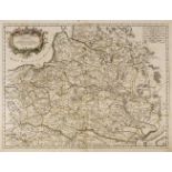
Poland. Blome (Richard), A Mapp of the Estates of the Crowne of Poland, where are the Kingdom of Poland withits Palatinates, the Dutches of Russia...
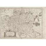
Poland. Danckerts (Justus), Regni Poloniae et Ducatus Lithuaniae, Voliniae, Podoliae, Ucraniae, Prussiae et Curlandiae..., Amsterdam circa 1700, e...
Poland. De L'Isle (Guillaume), La Pologne Dressée sur ce qu'en ont donné Starovolsk, Beauplan, Hartnoch et autres..., Paris, 1703, engraved map wi...
Poland. Gastaldi (Giacomo), Il vero disegno della seconda parte dil Regno di Polonia, Venice, 1568, uncoloured map, engraved by Paolo Forlani, tri...
Poland. Jansson (Jan), Novissima Poloniae Regni Descriptio , Amsterdam, circa 1660, engraved map with contemporary outline colouring, trimmed to n...
Poland. Jansson (Jan), Poloniae nova et Acurata descriptio, published Amsterdam, circa 1638, engraved map with contemporary outline colouring, sli...
* Poland. Jansson (Jan), Silesia Inferior..., Amsterdam, circa 1647, engraved map after J. Scultetus, contemporary hand colouring, 420 x 510 mm, w...
* Poland. Jansson (Jan), Tractuum Borussiae circa Gedanum et Elbingam..., Amsterdam, circa 1650
* Poland. Jansson (Jan), Tractuum Borussiae, circa Gedanum et Elbingam, ab Incolis Werder Appellati, cum Adiuncta Neringia, Nova et Elaboratissima...
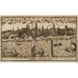
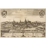
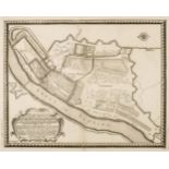
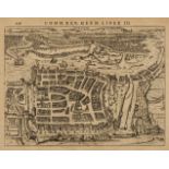
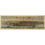
Poland. Muller ( Gottfried in Zittau ), Thoren , circa 1810, uncoloured woodcut panorama of Torun with key below image, 170 x 295 mm, together wit...
Poland. Rossi (Giacomo), Stati Della Corona di Polonia divisia nell sue principali Provincie e Palatinati, Rome, 1678, engraved map with contempor...
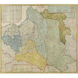
Poland. Sadebeck (August Friedrich pseud. Sirisa ), Polens Ende durch die letzen Theilungen und Besitznehmungen in den Jahren 1793 und 95 Preussen...
Poland. Sandrart (Jacob), Nova totius Regni Poloniae Mangique Ducatus Lituaniae cum suis Palatinabus Ac Confiniis Exacta Delineatio per G. Le Vass...
Poland. Visscher (Nicholas), Haec Tabula nova Poloniae et Silesiae, Amsterdam, 1630, hand-coloured 'carte des figures' map engraved by A. Goos, wi...
Poland. Zatta (Antonio), Il Regno di Polonia con le Provincie ora possedute dalle Tre confinati potenze Prussia Russia e Casa d'Austria, published...
Poland. Zurner (Adam Friedrich), Polonia et Lithuania cum suis Palatinatibus, circa 1680, hand coloured engraved map from Zurner's edition of Sans...
Poland/Pomerania. Jansson (Jan), Nova Illustrissimi ducta Pomeraniae tabula, Amsterdam, circa 1630, engraved map with contemporary outline colouri...
Poland/Pomerania . Le Rouge (George-Louis), Duché de Pomeranie, contenant les Duchés de Stettin, de Wolgats, de Bardt, de Cassubie, de Vandalie, L...
Poland/Pomerania. Seutter (Matthaus), Ducatus Pomeraniae cum magna Maris Balthici et Provinciarum ad Nexarum Parte..., Augsburg, 1725 - 1740, engr...
* Pomerania. Blaeu (Willem J.), Pomeraniae ducatus tabula Auctore Eilhardo Lubino, circa 1640
* Pomerania . Blaeu (Willem Janszoon), Pomeraniae ducatus tabula Auctore Eilhardo Lubino , Amsterdam, circa 1640, engraved map after E. Lubin, wit...
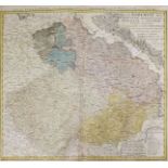
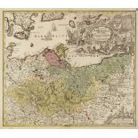
Pomerania. Quad (Matthias), Marca Brandenburgensis & Pomerania, published Johann Bussemacher, Cologne, circa 1592, uncoloured engraved map, inset ...
Pomerania . Waghenaer (L. J.), Caerte van de Zee Custe vant Landt te Pomere , also Tselfde in zijn Wessen en Gedaente is, Antwerp, circa 1600, sea...
Prussia. Blaeu (G.), Prussiae Nova Tabula Auctore Gasparo Henneberg Erlichensi, Amsterdam, circa 1635, hand coloured engraved map of north-eastern...
Prussia. De Jode (Gerard), Prussiae Regionis Sarmatiae Europae Nobibilis simae nova et vera descriptio , Antwerp, circa 1593, uncoloured engraved ...
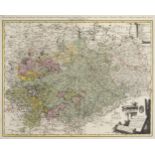
Prussia. Endersch (Johann Friedrich), Mappa Geographica Trium in Prussia, Quae Poloniareum Regi Serenissimo Paret, Accuratissima in qua Gedanensis...
Prussia. Gussefeld (F. L. & Homman J. B. , heirs of), ...., Ober-Saescsischen..., Nuremberg, 1783
Prussia. Gussefeld (F. L. & Homman J. B. , heirs of), Der Südliche Theil des Ober-Saescsischen Kreises die Chur-und Fürstl Sächsische..., Nurember...
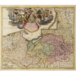
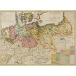
Prussia. Homann (Johann Baptiste), Regnum Borussiae Gloriosis auspicys Serenissimi et Potenetissimi Princ. Fridericic III Primi Borussiae..., Nure...
Prussia. Knittel (Johann Ernst), Neue militairische situations und Post-Carte von Polan und Preussen..., Nurmeberg, circa 1813, engraved map with ...
Prussia. Le Rouge (George Louis), Carte Generale de tous les Etats du Roy de Prusse..., Paris, circa 1760, engraved map with contemporary outline ...
* Prussia. Munster (Sebastian), Von dem Preussen Landt, [1550 and later], together four woodblock maps of Prussia, one with contemporary hand colo...
Prussia. Ortelius (Abraham), Thietmarsiae Holsaticae Regionis partis typus [and] Prussiae Descriptio ante aliquot annos ab Henrico Zellio..., Antw...

Prussia. Ottens (Reinier & Joshua), Regni Borussiae Secundum Observationes Novissima Acuratissima Descriptio, published Jan Barend Elwe, Amsterdam...
Prussia. Schleuen (Johann David), General-Carte der gesamten Koniglichen Preussischen..., 1750
Prussia. Schleuen (Johann David). General-Carte der Gesamten Königlichen Preussischen Lander, Berlin, [circa 1750], hand-coloured engraved map on ...
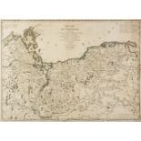
* Prussia. Sotzmann (Daniel Friedrich), General Karte von den Konig. Preussischen Staaten nach den neuesten und zuverlassigsten Hulfmitteln auf da...
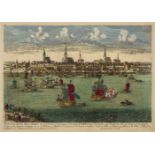
* Riga. Wolff ( Jeremias ), Riga Metropolis Livoniae , published Augsburg, circa 1750, large engraved panorama with contemporary hand colouring, s...
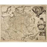
Russia. Ortelius (Abraham), Russiae , Moscoviae et Tartariae Descriptio , Auctore Antonio Jenkenson Anglo edita Londini Anno 1562, Amsterdam, [157...
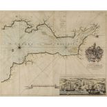
* Sea charts. Collins (Captain Greenville), The Severn or Channell of Bristoll , circa 1720, hand coloured engraved chart of the Severn Estuary, i...
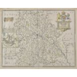
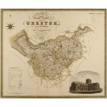
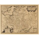
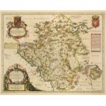
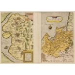
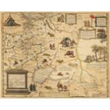
Shropshire. Saxton (Christopher & Lea Philip), Shropshire accuratly drawen and sett forth, 1693
Shropshire. Saxton (Christopher & Lea Philip), Shropshire accuratly drawen and sett forth by C. S. Corrected with some additions..., circa 1693, h...