Refine your search
Filtered by:
- Sale Section,
- Category,
- Creator / Brand
- List
- Grid
A subscription to the Price Guide is required to view results for auctions ten days or older. Click here for more information

Blaeu (Johannes), Ducatus Eboracensis Anglice York Shire, Ducatus Eboracensis pars Occidentalis; The
Blaeu (Johannes), Ducatus Eboracensis Anglice York Shire, Ducatus Eboracensis pars Occidentalis; The West Riding of Yorkshire, Ducatus Eboracensis...
Bowen (Emanuel), An Accurate Map of the County of York divided into its Wapontakes, drawn from
Bowen (Emanuel), An Accurate Map of the County of York divided into its Wapontakes, drawn from surveys with various improvements..., published J &...
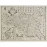
Bryant (A.), Map of the East Riding of Yorkshire from actual survey..., in the years 1827 & 1828,
Bryant (A.), Map of the East Riding of Yorkshire from actual survey..., in the years 1827 & 1828, published A. Bryant 1829, large scale uncoloured...
Clarke (James). A Survey of the Lakes of Cumberland, Westmorland and Lancashire: Together with an
Clarke (James). A Survey of the Lakes of Cumberland, Westmorland and Lancashire: Together with an Account, Historical, Topographical and Descripti...
Clarke (James). A Survey of the Lakes of Cumberland, Westmorland and Lancashire: Together with an
Clarke (James). A Survey of the Lakes of Cumberland, Westmorland and Lancashire: Together with an Account, Historical, Topographical and Descripti...
Greenwood (C.), Map of the County of York, made on the Basis of Triangles in the County, determined by Lieut. Col. Wm. Mudge, Royal Art. F.R.S. an...
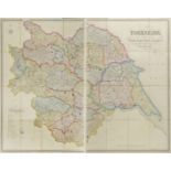
Hobson (William Colling), This Map of Yorkshire is most Respectfully dedicated to the Nobility,
Hobson (William Colling), This Map of Yorkshire is most Respectfully dedicated to the Nobility, Clergy, Gentry, Landowners and Manufacturers of th...
Hobson (William Colling). This Map of Yorkshire is most respectfully dedicated to the Nobility,
Hobson (William Colling). This Map of Yorkshire is most respectfully dedicated to the Nobility, Clergy, Gentry, Landowners and Manufacturers of th...
![Morden (Robert), The West Riding of Yorkshire,The East Riding of Yorkshire [and] The North Riding of](https://portal-images.azureedge.net/auctions-2017/srdom10087/images/66f9bd66-18a7-40c5-e028-16f0c35f9181.jpg?w=155&h=155)
Morden (Robert), The West Riding of Yorkshire,The East Riding of Yorkshire [and] The North Riding of
Morden (Robert), The West Riding of Yorkshire,The East Riding of Yorkshire [and] The North Riding of Yorshire, [1695 or later], together three han...
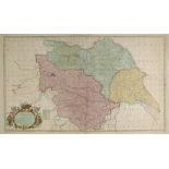
Overton (Philip & Bowles Thomas, publishers), A new map of the county of York laid down from an
Overton (Philip & Bowles Thomas, publishers), A new map of the county of York laid down from an actual survey wherein is included not only all Tow...
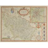
Saxton (Christopher & Hole WIlliam), Eboracensis comitatus pars Occidentalis vulgo West Riding,
Saxton (Christopher & Hole WIlliam), Eboracensis comitatus pars Occidentalis vulgo West Riding, Eboracensis comitatus pars Septentrionalis vulgo N...
![Saxton (Christopher & Webb William), [Yorkshire, circa 1642], untitled hand coloured map engraved by](https://portal-images.azureedge.net/auctions-2017/srdom10087/images/19564b60-0274-4c96-be2b-9d45112103f7.jpg?w=155&h=155)
Saxton (Christopher & Webb William), [Yorkshire, circa 1642], untitled hand coloured map engraved by
Saxton (Christopher & Webb William), [Yorkshire, circa 1642], untitled hand coloured map engraved by Augustus Ryther, on two conjoined sheets, ins...
Speed (John), The North and East Ridins of Yorkshire, 1st edition, published John Sudbury & George
Speed (John), The North and East Ridins of Yorkshire, 1st edition, published John Sudbury & George Humble, [1611], uncoloured engraved map, inset ...
![Speed (John), York Shire, published John Sudbury & George Humble, [1627], hand coloured engraved](https://portal-images.azureedge.net/auctions-2017/srdom10087/images/0e411551-97d7-4030-b27a-fc8fe5898c60.jpg?w=155&h=155)
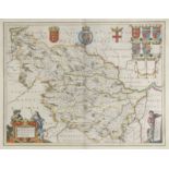
Speed (John), York Shire, published John Sudbury & George Humble, [1627], hand coloured engraved
Speed (John), York Shire, published John Sudbury & George Humble, [1627], hand coloured engraved map, split at base of central fold, repaired on v...
Speed (John), The West Ridinge of Yorkshyre with the most famous and fayre Citie Yorke described,
Speed (John), The West Ridinge of Yorkshyre with the most famous and fayre Citie Yorke described, published C.Dicey & Co., circa 1770, hand colour...
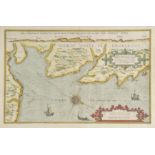
Waghenaer (Lucas van), Beschryvinghe vande zee custen van Engelandt tusschen Blargneii en Scharenburch..., circa 1583, hand coloured sea chart ori...