Filtered by:
- Primary Category,
- Category
- List
- Grid
A subscription to the Price Guide is required to view results for auctions ten days or older. Click here for more information

Ananthakrishna Iyer (L. K.). The Mysore Tribes and Castes, 4 volumes, Mysore: Mysore University,
Ananthakrishna Iyer (L. K.). The Mysore Tribes and Castes, 4 volumes, Mysore: Mysore University, 1935, 1928, 1930 & 1931, black & white plates, ma...
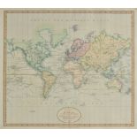
Blackie (W.G.). The Comprehensive Atlas & Geography of the World, published Blackie & Son, 1884,
Blackie (W.G.). The Comprehensive Atlas & Geography of the World, published Blackie & Son, 1884, additional half title, ten lithographic plates of...
Cary (John). Cary's New Universal Atlas, containing Distinct Maps of all the Principal States and
Cary (John). Cary's New Universal Atlas, containing Distinct Maps of all the Principal States and Kingdoms throughout the World from the Latest an...
Dutens (Louis, translated by John Highmore). Journal of Travels made through the Principal Cities of
Dutens (Louis, translated by John Highmore). Journal of Travels made through the Principal Cities of Europe, wherein the time employed in going fr...
Barclay (Rev. James). The Universal English Dictionary..., published J & F Tallis, circa 1850,
Barclay (Rev. James). The Universal English Dictionary..., published J & F Tallis, circa 1850, additional decorative half title, engraved frontisp...
![Africa. Ortelius (Abrahan), Presibiteri Johannis sive Abissinorum Imperii Descriptio, [1612],](https://portal-images.azureedge.net/auctions-2016/srdom10071/images/51ddd456-8588-4dc2-ed69-8c1a88e49b30.jpg?w=155&h=155)
Africa. Ortelius (Abrahan), Presibiteri Johannis sive Abissinorum Imperii Descriptio, [1612],
Africa. Ortelius (Abrahan), Presibiteri Johannis sive Abissinorum Imperii Descriptio, [1612], uncoloured engraved map, very slight toning to centr...
*Bedfordshire & Buckinghamshire. Jansson (Jan), Buckingamiae comitatus cum Befordiensi; vulgo
*Bedfordshire & Buckinghamshire. Jansson (Jan), Buckingamiae comitatus cum Befordiensi; vulgo Buckinghamshire and Bedfordshire, published Amsterda...

Braun (Georg, and Hogenberg, Franz). Pisaurum vulgo Pizaro, Vetustiss. ad mare Thyrrhenum Terracinae
Braun (Georg, and Hogenberg, Franz). Pisaurum vulgo Pizaro, Vetustiss. ad mare Thyrrhenum Terracinae oppidum, Tricaricum Basilicatae Civitas [and]...

*British Isles. Blaeu (Johannes), Britannia prout divisa suit temporibus Anglo-Saxonum praesertim
*British Isles. Blaeu (Johannes), Britannia prout divisa suit temporibus Anglo-Saxonum praesertim durante illorum Heptarchia, published Amsterdam,...
British Isles. Jansson (Jan), Insularum Britannicarum Acurata Delineatio ex Geographicis Conatibus
British Isles. Jansson (Jan), Insularum Britannicarum Acurata Delineatio ex Geographicis Conatibus Abrahami Ortelii, published Amsterdam, circa 16...

British Isles. Waldseemller (Martin), Untitled map of the British Isles, published Strasbourg,
British Isles. Waldseemller (Martin), Untitled map of the British Isles, published Strasbourg, circa 1520, Ptolemaic woodblock map with early hand...
Caernarvonshire. Speed (John), Caernarvon both Shyre and Shire-towne with the ancient Citie Bangor
Caernarvonshire. Speed (John), Caernarvon both Shyre and Shire-towne with the ancient Citie Bangor described, 1st edition, published John Sudbury ...

Cambridge. Braun (Georg & Hogenberg Frans), Cantebrigia Opulentissimi Anglie Regnum..., [1575 or
Cambridge. Braun (Georg & Hogenberg Frans), Cantebrigia Opulentissimi Anglie Regnum..., [1575 or later], engraved plan with contemporary hand colo...

*Cambridgeshire. Speed (John), Cambridgshire described with the devision of the hundreds, the Townes
*Cambridgeshire. Speed (John), Cambridgshire described with the devision of the hundreds, the Townes situation with the Armes of the colleges of t...

*Celestial Chart. Der Norliche Sternhimmel, published Hermann Haack, Leipzig, 1988, large lithographic chart of the northern celestial projection ...

*Celestial Chart. Unsere erde im Weltall (Our Earth in the Universe), published Hannover, 1960,
*Celestial Chart. Unsere erde im Weltall (Our Earth in the Universe), published Hannover, 1960, large colour lithographic poster showing projectio...

*Cornwall. Kitchin (Thomas), A New Improved Map of Cornwall from the best Surveys & Intelligences
*Cornwall. Kitchin (Thomas), A New Improved Map of Cornwall from the best Surveys & Intelligences Divided into its Hundreds..., circa 1770, engrav...
Crete. Ortelius (Abraham), Candia Insula - Archipelagi Insula rum Aliquot Descrip. [1588], uncoloured engraved map of Crete with a further ten ins...

England & Wales. Coronelli (Vincenzo Maria), Parte settentrionale de Regno d'Inghilterra..., [
England & Wales. Coronelli (Vincenzo Maria), Parte settentrionale de Regno d'Inghilterra..., [together with] Parte meridionale del regno d'Inghilt...

*England & Wales. Speed (John), The Kingdome of England, published Thomas Bassett & Richard Chiswell, [1676], engraved hand coloured 'carte-a-figu...
![England, Wales & Ireland. Anglia, Cambria [and] Hibernia, circa 1618,](https://portal-images.azureedge.net/auctions-2016/srdom10071/images/52c52a2d-c539-4062-b1cb-52eb295711ea.jpg?w=155&h=155)
England, Wales & Ireland. Bertius (Pieter), Anglia, Cambria [and] Hibernia, circa 1618, three uncoloured engraved maps with additional text leaves...

*Globe. Philips' 10 inch Terrestrial Globe, printed Philip & Son Ltd, 1958, twelve colour photolithographic gores, calibrated aluminium half merid...

Italy. Braun (Georg & Hogenberg Franz), Seravallum Celiberrimun Marchiae Tarusiniae, published
Italy. Braun (Georg & Hogenberg Franz), Seravallum Celiberrimun Marchiae Tarusiniae, published Cologne, circa 1590, uncoloured engraved plan of Se...
![Italy. Fries (Lorenz), Tabula nova Italiae [and] Tabula nova Siciliae, Sardiniae & Corsicae,](https://portal-images.azureedge.net/auctions-2016/srdom10071/images/c8d0809e-2cc3-492b-bf3b-609fadb06ba2.jpg?w=155&h=155)
Italy. Fries (Lorenz), Tabula nova Italiae [and] Tabula nova Siciliae, Sardiniae & Corsicae,
Italy. Fries (Lorenz), Tabula nova Italiae [and] Tabula nova Siciliae, Sardiniae & Corsicae, published Vienne, circa 1535, two uncoloured wood blo...

London. Smith (Charles), Map of the Country Twelve Miles round London, 1822, engraved map with
London. Smith (Charles), Map of the Country Twelve Miles round London, 1822, engraved map with contemporary outline colouring, engraved by W.R.Gar...

London. Mogg (Edward), London in Miniature with the Surrounding Villages, An entire new plan...,
London. Mogg (Edward), London in Miniature with the Surrounding Villages, An entire new plan..., 1808, engraved map with contemporary outline colo...
London. Andrews (John), Andrew's New and Accurate Map of the Country Twenty-five miles round London,
London. Andrews (John), Andrew's New and Accurate Map of the Country Twenty-five miles round London, on which are delineated from an Actual Survey...

London. Cruchley (George Frederick), Cruchley's New Plan of London Shewing all the New and Intended Improvements to the Present Time, new edition,...
Maps. A mixed collection of approximately 360 British and foreign maps, mostly 19th century,
Maps. A mixed collection of approximately 360 British and foreign maps, mostly 19th century, engraved and lithographic maps and town plans, includ...

Maps. A mixed collection of twelve maps, 17th - 19th century, engraved maps of Europe and European
Maps. A mixed collection of twelve maps, 17th - 19th century, engraved maps of Europe and European countries and regions including examples by Wel...

*Moscow. Mockba, published Hermann Haack, Leipzig, 1981, large colour lithographic pictorial plan of
*Moscow. Mockba, published Hermann Haack, Leipzig, 1981, large colour lithographic pictorial plan of Moscow (in Russian), 1515 x 1550 mm, framed a...

North Eastern England. Waghenaer (Lucas Janszoon), Caerte der Noordt custe va Engelandt, beginnende van Robinhodes baij tot Cocket Eijlandt ..., c...
Ortelius (Abraham). Belgii Veteris Typus, [and] Nobilis Hannoniae comitatus Descrip. (two copies),
Ortelius (Abraham). Belgii Veteris Typus, [and] Nobilis Hannoniae comitatus Descrip. (two copies), 1584, 1588 & 1602 respectively, three uncoloure...
*Ortelius (Abraham). Spectandum dedit Ortelius mortalib orbem Orbi spectandum Galleus Ortelium.
*Ortelius (Abraham). Spectandum dedit Ortelius mortalib orbem Orbi spectandum Galleus Ortelium. Papius, [1579 or later], engraved portrait of Abra...

*South East England. South East England, circa 1960, very large moulded colour plastic relief map
*South East England. South East England, circa 1960, very large moulded colour plastic relief map showing the topography and geography of southern...

Spain. Waghenaer (Lucas Janszoon), Die Zee Custen van Galissien, van Capo Daviles off tot Ortegal
Spain. Waghenaer (Lucas Janszoon), Die Zee Custen van Galissien, van Capo Daviles off tot Ortegal tho Galliciae orae maritimae a Promontorio Avila...

World. Homann (Johann Baptist), Planiglobii Terrestris cum utroq Hemisphaerio Caelesti Generalis
World. Homann (Johann Baptist), Planiglobii Terrestris cum utroq Hemisphaerio Caelesti Generalis Repraesentatio..., published Nuremberg, circa 173...
![World. Ortelius (Abraham), Typus Orbis Terrarum, published Antwerp, [1570], hand coloured map,](https://portal-images.azureedge.net/auctions-2016/srdom10071/images/f34e4c50-b38c-49ca-dfa0-290bdf4b255c.jpg?w=155&h=155)
World. Ortelius (Abraham), Typus Orbis Terrarum, published Antwerp, [1570], hand coloured map,
World. Ortelius (Abraham), Typus Orbis Terrarum, published Antwerp, [1570], hand coloured map, engraved by Franz Hogenberg, slight worming repair...

World. Blome (Richard), A Mapp or General carte of the World, Designed in two Plaine Hemisphers by
World. Blome (Richard), A Mapp or General carte of the World, Designed in two Plaine Hemisphers by Monsieur Sanson Geograph'r to the French King a...

World. Wells (Edward), A New Map of the Terraqueous Globe according to the latest Discoveries and
World. Wells (Edward), A New Map of the Terraqueous Globe according to the latest Discoveries and the most General Divisions of it into Continents...

World. Senex (John), A New Map of the World from the latest Observations, circa 1720, hand coloured engraved hemispheral map of the world, four a...

World. Munster (Sebastian), Das erst general, inhaltend die beschreibung und den circtel des gantzen
World. Munster (Sebastian), Das erst general, inhaltend die beschreibung und den circtel des gantzen erdtreichs und moeres, [1550 - 1578], hand co...

World. Munster (Sebastian), Ptolemeisch General Tafel die Halbe Kugel der Welt Begreiffende,
World. Munster (Sebastian), Ptolemeisch General Tafel die Halbe Kugel der Welt Begreiffende, published Basle, [1588 or later], hand coloured woodc...