Filtered by:
- Category,
- Item Type
- List
- Grid
This auctioneer has chosen to not publish their results. Please contact them directly for any enquiries.
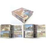

Local Interest Buckinghamshire / Hertfordshire : A 20thC postcard album to include country views and
Local Interest Buckinghamshire / Hertfordshire : A 20thC postcard album to include country views and vistas in local towns and villages Steeple Cl...
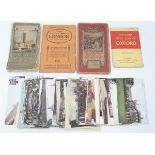
A quantity of assorted Oxford postcards, together with a 1921 ordnance survey map of Oxford, a
A quantity of assorted Oxford postcards, together with a 1921 ordnance survey map of Oxford, a coloured street plan of Oxford, a contoured road ma...
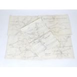
Five British Railway Eastern Region route maps. To include Stratford District, plan no. 51 L PY
Five British Railway Eastern Region route maps. To include Stratford District, plan no. 51 L PY 46, Ipswich District, plan no. 51 L PY 48, Norwich...
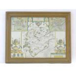
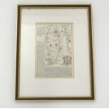
Map: A John Speed coloured map of Rutlandshire with inset plans of Oukham and Stanford. Approx. 14
Map: A John Speed coloured map of Rutlandshire with inset plans of Oukham and Stanford. Approx. 14 1/2" x 19 1/2"Please Note - we do not make ref...
Map: An 18thC double glazed hand coloured road strip map of the City of Oxford, with the Road from
Map: An 18thC double glazed hand coloured road strip map of the City of Oxford, with the Road from Oxford to Bristol verso, published in John Owen...
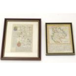
Maps: Two 18thC maps of Bedfordshire, comprising a hand coloured road strip map, published in John
Maps: Two 18thC maps of Bedfordshire, comprising a hand coloured road strip map, published in John Owen & Emanuel Bowen's Britannia Depicta or Ogi...
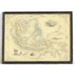
Map: A 19thC engraved and hand coloured map after J. Rapkin depicting Malay Archipelago or East
Map: A 19thC engraved and hand coloured map after J. Rapkin depicting Malay Archipelago or East India Islands, with illustrations of Victoria Moun...
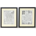
Maps: Two monochrome engraved and hand coloured county maps, one depicting Momouthshire with a
Maps: Two monochrome engraved and hand coloured county maps, one depicting Momouthshire with a view of Chepstow Castle and Tintern Abbey; the othe...
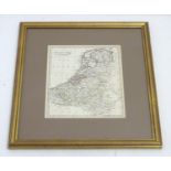
A 19thC hand coloured map of the Netherlands, by J. C. Russell Jnr. Approx. 9" x 7 1/2" Please
A 19thC hand coloured map of the Netherlands, by J. C. Russell Jnr. Approx. 9" x 7 1/2"Please Note - we do not make reference to the condition o...