Filtered by:
- Category,
- Creator / Brand
- List
- Grid
This auctioneer has chosen to not publish their results. Please contact them directly for any enquiries.
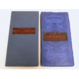

Maps: Two early 20thC Bartholomew?s maps, New Reduced Survey for Tourists and Cyclists, mounted on
Maps: Two early 20thC Bartholomew?s maps, New Reduced Survey for Tourists and Cyclists, mounted on cloth, 2" to 1 mile. To include Sheet 28 Bath, ...
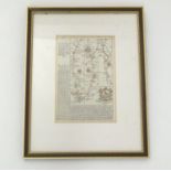
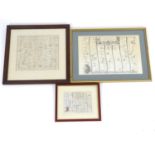
Map: An 18thC double glazed hand coloured road strip map of the City of Oxford, with the Road from
Map: An 18thC double glazed hand coloured road strip map of the City of Oxford, with the Road from Oxford to Bristol verso, published in John Owen...
Maps: Two maps of Devon, comprising an 18thC hand coloured road strip map, published in John
Maps: Two maps of Devon, comprising an 18thC hand coloured road strip map, published in John Owen & Emanuel Bowen's Britannia Depicta or Ogilby Im...
Maps: Two 18thC maps of Bedfordshire, comprising a hand coloured road strip map, published in John
Maps: Two 18thC maps of Bedfordshire, comprising a hand coloured road strip map, published in John Owen & Emanuel Bowen's Britannia Depicta or Ogi...
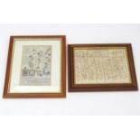
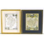
Maps: Three maps of Buckinghamshire, comprising a hand coloured map A New Map of Buckingham-shire
Maps: Three maps of Buckinghamshire, comprising a hand coloured map A New Map of Buckingham-shire drawn from the latest and best Authorities, by T...
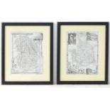
Maps: Three road strip maps, comprising the Road from London to Buckingham after John Ogilby, a hand
Maps: Three road strip maps, comprising the Road from London to Buckingham after John Ogilby, a hand coloured example of the same route, and a han...
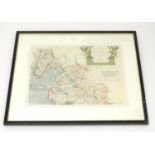
Maps: Three 19thC Admiralty navigational charts, comprising Bantry Bay, County Cork, Ireland,
Maps: Three 19thC Admiralty navigational charts, comprising Bantry Bay, County Cork, Ireland, Lough Swilly, County Donegal, Ireland and England wi...
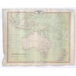
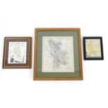
Map: A 19thC engraved map of Australia, New Zealand and East India Islands, engraved and published
Map: A 19thC engraved map of Australia, New Zealand and East India Islands, engraved and published by G. F. Crutchley. Approx. 15 1/2" x 18 1/2"Pl...
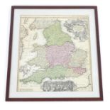
Map: An 18thC hand coloured engraved map of England and Wales by Johann Baptist Homann titled Magnae
Map: An 18thC hand coloured engraved map of England and Wales by Johann Baptist Homann titled Magnae Britanniae Pars Meridionalis in qua Regnum An...
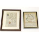
Map: A hand coloured map depicting the County Palatine of Lancaster, Yorkshire by Robert Morden.
Map: A hand coloured map depicting the County Palatine of Lancaster, Yorkshire by Robert Morden. Approx. 10" x 13 1/2"Please Note - we do not mak...
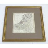
A 19thC hand coloured map of the Netherlands, by J. C. Russell Jnr. Approx. 9" x 7 1/2" Please
A 19thC hand coloured map of the Netherlands, by J. C. Russell Jnr. Approx. 9" x 7 1/2"Please Note - we do not make reference to the condition o...
Maps: Two monochrome engraved and hand coloured county maps, one depicting Momouthshire with a
Maps: Two monochrome engraved and hand coloured county maps, one depicting Momouthshire with a view of Chepstow Castle and Tintern Abbey; the othe...
Maps: Two engraved and hand coloured county maps after Thomas Moule, one depicting Warwickshire with
Maps: Two engraved and hand coloured county maps after Thomas Moule, one depicting Warwickshire with a view of Kenilworth Castle and Warwick Castl...
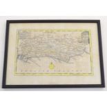
Map: An 18thC hand coloured map of Sussex engraved by Thomas Kitchin (1718-1784) and published in
Map: An 18thC hand coloured map of Sussex engraved by Thomas Kitchin (1718-1784) and published in Henry Boswell's atlas Antiquities of England & W...
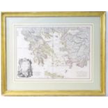
Map: An engraved and hand coloured map by W. Palmer after Louis Stanislas d'Arcy Delarochette
Map: An engraved and hand coloured map by W. Palmer after Louis Stanislas d'Arcy Delarochette depicting Greece, Archipelago and Anadoli. Approx. 2...