Refine your search
Filtered by:
- Category
- List
- Grid
This auctioneer has chosen to not publish their results. Please contact them directly for any enquiries.
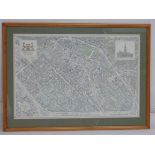

A framed 20thC limited edition map of the centre of Brussels by Anne Lernout, 1986. No. 303 of 2000, signed an numbered in pencil under. Approx. 2...
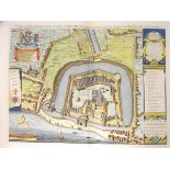
A late 20thC copy of Gulielmus Haiward and John Gascoyne's map, engraved by George Vertue, the plan of the Tower of London, entitled A true and ex...
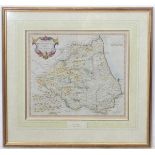
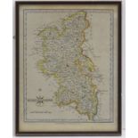
A framed map of the Bishoprick of Durham by Robert Morden, 1715. Approx. 15" x 43" CONDITION: Please Note - we do not make reference to the condi...
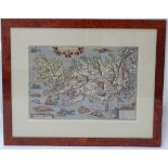
A print of Abraham Ortelius' map of Islandia - Iceland, from his atlas 'Theatrum Orbis Terrarum'.
A print of Abraham Ortelius' map of Islandia - Iceland, from his atlas 'Theatrum Orbis Terrarum'. Detailing Iceland's mountains, fjords, glaciers ...
A hand coloured map of Belgium. Approx. 12 1/2" x 22" CONDITION: Please Note - we do not make reference to the condition of lots within descripti...
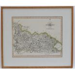
An engraved and hand coloured map of the north part of the West Riding of Yorkshire, published in New and Correct Atlas, by John Cary, 1809. Appro...
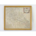
An engraved and hand coloured map of Buckinghamshire, published by John Cary, 1793. Approx. 10 1/4" x 8 1/4" CONDITION: Please Note - we do not m...
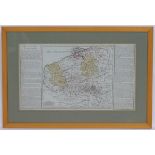
An engraved and hand coloured map of Northamptonshire, by Robert Morden, titled within a decorative cartouche, top right. Published by Abel Swale,...