Filtered by:
- Sale Section,
- Category
- List
- Grid
A subscription to the Price Guide is required to view results for auctions ten days or older. Click here for more information

After Pieter Casteels, a pair of hand-coloured engravings depicting vases of flowers for April and
After Pieter Casteels, a pair of hand-coloured engravings depicting vases of flowers for April and July inscribed from 'The Collection of Rob. Fur...
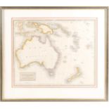
Drawn and engraved for Thomson's New General Atlas, New Holland and Asiatic Isles, engraved map,
Drawn and engraved for Thomson's New General Atlas, New Holland and Asiatic Isles, engraved map, hand coloured, 52 cm x 63 cm, framed and glazed.
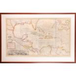
West Indies. Moll (Herman), 'A Map of the West-Indies or the Islands of America in the North Sea
West Indies. Moll (Herman), 'A Map of the West-Indies or the Islands of America in the North Sea with ye adjacent Countries; explaining what belon...
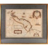
A 17th century hand-coloured engraving entitled 'Map of Guiana' Dutch text to verso recounting
A 17th century hand-coloured engraving entitled 'Map of Guiana' Dutch text to verso recounting history of the Wild Coast, by Jhannes Jansonius of ...
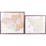
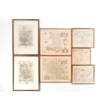
A Robert Morden map of North Wales , hand tinted, 37 x 43cm, together with an early 19th century map
A Robert Morden map of North Wales , hand tinted, 37 x 43cm, together with an early 19th century map of Durham, printed for C. Smith, 44.5 x 49cm ...
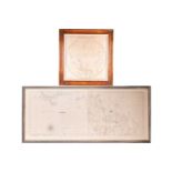
A framed French navigational circular map, 'Hemisphere Austral ou Antarctique', 18th century
A framed French navigational circular map, 'Hemisphere Austral ou Antarctique', 18th century coloured engraving, 67 cm square, together with a fur...
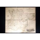
Greenwood, C. & J: 'Map of the County of Essex from an Actual Survey Made in the Year 1824'.
Greenwood, C. & J: 'Map of the County of Essex from an Actual Survey Made in the Year 1824'. Greenwood Pringle & Co., folio of two fold-out linen-...