Filtered by:
- Category,
- Creator / Brand
- List
- Grid
This auctioneer has chosen to not publish their results. Please contact them directly for any enquiries.
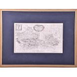

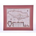
A 17th century map of Berkshire made by Richard Blome (1635 - 1705), engraved and dated by Wenceslas
A 17th century map of Berkshire made by Richard Blome (1635 - 1705), engraved and dated by Wenceslas Hollar (1607 - 1677), from the book 'Britanni...
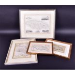
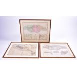
A group of four British maps of different parts of England comprising a map of 'Gloucestershire'
A group of four British maps of different parts of England comprising a map of 'Gloucestershire' published in 1806 by Laurie & Whittle, 24 x 19 c...
A group of six antique maps comprising an Italian map 'La Giammaica', 33 x 44 cm, a Spanish colour
A group of six antique maps comprising an Italian map 'La Giammaica', 33 x 44 cm, a Spanish colour bordered map 'Insula Iamaica in suas Parochias ...
A group of three antique French maps of Jamaica comprising 'Carte de l'Isle de La Jamaique, par le
A group of three antique French maps of Jamaica comprising 'Carte de l'Isle de La Jamaique, par le S. Beltin Ingen. de la Marine', 1758, 21 x 31 c...
A group of three British antique maps of Jamaica comprising A Correct map of Jamaica by B. Cole,
A group of three British antique maps of Jamaica comprising A Correct map of Jamaica by B. Cole, 11 x 20 cm; a Map of the Island of Jamaica by J. ...
A group of five antique rolled maps Espaniola, Hispalensis Conventus Deline Atio, the Gold of
A group of five antique rolled maps Espaniola, Hispalensis Conventus Deline Atio, the Gold of Mexico, Insulae Canariae alias Furtunatae, and Palos...
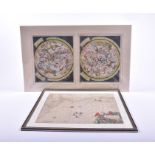
Two antique framed maps of astrological relevance each depicting various signs of the zodiac
Two antique framed maps of astrological relevance each depicting various signs of the zodiac within the celestial system, Facies Hemisphaerii Coel...
A group of three antique maps comprising Mare del Nord by Giovanni Grimani, 47 x 62 cm; a chart
A group of three antique maps comprising Mare del Nord by Giovanni Grimani, 47 x 62 cm; a chart of the Coasts of Spain and Portugal 1780 by L.S D...
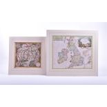
A French map of England, Scotland and Ireland by Sir Robert Georg 48 x 59 cm, together with a pole
A French map of England, Scotland and Ireland by Sir Robert Georg 48 x 59 cm, together with a pole map of the Northern hemisphere, 'Septentrio Nal...
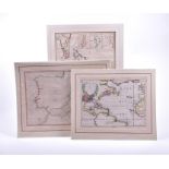
A group of three 18th century maps by Thomas Jefferys comprising a map of the Isle of Cuba, with the
A group of three 18th century maps by Thomas Jefferys comprising a map of the Isle of Cuba, with the Bahama Islands, Gulf of Florida and Windward...
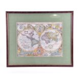
A 17th century map of the world 'A new and accurat map of the world, drawne according to ye truest
A 17th century map of the world 'A new and accurat map of the world, drawne according to ye truest Descriptions latest Discoveries and best Observ...
A group of four antique coloured maps comprising Jamaica by Johannem Ogiluium, 1671; a map of the
A group of four antique coloured maps comprising Jamaica by Johannem Ogiluium, 1671; a map of the world in German; a map of Barbadoes by J. Lodge ...
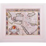
John Speed (1552-1629), British map of 'The Turkish Empire augmented by John Speed 1626' hand
John Speed (1552-1629), British map of 'The Turkish Empire augmented by John Speed 1626' hand coloured engraving, the border with figural cartouch...
Two 18th century maps of Jamaica one from the latest surveys improved and engraved by Thomas
Two 18th century maps of Jamaica one from the latest surveys improved and engraved by Thomas Jeffreys, c. 1794, the other showing Jamaica with det...
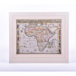
John Speed (1552-1629), British map of 'Africa (AFRICAE) augmented by John Speed 1626' hand coloured
John Speed (1552-1629), Britishmap of 'Africa (AFRICAE) augmented by John Speed 1626' hand coloured engraving, the border with figural cartouches ...
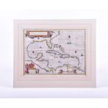
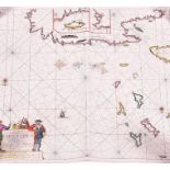
A 17th century map of Central America 'Insulae Americanae in Oceano Septentrionali. Cum Terris
A 17th century map of Central America 'Insulae Americanae in Oceano Septentrionali. Cum Terris adiacentribus', by Guiljelmus Blaeu, depicting Cent...
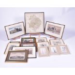
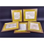
A collection of Victorian fashion prints depicting ladies in elegant clothing, together with a
A collection of Victorian fashion prints depicting ladies in elegant clothing, together with a selection of British topographical maps and print...
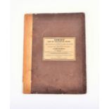
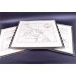
Norie's set of Celestial Maps for finding the Principal Stars in the Heavens, adapted for the use of
Norie's set of Celestial Maps for finding the Principal Stars in the Heavens, adapted for the use of Nautical Men, Astronomers, and Others, publis...