Filtered by:
- Category,
- Item Type
- List
- Grid
A subscription to the Price Guide is required to view results for auctions ten days or older. Click here for more information
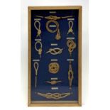

A West country sailor's hemp knot board, the glazed frame containing eleven named examples including
A West country sailor's hemp knot board, the glazed frame containing eleven named examples including 'Carrick Bend', 85cm X 44cm. ...[more]
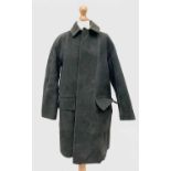
A British Railway Greengate coat.Condition report: It is dirt and scuff marks that will wipe away.
A British Railway Greengate coat.Condition report: It is dirt and scuff marks that will wipe away. ...[more]
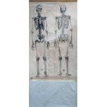
A 1960s Adam Rouilly Colombo Series C.V.1. skeleton chart. 152 x 101cm (209 x 124.5cm overall).
A 1960s Adam Rouilly Colombo Series C.V.1. skeleton chart. 152 x 101cm (209 x 124.5cm overall).
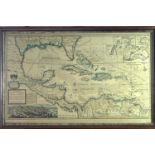
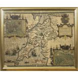
A reproduction Hondius 1630 World Map together with four other reproduction maps ...[more]
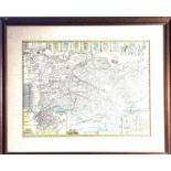
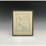
A map of Caernarfon, 40 x 50cm
A map of Caernarfon, 40 x 50cm ...[more]
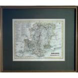
Map, handcoloured Richard BlomeA Map of the County of Suffolk with its HundredsBritannia 1673Dedicated to Thomas Timperley26.5 x 32.1cm ...[more]
Twelve antique County maps
Twelve antique County maps ...[more]
Map, handcolouredDresdenReproduction after the antique35.5x89cmTogether with other maps, The
Map, handcolouredDresdenReproduction after the antique35.5x89cmTogether with other maps, The World, Essex & Shropshire ...[more]
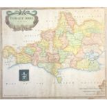
Map, handcolouredEman. BOWEN (1694-1767)Shrop Shire 51.5 x 70.8cm
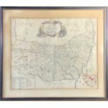
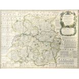
Map, handcolouredEmanuel BOWEN (1694-1767) An accurate map of Lincolnshire. Divided into its
Map, handcolouredEmanuel BOWEN (1694-1767) An accurate map of Lincolnshire. Divided into its Wapontakes51.8 x 70.6cm Condition report: This map is...
Map, handcolouredEmanuel BOWEN (1694-1767)An Accurate Map of Bedford divided into its Hundreds c.
Map, handcolouredEmanuel BOWEN (1694-1767)An Accurate Map of Bedford divided into its Hundreds c.1749 70 x 52.3cm ...[more]
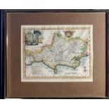
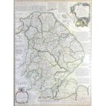
Map, handcolouredRob MORDEN (1650-1703)Dorset Shire sold by Abel Swale Awnsham and John Churchill.
Map, handcolouredRob MORDEN (1650-1703)Dorset Shire sold by Abel Swale Awnsham and John Churchill.From Camden's Britannia 169542.2 x 37cm ...[mor...
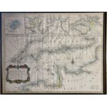
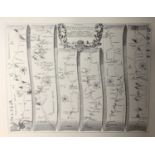
A Correct Chart of the English Channel - For Mr Tindal's Continuation of Mr Rapin's History c.1744
A Correct Chart of the English Channel - For Mr Tindal's Continuation of Mr Rapin's History c.174438.5 x 49cm
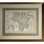
Chiquet L'AMERIQUE map 1719 17 x 22cm sight sizetogether with his L'AFRIQUE
The fairyland of Dartmoor, pictures and verseby j Thomson DunningTogether with maps
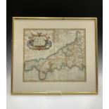
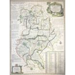
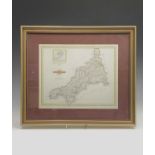
Robert MORDEN (c.1650-1703)CornwallCamden's Britannia (later edition) 1695 approx. 36cm x 42.5cm (
Robert MORDEN (c.1650-1703)CornwallCamden's Britannia (later edition) 1695 approx. 36cm x 42.5cm (sight size)Note: Morden contributed new maps to ...
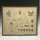
T Alan KEITH-HILL (20th Century) Heraldic Map of CornwallA modern map evoking traditional styles,
T Alan KEITH-HILL (20th Century) Heraldic Map of CornwallA modern map evoking traditional styles, 197144.5 x 54.5cm ...[more]
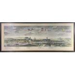
CREIGHTON (drawn by) and WALKER (engraved by) Truro, St.Ives, Penryn and Falmouth, View of the
CREIGHTON (drawn by) and WALKER (engraved by) Truro, St.Ives, Penryn and Falmouth, View of the Representative History of England. showing the elec...
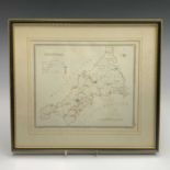
CREIGHTON (drawn by) and WALKER (engraved by) CORNWALL (full county) showing main towns with details
CREIGHTON (drawn by) and WALKER (engraved by) CORNWALL (full county) showing main towns with details of MPs etc. View of the Representative Histor...
Benjamin Rees DAVIES (1789-1872)CORNWALL With Cheese Wring, Scilly and compass rose. Larger Version.
Benjamin Rees DAVIES (1789-1872)CORNWALL With Cheese Wring, Scilly and compass rose. Larger Version. Cornwall Illustrated In A Series of Views (Fi...