Refine your search
Filtered by:
- Category,
- Creator / Brand
- List
- Grid
A subscription to the Price Guide is required to view results for auctions ten days or older. Click here for more information
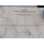

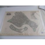
ENGRAVED MAP. folding litho map Viscaya, Bilbao. "Plano de las Minas y vias de trasporte de la zona minerea de Vizcaya." folding linen-backed map,...
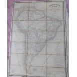
ENGRAVED MAP. folding hand col engr map "Amerique du Sud." by A.H. Dufour, folding linen-backed approx 32 x 21 inches, Longuet 1845 good condition.
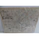
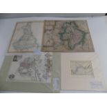
ENGRAVED MAP. folding engr map "Surrey" approx 60 x 40 inches, Sifton, Praed & Co., c 1880.
ENGRAVED MAP. folding engr map "Surrey" approx 60 x 40 inches, Sifton, Praed & Co., c 1880. ...[more]
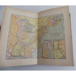
ATLAS. "The Eclectic Historical Atlas & Charts." 25 col double page maps comp, charts, orig cl loose, sm 8vo, 1884; plus 2 very incomplete books o...
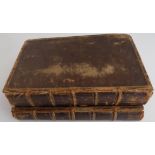
CAMBRAY (DUC DE). "The Adventures of Telemachus ..." 2 Vols, some engr plts & maps, cont cf, small 8vo, 1734-5. ...[more]
GUTHRIE (W.). "A new geographical grammar ..." some folding maps, cont cf, 8vo 1782; plus 2 other incomplete 18C grammars.

ORDNANCE SURVEY. Landranger maps. SMALL BOX.
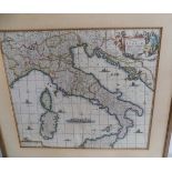
FREDERICK DE WIT. "Novissima et Accuratissima totius Italiae ..." hand col engr map, 20 x 26 inches, c1680 framed vg.
THOMAS MILTON. Complete series of Thomas Milton's Royal Dockyards. 6 fine hand col original etched plans with views engr titles ships & ship build...
RICHARD BLOME. "England Exactly Described." bound fragment incl folding engr map "Cornwal." plus title & 4 Ogilby computed mile charts, tall 12mo ...
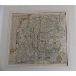
BOWEN & KITCHIN. "A New Improved Map of Hampshire." from the "Large English Atlas", 21 x 24 inches 1764g ...[more]
NORDEN & HOLE. "Hamshire, olim pars Belgarum." hand col engr map, 13 x 16 inches, late 17C.
NORDEN & HOLE. "Hamshire, olim pars Belgarum." hand col engr map, 13 x 16 inches, late 17C. ...[more]
JOHANNES BLEU. "Somersettensis Comitatas, Somersetshire." hand col engr map, cartouche & armorials, 18 x 20 inches, 1645 ...[more]
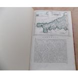
VENICE. engr map hand col in outline with vignette & inset, 18 x 21 inches, SDUK, 1838. ...[more]
SAXTON, KIP. "Somersettensis Comitatus Vulgo Somersett ..." hand col engr, cartouche, shipping etc, f&g, 13 x 16 inches, c1637 Condition report: T...
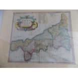
ROBERT MORDEN. "Cornwall." hand col engr map, 18 x 20 inches, c1695. ...[more]
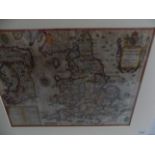
JOHN SPEED. "Invasions of England & Ireland, with al their Civill Wars Since the Conquest." fine hand col engr map with cartouche, compass, shippi...
THOMAS BOWEN. "The World including the late Discoveries by Capt Cook ..." hand col engr map, f & g, 16 x 20 inches, c1770's vg. Condition report: ...
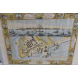
BELLIN (J.N.). "Carte de la Bays et Port de Plimouth." engr amp 10 x 7 inches 1764; plus facsimile "Devoniae." by Kip; plus facsimile "Devonshire....
OWEN & BOWEN. "The Road from Exeter to Truro showing Map of Cornwall 1720. ...[more]
PATERSON & OTHERS, 7 various road maps 18C; plus 4 misc small maps. ...[more]
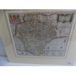
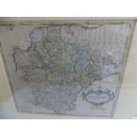
JOHN SPEED. "Devonshire with Excester Described ..." hand col engr map with plan of the city armorials, cartouche etc, f&g 19 x 22 inches 17C. .....
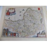
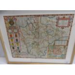
SAXTON & HOLE. "Glocestriae Comitacius olim Sedes Dobunorum." hand col engr map with cartouche, compass etc 14 x 16 inches, early 17C (bottom marg...
RICHARD BLOME. "A Mapp of Devonshire with its Hundreds." hand col engr map with shipping, cartouche etc 15 x 17 inches c1680 ...[more]
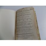
BOWLES "Post-Chaise Companion.
BOWLES "Post-Chaise Companion." bound fragment containing 5 double page road maps, mod 1/4 cf, 12mo 1782; plus 3 loose strip maps.
LAURIE & WHITTLE. "Completion of the Road to Land's End...." hand col engr map 12 x 10 inches 1815; SAXTON & KIP. "Warwici Comitatus a cornauiius ...
GERARD MERCATOR. "Cornubia, Devonia ..." good hand col engr map, 18 x 20, c1633
ROBERT MORDEN. "Dorsetshire.
ROBERT MORDEN. "Dorsetshire." hand col engr map, 18 x 20 inches c1695
ROBERT MORDEN. "Devonshire.
ROBERT MORDEN. "Devonshire." hand col engr map, 18 x 20 inches, c1695
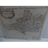
JOHN CARY. "A Map of Cornwall from the best authorities." hand col engr map 20 x 24 inches 1805; plus similar "Somersetshire."; plus one other.
FRAMED & UNFRAMED MAPS, bundle.
FRAMED & UNFRAMED MAPS, bundle. ...[more]
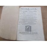
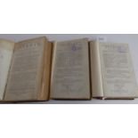
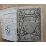
TOLOMEO (CLAUDIO). "Geografia.
TOLOMEO (CLAUDIO). "Geografia." woodcuts of globes etc (lacks maps & pp 109-122 & 125-138), no covers, 4to, Veneita 1599. ...[more]
CASED MAP. 2 part folding col engr map "Cornwall." E. Stanford, large size, latest date 1898
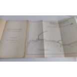
"Harbour of Refuge Inquiry. North Coast of Devon & Cornwall." a report by Wm. Matthews, 23 June, 1906. 6 folding col maps comp, list of ships lost...
PUBLISHER S. HOOPER. "Cornwall Illustrated." hand col map & 23 engr plts comp, well bound mod 1/2 calf gt, 4to 1786 vg. ...[more]
SYMONS (R.). "A Geographical Dictionary of the County of Cornwall." folding maps (1 torn & repaired) orig cl, 4to 1884. ...[more]
WILLIAM CAMDEN. "Britannia.
WILLIAM CAMDEN. "Britannia." woodcut title with royal arms, plus additional woodcut title with map, 3 engr maps comp, other engr plts, 831 pp comp...
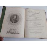
CULPEPER (NICHOLAS) "The Complete Herbal." engr port & 20 hand col plts comp, mod 1/2 mor, 4to, 1835 good. ...[more]
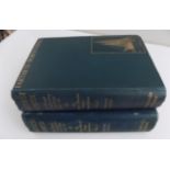
FRIDTJOF NANSEN "Farthest North.
FRIDTJOF NANSEN "Farthest North." 2 Vols, col plts, maps etc comp, orig cl gt, 1897 good; SORENSEN (J.). "The Saga of Fridtjof Nansen." 1932
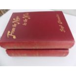
ALEXANDER (LT. BOYD). "From the Niger to the Nile." 2 Vols, maps, plts etc comp, orig cl gt, 1908 good.