Refine your search
Filtered by:
- Category,
- Item Type
- List
- Grid
A subscription to the Price Guide is required to view results for auctions ten days or older. Click here for more information
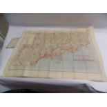

FOLDING MAP. "Guide Touriste Carte des Environs de Nice, Menton & Monaco." orig cl, c1900. ...[more]
ALETHEA GARSTIN. quantity pocket maps once belonging to Garstin, early 20C.
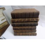
RAPIN (THOMAS). "The History of england." Vol 1, 1758; Vol 2, 1733, Vol 2, 1743; plus "A Universal History." Vol 2 & 3 1744 & Vol 7, 1744. cont cf...
WRIGHT (T.). "The Univeral Pronouncing Dictionary." only 3 maps; plus "Statues at Large." 3 misc vols 1769, 1774 & 1798. ...[more]
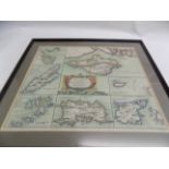
ENGRAVED MAP. "The Smaller Islands of the British Ocean." by Robert Morden, f&g, c 1695 vg.
ENGRAVED MAP. "The Smaller Islands of the British Ocean." by Robert Morden, f&g, c 1695 vg. ...[more]
Central Cornwall Railway. compulsory purchase form land nr St. Columb Major, 1867; plus small quantity unrelated printed maps.
LYSONS (D. & S.). "Magna Britannia, Cornwall." map & plts comp, cont 1/2 cf, split, 4to 1814 ...[more]
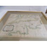
ENGRAVED MAP. "A Correct Chart of the English Channel." hand col map 18 x 20 inches Tindall & Rapin c 1690 vg. ...[more]
ENGRAVED MAP. "Brighthelmstone." Survey J. Marchant, 16 x 18 inches c1800.
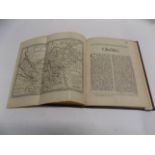
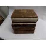
COX'S "History of Cheshire.
COX'S "History of Cheshire." complete with Morden map & lists, later 1/4 roan, sm 4to c1695 ...[more]