Refine your search
Filtered by:
- Category,
- Creator / Brand
- List
- Grid
A subscription to the Price Guide is required to view results for auctions ten days or older. Click here for more information
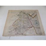

ENGRAVED MAP. "Northumbriae Comitatus olim sedes Otadinorum." by Chrysophorus Saxton & William Hole, hand col in outline, approximately 12 x 14 in...
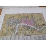
EARLY MAP OF LONDON.
EARLY MAP OF LONDON. "Fores's New Large Plan of London with the Names of the Streets Alphabetically Arranged & directions to find then in the MAP....
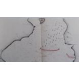
RASHLEIGH & THE MENABILLY ESTATES.
RASHLEIGH & THE MENABILLY ESTATES. Auction particulars Manors of Lantyan, Tywardreath, Polveithan, Polruan, & Manely Fleming. Seven large col fold...
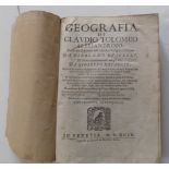
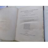
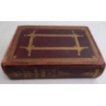
TOLOMEO (CLAUDIO). "Geografia.
TOLOMEO (CLAUDIO). "Geografia." woodcuts of globes etc (lacks maps & pp 109-122 & 125-138) no covers, 4to, Venetia 1599. ...[more]
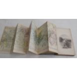
POCKET BATTLE MAPS.
POCKET BATTLE MAPS. "Les Tablettes Guerrieresm ou Cartes choisies Pour la Commodite Des Officiers et des Voyageurs." 2 black& red titles, only 1 m...
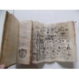
WILLIAM BORLASE. "The Natural History of Cornwall." folding engr map & 28 copper plts comp, cont 1/2 roan, crudely repaired, some foxing, fl, Oxfo...
"The Royal River, The Thames from Source to Sea." map, plts etc, pict gt cl, aeg, 4to, 1885 g.
"The Royal River, The Thames from Source to Sea." map, plts etc, pict gt cl, aeg, 4to, 1885 g.
BRITTON (J.) & BRAYLEY(E.W.). "Devonshire & Cornwall Illustrated." maps & plts comp, mod binding, 4to, 1832.
BRITTON (J.) & BRAYLEY (E.W.). "Devonshire & Cornwall Illustrated." 2 maps & engr views comp, cont 1/2 cf, 4to, 1832 g; plus 5 other view books.
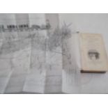
PADSTOW HARBOUR. "Padstow Harbour Association." prospectus for the preservation of Life & Property from Shipwreck ... pub 11 Nov, 1829 comp with m...
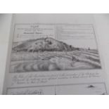
PLYMOUTH BREAKWATER.
PLYMOUTH BREAKWATER. good original map & estimate "Sheltering of Plymouth Sound & Bovisand Bay, 1812." detailed map with estimate on reverse, fool...
ENGRAVED MAP. "Map of the County of Norfolk from an Actual Survey by A. Bryant in the Years 1824, 1825 & 1826." fine linen backed hand col engr ma...
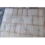
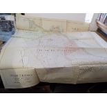
CHEFFINS RAILWAY MAP. "Cheffins Map of the Railways in Breat Britain from the Ordnance Surveys.
CHEFFINS RAILWAY MAP. "Cheffins Map of the Railways in Breat Britain from the Ordnance Surveys." hand col engr map, linen backed, 52 1/2 s 36 inch...
ROSCOE (THOMAS). "The London & Birmingham Railway." hand col folding map & engr plts comp, cont 1/2cf, 8vo, Titl, 1839.
GRAND JUNCTION RAILWAY.
GRAND JUNCTION RAILWAY. "Osborne's Guide to the Grand Junction, or, Birmingham, Liverpool & Manchester Railway." ads folding map & plans, orig cl,...
FULLARTON & CO. "The Imperial Map of England & Wales." 4 inches to 1 mile, 18 sheets, linen backed showing Railways & their Stations (interesting ...
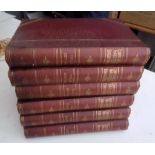
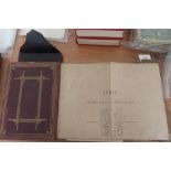
BRABNER (J.H.F.). "The Comprehensive Gazetteer of England & Wales." 6 Vols, maps, plans etc comp, orig cl C1895 vg.
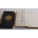
TOMLINS (F.G.). "A Complete System of Geography ..." maps, tables etc, orig cl, thick 8vo, 1851; PHILIPS. "Comprehensive Atlas." col maps, lg 8vo,...
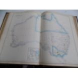
AMERICAN ATLAS. "Watson's New & Complete Illustrated Atlas of the World." col engr maps comp, other engrs, orig cl, 4to, 1888 good.

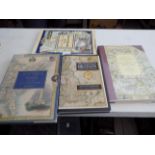
"The Old Series Ordnance Survey Maps of England & Wales." by Harry Margary, complete set Vols 1-8, dj, 1975-1991 vg.
A. & C. BLACK. "General Atlas of the World." hand col engr maps comp, cont 1/2 mor rubbed, folio, 1845 g.