Refine your search
Filtered by:
- Primary Category,
- Category
- List
- Grid
A subscription to the Price Guide is required to view results for auctions ten days or older. Click here for more information

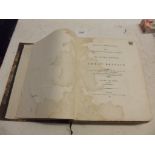
DARWIN (CHARLES). "On the Structure & Distribution of Coral Reefs..." ed J.W. Judd, maps, plts etc comp, mod 1/2 mo, 12mo, Minerva Lib, 1890 vg.
M'ALPINE (D.). "The Botanical Atlas ..." col plts comp, orig cl gt, fl, 1883.
BRITTON (J.). & BRAYLEY (E.W.). "Devonshire & Cornwall Illustrated." engr plts comp, maps comp, cont 1/2 cf, rubbed, 4to 1832
WILLIAM BORLASE. "Antiquities, Historical and Monumental of the County of Cornwall." 1769 edn with extra plates, 2 engr maps & 37 engr plts comp, ...
LYSONS (D. & S.). "Magna Britannia ..." Vol 3 containing Cornwall, folding engr maps, plates etc comp, cont 1/2 cf, (lacks backstrip) 4to, 1814
LUKIS (W.C.).
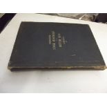
LUKIS (W.C.). "The Prehistoric Stone Monuments of the British Isles, Cornwall" map & 40 col litho plts comp (some sellotape noted), orig cl, loose...
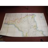
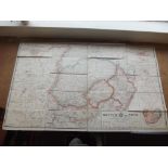
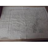
ENGRAVED MAP. "Cornwall.
ENGRAVED MAP. "Cornwall." Stanford, Ordanance Survey, hand col, engr map, linen backed, 2 sections in case, latest date 1894, each section 65 x 28...
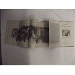
PANORAMA OF THE RIVER THAMES.
PANORAMA OF THE RIVER THAMES. contained in "The Illustrated Hand-Book to London & its Environs, with 50 engrs 2 maps & a panorama of the River Tha...
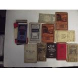
POCKET MAPS. bundle, various.
POCKET MAPS. bundle, various.
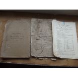
TREVETHOE ESTATE. Auction particulars Part 1 & 2, some maps, fl, 1920 poor condition; plus 1 other.
TREVETHOE ESTATE. Auction particulars Part 1 & 2, some maps, fl, 1920 poor condition; plus 1 other.
BOER WAR. col folding map. "Briton or Boer, Special Map of the Boer Republics." linen-backed, approx 28 x 30 " 1899 good
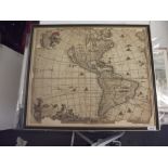
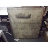
WIT (FREDERICK DE) "Novissima et Accuatima Totius Americae Descripto." hand col engr map, 19.
WIT (FREDERICK DE) "Novissima et Accuatima Totius Americae Descripto." hand col engr map, 19.5" x 23" (edges chipped with loss) c1670
THOMPSONS "New General Atlas." 1815.
THOMPSONS "New General Atlas." 1815. Seventeen loose hand col engr maps, (mostly Europe but with three India, & one Pacific Islands 21 x 25"
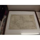
KITCHIN (THOMAS). "Map of the Gulf of Mexico ... " engr map, 12.5 x 19", f&g, c1770
CREIGHTON (R.). & DOWER (J.). "A Map of England & Wales." large scale hand col engr map with London vign etc (incomplete in three sections) c1820.
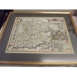
SPEEDE (JOHN). "Essex.
SPEEDE (JOHN). "Essex." hand col engr map, strapwork cartouche, inset Colchester Etc, 16 x 21 ", double sided f&g c1660 vg
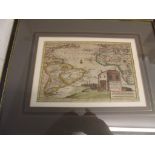
KNIVETS (A.). "Straat Magellaan ...
KNIVETS (A.). "Straat Magellaan ..." hand col engr map, 7 x 10 ", f &g c1660's
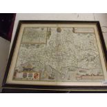
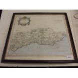
SPEEDE (JOHN). "Dorsetshyre.
SPEEDE (JOHN). "Dorsetshyre." hand col engr map with inset of Dorcester, 16 x 21 ", double sided f&g c1695 vg
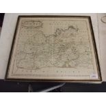
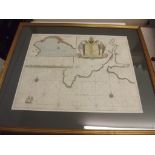
MORDEN (ROBERT). "Surrey.
MORDEN (ROBERT). "Surrey." hand col engr map, 15 x 17 ", f&g c1695 g
MORDEN (ROBERT). "Sussex." hand col engr map, 15 x 17 ", f&g c 1695 g.
COLLINS (CAPT. GREENVILE). "Fowey & Mounts-Bay." hand col engr chart with cartouche, inset etc, 18 x 22 ", f&g c1693 vg.
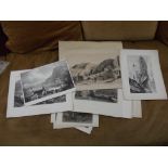
J.M.W. TURNER & OTHERS. 42 good 19C engrs North Devon (some hand col.)

MAPS. Two litho maps hand col in outline by Robert K. Dawson, Helston & St Ives 1834 vg; plus four litho maps Cornish Towns c 1830's vg; plus Mou...
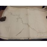
CHART. "A Survey of the Coasts .. St Agnes Head to Hartland Point." by Murdoch Mackenzie Junr.
CHART. "A Survey of the Coasts .. St Agnes Head to Hartland Point." by Murdoch Mackenzie Junr. 1772 vg; plus quantity Admiralty charts 20C
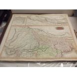
INDIAN RAILWAY MAPS. 2 hand col maps printed on linen titled "Calcutta and Surrounding Country.
INDIAN RAILWAY MAPS. 2 hand col maps printed on linen titled "Calcutta and Surrounding Country." very detailed, 28 x 34 ", date 1884 noted.