Filtered by:
- Category
- List
- Grid
A subscription to the Price Guide is required to view results for auctions ten days or older. Click here for more information
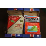

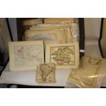
A QUANTITY OF DELORME AMERICAN ATLAS & GAZETEER, 1980s and 1990s (48) ...[more]
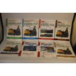
A QUANTITY OF 'SPV'S RAILROAD ATLAS OF NORTH AMERICA' by Mike Walker (15) together with '1948
A QUANTITY OF 'SPV'S RAILROAD ATLAS OF NORTH AMERICA' by Mike Walker (15) together with '1948 Handy Railroad Atlas of The United States'
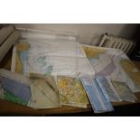
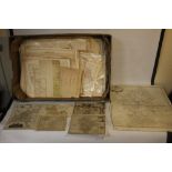
TWO BOXES OF MAINLY OS MAPS, together with a bag of OS maps, large scale maps etc.
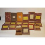
A SMALL COLLECTION OF FOLDING MAPS MAINLY LINEN BACKED ORDNANCE SURVEY to include 1:2500, 1:63360,
A SMALL COLLECTION OF FOLDING MAPS MAINLY LINEN BACKED ORDNANCE SURVEY to include 1:2500, 1:63360, various areas together with W. H. Smith & Son's...
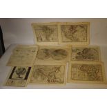
A QUANTITY OF ANTIQUE MAPS, mainly 19th century to include county maps by Moule, Archer, Fullarton, ordnance survey, plans of the river Thames etc...
A QUANTITY OF ANTIQUE MAPS, mainly 19th century to include county maps by C. Smith, J. Cary,
A QUANTITY OF ANTIQUE MAPS, mainly 19th century to include county maps by C. Smith, J. Cary, Teesdale, Hogg, Baker, Archer, J. Seller, together wi...
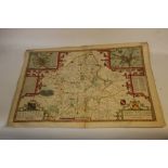
JOHN SPEED MAP OF STAFFORDSHIRE, Bassett & Chiswell, English text on back, later hand colouring,
JOHN SPEED MAP OF STAFFORDSHIRE, Bassett & Chiswell, English text on back, later hand colouring, unframed Condition Report:Small nicks top edge, m...
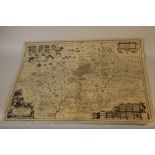
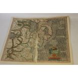
JAN JANSSON MAP OF WARWICKSHIRE AND WORCESTERSHIRE, c.1647, German text on back, uncoloured,
JAN JANSSON MAP OF WARWICKSHIRE AND WORCESTERSHIRE, c.1647, German text on back, uncoloured, unframed, ...[more]
MERCATOR MAP OF EASTERN IRELAND, c.1600, later hand colour, French text on reverse, A/F Condition Report:Damage and repairs to centre fold, close ...
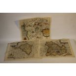
SAXTON KIP MAPS OF WELSH COUNTIES - RADNOR, BRECKNOC AND MERIONITH, c.1607, later hand colour (3)
SAXTON KIP MAPS OF WELSH COUNTIES - RADNOR, BRECKNOC AND MERIONITH, c.1607, later hand colour (3) ...[more]
VARIOUS MILITARY MAPS to include 'Segnalata Vittoria Ottenuta Dalle Armi Imperiali e Polacche
VARIOUS MILITARY MAPS to include 'Segnalata Vittoria Ottenuta Dalle Armi Imperiali e Polacche Sotto La Citta, E Fortezza Di Strgonia Con L'Acquist...
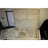
HENRY TEESDALE LARGE SCALE MAP OF YORKSHIRE, 1828, in 9 large separate sections on paper with a view
HENRY TEESDALE LARGE SCALE MAP OF YORKSHIRE, 1828, in 9 large separate sections on paper with a view of Yorkminster by Woolnoth ...[more]
A FOLIO OF MAPS BOTH ANTIQUARIAN AND REPRODUCTION to include original C. Smith Warwickshire, J. Cary
A FOLIO OF MAPS BOTH ANTIQUARIAN AND REPRODUCTION to include original C. Smith Warwickshire, J. Cary Shropshire, Robert Morden, Donne's Plan of Br...
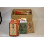
FOUR BOXES ORDNANCE SURVEY MAPS
FOUR BOXES ORDNANCE SURVEY MAPS
A LARGE QUANTITY OF ORDNANCE SURVEY MAPS to include many early 20th century, "One-Inch" Map Popular Edition, ½-inch to one mile road maps, 1960s o...
EDWARD STANFORD FOLDING MAP OF 'THE DANUBIAN PRINCIPALITIES prepared from the Vienna Map in 21
EDWARD STANFORD FOLDING MAP OF 'THE DANUBIAN PRINCIPALITIES prepared from the Vienna Map in 21 sheets', c.1857, a linen backed dissected map with ...
A COLLECTION OF VINTAGE MAPS, mostly Ordnance Survey and Bartholomew's
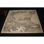
A SMALL GROUP OF "EMAN BOWEN" MAPS CONSISTING OF NORTH AMERICA, SOUTH AMERICA, ASIA (DATED 1747),
A SMALL GROUP OF "EMAN BOWEN" MAPS CONSISTING OF NORTH AMERICA, SOUTH AMERICA, ASIA (DATED 1747), AFRICA (1747), EUROPE AND "AN ACCURATE MAP OF TH...