Filtered by:
- Category,
- Item Type
- List
- Grid
A subscription to the Price Guide is required to view results for auctions ten days or older. Click here for more information
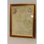

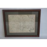
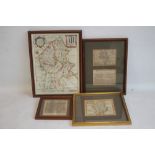
EMANUEL BOWEN MAP OF STAFFORDSHIRE c.1760 from 'The Large English Atlas', cartouche dedicated to '
EMANUEL BOWEN MAP OF STAFFORDSHIRE c.1760 from 'The Large English Atlas', cartouche dedicated to 'The Noble and Right Honourable John Gower', has ...
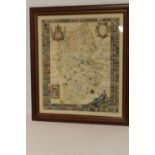
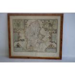
ROBERT PLOT MAP OF STAFFORDSHIRE c.1686, map surrounded by shields, later hand colouring, framed and
ROBERT PLOT MAP OF STAFFORDSHIRE c.1686, map surrounded by shields, later hand colouring, framed and glazed, frame size 80 x 71 cm Condition Repor...
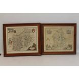
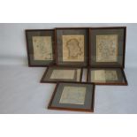
JANSSON MAP OF STAFFORDSHIRE AND SHROPSHIRE, 17th Century, with early hand colouring, framed and
JANSSON MAP OF STAFFORDSHIRE AND SHROPSHIRE, 17th Century, with early hand colouring, framed and glazed, frame size 60 x 68 cm together with Blaeu...
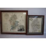
GREENWOOD MAP OF STAFFORDSHIRE c.1830, with vignette of Lichfield cathedral, 73 x 83 cm including
GREENWOOD MAP OF STAFFORDSHIRE c.1830, with vignette of Lichfield cathedral, 73 x 83 cm including frame together with a framed Robert Morden map o...
WILLIAM KIP MAP OF STAFFORDSHIRE, c.1637, uncoloured, 43 x 54 cm including frame
JOHN SPEED MAP OF STAFFORDSHIRE early 17th Century Sudbury & Humble, later hand colour, good margins, 53 x 62 cm including frame ...[more]
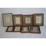
EIGHTEENTH CENTURY STAFFORDSHIRE MAPS to include H. Moll with antiquities, William Tunnicliff,
EIGHTEENTH CENTURY STAFFORDSHIRE MAPS to include H. Moll with antiquities, William Tunnicliff, Emanuel Bowen, John Cary, Thomas Kitchin etc., all ...
NINETEENTH CENTURY STAFFORDSHIRE MAPS to include Thomas Moule (early version), Pigot, Duncan,
NINETEENTH CENTURY STAFFORDSHIRE MAPS to include Thomas Moule (early version), Pigot, Duncan, Langley, Archer etc. framed together with two unfram...
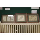
RICHARD BLOME MAP OF STAFFORDSHIRE c.1673 hand colour, 38 x 29 cm including frame together with
RICHARD BLOME MAP OF STAFFORDSHIRE c.1673 hand colour, 38 x 29 cm including frame together with three other 17th Century maps of Staffordshire - V...
EIGHTEENTH CENTURY MAPS OF STAFFORDSHIRE to include Badeslade & Toms, Robert Morden, John Rocque,
EIGHTEENTH CENTURY MAPS OF STAFFORDSHIRE to include Badeslade & Toms, Robert Morden, John Rocque, Thomas Conder, Kitchin/Jeffries and Thomas Osbor...
UNUSUAL PERROT MAP OF WORCESTER, SHROPSHIRE AND STAFFORDSHIRE c.1823, known as the 'Gravestone
UNUSUAL PERROT MAP OF WORCESTER, SHROPSHIRE AND STAFFORDSHIRE c.1823, known as the 'Gravestone Map' together with seven other miniature maps of St...
OWEN & BOWEN COUNTY MAP OF STAFFORDSHIRE double framed with two Owen & Bowen road strips showing
OWEN & BOWEN COUNTY MAP OF STAFFORDSHIRE double framed with two Owen & Bowen road strips showing Lichfield together with a 1930s reproduction of O...
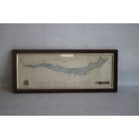
A FRAMED MAP OF LAKE WINDERMERE c.1783, surveyed by P. Crosthwaite, hand coloured with illustrations
A FRAMED MAP OF LAKE WINDERMERE c.1783, surveyed by P. Crosthwaite, hand coloured with illustrations of Windermere Island House and Low-Wood Inn 2...
THE SELLER HAS WITHDRAWN THIS LOT ...[more]