Filtered by:
- Category,
- Creator / Brand
- List
- Grid
A subscription to the Price Guide is required to view results for auctions ten days or older. Click here for more information

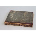
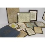
BEETON'S DICTIONARY OF GEOGRAPHY', Ward Lock & Tyler 19th Century, includes folding maps with outli
BEETON'S DICTIONARY OF GEOGRAPHY', Ward Lock & Tyler 19th Century, includes folding maps with outline colour and engravings, together with Bacon's...
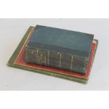
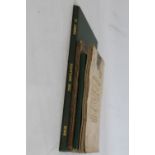
TOMBLESON'S VIEWS OF THE RHINE', and 'Tombleson's Upper Rhine', Black & Armstrong, London (2)
TOMBLESON'S VIEWS OF THE RHINE', and 'Tombleson's Upper Rhine', Black & Armstrong, London (2) ...[more]
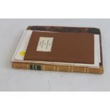
REV. J. NIGHTINGALE - 'ENGLISH TOPOGRAPHY OR, GEOGRAPHICAL, HISTORICAL, AND STATISTICAL DESCRIPTION
REV. J. NIGHTINGALE - 'ENGLISH TOPOGRAPHY OR, GEOGRAPHICAL, HISTORICAL, AND STATISTICAL DESCRIPTIONS OF THE SEVERAL COUNTIES OF ENGLAND AND WALES ...
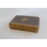
THOMAS COX - 'MAGNA BRITANNIA', c.1720 with folded map by Robert Morden and distance table in back,
THOMAS COX - 'MAGNA BRITANNIA', c.1720 with folded map by Robert Morden and distance table in back, together with Staffordshire section from a gaz...
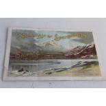
TO NORWAY & SPITZBERGEN BY ORIENT CO'S S. S. "LUSITANIA", Fenchurch Avenue, London E. C. Aug 1894,
TO NORWAY & SPITZBERGEN BY ORIENT CO'S S. S. "LUSITANIA", Fenchurch Avenue, London E. C. Aug 1894, Pleasure Cruise to the Norway Fiords and Spitzb...
BROOKES' TRAVELLING COMPANION THROUGH ENGLAND AND WALES, folding map on linen, published by William
BROOKES' TRAVELLING COMPANION THROUGH ENGLAND AND WALES, folding map on linen, published by William Darton 1819, 2nd edition together with, Philip...
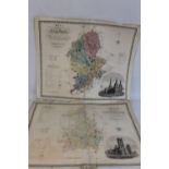
C & J GREENWOOD COUNTY MAP OF STAFFORDSHIRE, c.1830 together with same of Cambridgeshire c.1834, 57
C & J GREENWOOD COUNTY MAP OF STAFFORDSHIRE, c.1830 together with same of Cambridgeshire c.1834, 57.5 x 69 cm, unframed (2)Condition Report:Staffo...
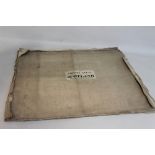
FOUR ANTIQUE MAPS OF SCOTLAND published by John Thomson & Co. Edinburgh, 1820/21, Linlithgowshire,
FOUR ANTIQUE MAPS OF SCOTLAND published by John Thomson & Co. Edinburgh, 1820/21, Linlithgowshire, Stirlingshire, Peebleshire & Berwickshire with ...
THE TIMES SURVEY ATLAS OF THE WORLD', London 1922 together with fourteen assorted maps including or
THE TIMES SURVEY ATLAS OF THE WORLD', London 1922 together with fourteen assorted maps including original antique examples by Cary, Cole, Roper, O...
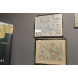
SAXTON-KIP MAP OF BRECKNOC, c.1610, in later frame along with a reproduction map of the world (2)
SAXTON-KIP MAP OF BRECKNOC, c.1610, in later frame along with a reproduction map of the world (2)
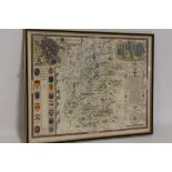
JOHN SPEED MAP OF WILTSHIRE c.1627, double framed, English text on the back, frame size 43 x 56 cm<
JOHN SPEED MAP OF WILTSHIRE c.1627, double framed, English text on the back, frame size 43 x 56 cmCondition Report:Repair on back to centrefold ot...
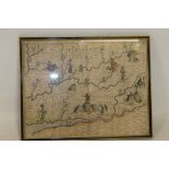
MICHAEL DRAYTON ALLEGORICAL MAP OF SOUTHERN HEREFORDSHIRE, part of Gloucestershire and part of Worc
MICHAEL DRAYTON ALLEGORICAL MAP OF SOUTHERN HEREFORDSHIRE, part of Gloucestershire and part of Worcestershire from the Polyolbion c.1612 in Hogart...
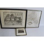
ROBERT MORDEN MAP OF OXFORDSHIRE, together with two prints of Lincoln College, Oxford (3)
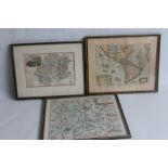
FRAMED ANTIQUE MAPS OF DORSET, WILTSHIRE AND HAMPSHIRE to include Saxton-Kip of Dorset, Saxton-Kip
FRAMED ANTIQUE MAPS OF DORSET, WILTSHIRE AND HAMPSHIRE to include Saxton-Kip of Dorset, Saxton-Kip of Wiltshire, Richard Blome of Hampshire, Ogilb...
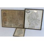
A JOHN SPEED MAP OF SHROPSHIRE, Henry Overton edition 1743, in traditional Hogarth frame. 42,5 x 55
A JOHN SPEED MAP OF SHROPSHIRE, Henry Overton edition 1743, in traditional Hogarth frame. 42,5 x 55 cm together with Robert Morden map of Stafford...
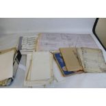
AVIATION CHARTS AND MAPS to include Imperial Airways Ltd. Southampton-Jersey 1938 (only half of it)
AVIATION CHARTS AND MAPS to include Imperial Airways Ltd. Southampton-Jersey 1938 (only half of it) (qty)