Filtered by:
- Sale Section,
- Category
- List
- Grid
A subscription to the Price Guide is required to view results for auctions ten days or older. Click here for more information

Quantity of Ordnance Survey maps including 19th century Harrow, later edition of Manchester, etc.
Quantity of Ordnance Survey maps including 19th century Harrow, later edition of Manchester, etc. together with reproduction London and c/d and a ...
Quantity of reproduction maps and London Topographical Society reprints including the 1981 copy of
Quantity of reproduction maps and London Topographical Society reprints including the 1981 copy of the Rhinebeck panorama of London circa 1810, a...

Handcoloured folding "Map of England and Wales including principal part of Scotland, delineated and the mail and turnpike roads direct and cross w...
Quantity of 19th century loose leaf maps from around the World, earlier bookplates of maps depicting coastal islands around Spain, a handcoloured ...
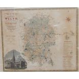
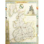
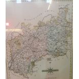
19th century handcoloured engraved map of the County of Wilts from an actual survey, made in the years 1819 and 1820 by C & I Greenwood, bearing S...
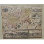
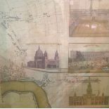
Antique handcoloured engraved map... "Haupt und Residenz-Stadt, London..., Edirt von Ioh Baptiste Homanns... in Nurnberg", bearing vignettes of Wi...
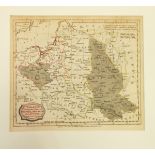
Quantity of 19th century and later mounted maps from around the world, including handcoloured engraved map 'Haut et Bas Rhin, Franconie et Souabe'...
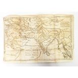
Antique engraved map of India,
Antique engraved map of India, inscribed in roundel "Das Südöstliche Asien Zur Erlauterung von Dr Robertsons Historischen Unterfuchungen 1791", 26...
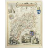
Two handcoloured maps of Gloucestershire and Herefordshire
Map depicting West London with Pall Mall and other street names and others