Filtered by:
- Category
- List
- Grid
This auctioneer has chosen to not publish their results. Please contact them directly for any enquiries.
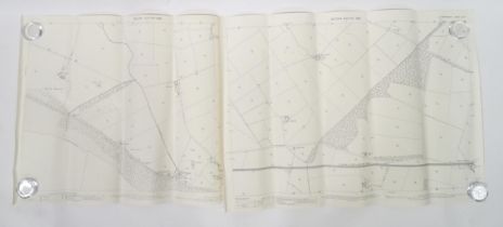

Two 1899 1:2500 Ordnance Survey maps, Dumfriesshire , Scotland area, depicting Newbie Castle and the
Two 1899 1:2500 Ordnance Survey maps, Dumfriesshire , Scotland area, depicting Newbie Castle and the Glasgow & South Western Railway between Dumfr...
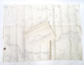
A quantity of early 20thC 1:2500 Ordnance Survey maps, area of Aberporth , Cardigan (Ceredigion),
A quantity of early 20thC 1:2500 Ordnance Survey maps, area of Aberporth , Cardigan (Ceredigion), Wales 1905-1906 (5)Please Note - we do not make ...
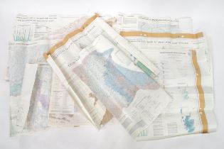
A quantity of 20thC 1:50km Hydrogeological maps, areas including Chilterns and Downs, Hampshire,
A quantity of 20thC 1:50km Hydrogeological maps, areas including Chilterns and Downs, Hampshire, South Downs, East Yorkshire, Scotland, England & ...
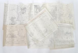
A quantity of 20thC 6" : 1 mile Ordnance Survey maps, areas including Bulford, Tidworth, Dalton
A quantity of 20thC 6" : 1 mile Ordnance Survey maps, areas including Bulford, Tidworth, Dalton Furness and Barrow in Furness etc (9)Please Note -...
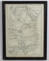
Map: A 20thC map territorial divisions of South Africa before the Boer War, produced as a Supplement
Map: A 20thC map territorial divisions of South Africa before the Boer War, produced as a Supplement to the Guardian, June 25th 1890. Published by...
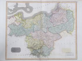
Map: A 19thC engraved map titled Prussian Dominions after John Thomson, for Thomson's New General
Map: A 19thC engraved map titled Prussian Dominions after John Thomson, for Thomson's New General Atlas, 1814, with hand coloured detail. Approx. ...
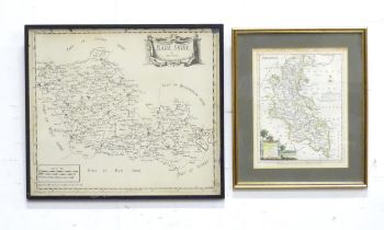
Two 20thC engraved maps to include a map of Buckinghamshire after John Ellis, and a map of Berkshire. Largest approx. 14 1/2" x 16 1/2" (2)Please ...
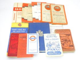
A quantity of mid 20thC maps, including Geographia Ramblers' Map - Isle of Wight, Ordnance Survey
A quantity of mid 20thC maps, including Geographia Ramblers' Map - Isle of Wight, Ordnance Survey one-inch maps - Cardiff, Buckingham, The Chilter...