
Filtered by:
- Category,
- Item Type
- List
- Grid
A subscription to the Price Guide is required to view results for auctions ten days or older. Click here for more information
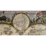

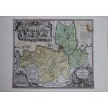
Map, Frederick De Wit
Frederick De Wit (Dutch, 1630-1706), "Nova Tabula in Lucem Edita," circa 1670, hand-colored engraving, sight (image): 18.5"h x 22"w, overall (with...
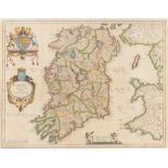
Map, Robert de Vaugondy
Robert de Vaugondy (French, 1688-1766), "Royaume d'Irlande divise en ses quatre Provinces," 1750, hand-colored engraving, sight (image): 19.5"h x ...
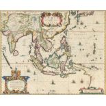
Map, Willem Blaeu
Willem Blaeu (Dutch, 1571-1638), "India quae Orientalis dicitur et Insulae Adjacentes," circa 1635, hand-colored engraving, sight (image): 16"h x ...
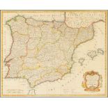
Map, William Richard Seale
Richard William Seale (British,1703-1762), "A Map of the Kingdoms of Spain and Portugal from the latest and best Observations," circa 1730, hand-c...
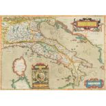
Map, Abraham Ortelius
Abraham Ortelius (Dutch, 1527-1598), "Italiae Veteris Specimen," 1581, hand-colored engraving, sight (image): 13.5"h x 19"w, overall (with frame):...
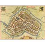
Map, Willem Janszoon Blaeu
Willem Janszoon Blaeu (Dutch, 1571–1638), "Sneeck," handcolored engraving, sight: 16"h x 21"w, overall (with frame): 22.75"h x 27.25"w
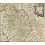
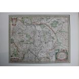
Map, Johann Baptist Homann
Johann Baptist Homann (German, 1663-1724), "Exactissima Palatinatus ad Rhenum Tabula," 1715, hand-colored engraving, sight (image): 19.5"h x 22.5"...
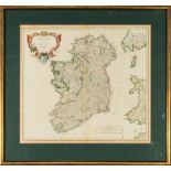
Map, Johannes (Janssonius) Jansson
Johannes (Janssonius) Jansson (German, 1596-1666), "Hibernia Regnum Vulgo Ireland," circa 1636, handcolored engraving, image (sight): 15"h x 20"w,...
Map, Jacques-Nicolas Bellin
Jacques-Nicolas Bellin (French, 1703-1772), "Carte de l'Entree de la Riviere de Canton Dressee sur les Observations les pls recentes," 1764, hand-...
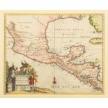
Map, John Ogilby
John Ogilby (British, 1600-1676), "Nova Hispania Nova Galicia Guatimala (with part of Florida and Cuba)," 1671, hand-colored engraving, sight (ima...
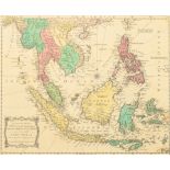
British School (18th century), "An Accurate Map of India beyond the Ganges, with the Oriental Islands; generally call'd East India: From the lates...
Map, Johannes (Janssonius) Jansson
Johannes (Janssonius) Jansson (German, 1596-1666), "Nova Descripto Palatinatus Rheni," circa 1630, hand-colored engraving, image (sight): 15"h x 1...
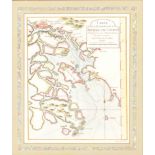
Map, Homann Heirs
Homann Heirs (German, 1664-1724), "Ingermanlandiae seu Ingriae Novissima Tabula Luci Tradita," 1740, hand-colored engraving, image (sight): 19.25"...