Refine your search
Filtered by:
- Category,
- Item Type
- List
- Grid
A subscription to the Price Guide is required to view results for auctions ten days or older. Click here for more information
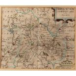

Christopher Saxton/Brecknoc/Glamorgan/two hand coloured maps, 27cm x 34cm
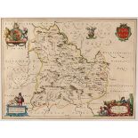
John Speed/Breknoke/county map/hand coloured engraving, 37cm x 50cm and two other maps
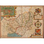
John Speed/Caermarden County Map/hand coloured engraving, 37cm x 50cm CONDITION REPORT: The map is 17th Century, the impression is a little faint ...
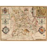
John Speed/County Map of Brechiniae/hand coloured engraving, 37cm x 50cm
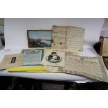
18th Century/La Rochelle/black and white engraved map and other maps, prints etc
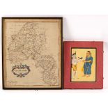
Robert Morden/Oxfordshire/engraved map 42.5cm x 36cm/and an Indian watercolour depicting figures CONDITION REPORT: The paper has browned and the W...
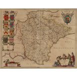
Johannes Blaeu/Devonia vulgo Devon-Shire/Amsterdam, circa 1645/engraved map with contemporary hand colouring, decorative cartouche and mileage sca...
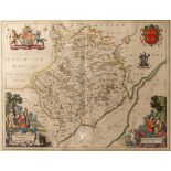
Johannes Blaeu/Monumethensis Comitatus Vernacule Monmouth Shire/Amsterdam, circa 1645/engraved map with hand colouring, large decorative cartouche...
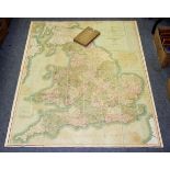
Cary's Six Sheet Map of England & Wales With Part of Scotland, 1818.Hand coloured folding engraved map, mounted on linen, board slipcase/Provenanc...
Cary's Actual Survey of the Country Fifteen Miles Round London, 1800, Hand coloured folding map on linen, board slipcase (lacks index) - Laurie &...
Gardner, Jos. New Plan of the Cities of London & Westminster with the Borough of Southwark, 1833.
Gardner, Jos. New Plan of the Cities of London & Westminster with the Borough of Southwark, 1833. Hand coloured folding map, mounted on linen, gre...
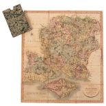
County maps etc. A collection of 19th c. maps including Cary, John. A New Map of Hampshire, 1811; A New Map of Warwickshire, 1818; A New Map of D...