Refine your search
Filtered by:
- Show only bulk lots,
- Category,
- Item Type
- List
- Grid
A subscription to the Price Guide is required to view results for auctions ten days or older. Click here for more information
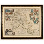

Jan Jansson (1588-1664)/Oxonium Comitatus Vulgo Oxfordshire/hand coloured engraved map, 38.5cm x 50cm
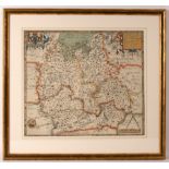
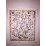
Christopher Saxton (1540-1610)/Oxfordshire, Berkshire and Buckinghamshire/colour print, 39.5cm x 46cm CONDITION REPORT: I have examined this out o...
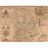
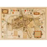
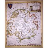
John Speed (1552-1629)/The Countie and Citie of Lyncolne/described with the Armes of them that have
John Speed (1552-1629)/The Countie and Citie of Lyncolne/described with the Armes of them that have bene Earles Thereof Since the Conquest/text on...
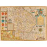
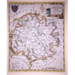
John Speed (1552-1629)/Shropshyre/described the sittuation of Shrowesbury Shewed/text on reverse/coloured engraved map, 39cm x 51cm
Menke/Ancient World/coloured engraved map, 21.5cm x 28cm/and two facsimiles of 17th Century maps
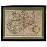
Gerard Mercator/Irlandiae Regnum/coloured engraved map, 35cm x 47cm
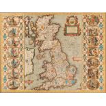
John Speed (1552-1629)/Britain as it was Devided in the Tyme of the Englishe Saxons especially
John Speed (1552-1629)/Britain as it was Devided in the Tyme of the Englishe Saxons especially during their Heptarchy/coloured engraved map/with t...
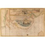
Captain Greenville Collins/The River of Thames from London to the Buoy of the Noure/coloured
Captain Greenville Collins/The River of Thames from London to the Buoy of the Noure/coloured engraved map with central vignette of shipping along ...
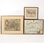
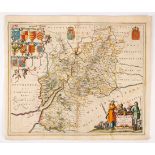
Abraham Ortelius/Venuximi Comita Tus Nova Descr/and two other colour engraved maps, framed as one/and Skelton's plan of Oxford
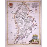
Johannes Blaeu (1650-1712)/Glocestria Ducatus Vulgo Glocestershire/circa 1648/coloured engraved map,
Johannes Blaeu (1650-1712)/Glocestria Ducatus Vulgo Glocestershire/circa 1648/coloured engraved map, 45cm x 56cm and/Joannes Janssonius (1588-1664...
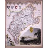
Thomas Kitchin (1718-1784)/Bedfordshire, Derbyshire, Leicestershire, Monmouthshire, Nottinghamshire,
Thomas Kitchin (1718-1784)/Bedfordshire, Derbyshire, Leicestershire, Monmouthshire, Nottinghamshire, Rutlandshire, Staffordshire, Westmoreland and...
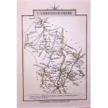
Thomas Moule (1785-1851)/Cambridgeshire, Cumberland, Derbyshire and Northumberland/four hand coloured engraved maps, various sizes, unframed
John Cary (1754-1835)/Cambridgeshire, Devonshire, Hertfordshire, Leicestershire, Norfolk, Somersetshire, Warwickshire, Westmoreland/eight hand col...
Thomas Conder (fl.
Thomas Conder (fl. 1775-1801)/Bedfordshire, Derbyshire, Hertfordshire, Herefordshire, Lincolnshire, Norfolk, Shropshire, Staffordshire/eight hand ...
Thomas Conder (fl.
Thomas Conder (fl. 1775-1801)/Herefordshire, Monmouthshire, Shropshire, Staffordshire, Suffolk, Sussex, Wiltshire/seven hand coloured engraved map...
Thomas Conder (fl.
Thomas Conder (fl. 1775-1801)/Bedfordshire, Berkshire, Cumberland and Westmoreland, Leicester and Rutland, Northumberland, Nottinghamshire, Somers...
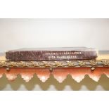
Benjamin Baker (act.
Benjamin Baker (act. circa 1880-1900)/Bristol, Cirencester, Bath, Warminster/coloured engraved map in fifty-five linen backed sections/published b...
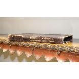
Benjamin Baker (act.
Benjamin Baker (act. circa 1880-1900)/Worcester, Hereford, Gloucester and Monmouth/coloured engraved map in fifty-five linen backed sections/publi...
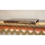
Benjamin Baker (act.
Benjamin Baker (act. circa 1880-1900)/Leicester, Warwick, Banbury, Buckingham/coloured engraved map in thirty-six linen backed sections/published ...
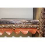
Benjamin Baker (act.
Benjamin Baker (act. circa 1880-1900)/Macclesfield, Stafford, Bridgeworth (sic), Birmingham/coloured engraved map in forty-eight linen backed sect...