Refine your search
Filtered by:
- Category,
- Item Type
- List
- Grid
A subscription to the Price Guide is required to view results for auctions ten days or older. Click here for more information

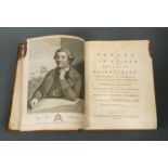
DE WINT (Peter)
Views in the South of France, chiefly on the Rhone. London: W B Cooke 1825, slim 4to, 24 engraved plates as required, contemporary spotted calf
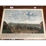
After James Seymour,
The Chaise Match Run on Newmarket Heath on Wednesday the 29th of August, 1750, coloured engraving originally published by R. Sayer, London, laid d...
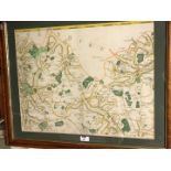
two engraved sheets with hand colour from the large scale edition by Chapman and Andre, c.46 x 58cm (visible), maple frmaed (2)
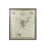
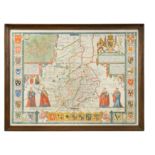
Richard Grey Baker,
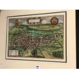
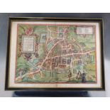
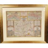
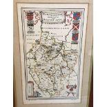
New Map of the University and Town of Cambridge, dissected hand coloured large scale engraved plan of Cambridge, 1830, published by T. G. Baker an...
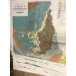
Geological Map of the British Islands, 1912; Maps of England and Wales, Ordnance Survey, by Wedd 1913; Durham and Northumberland, folded; together...
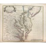
John Senex
A New Map of Virginia, Maryland, and the Improved Parts of Pennsylvania & New Jersey, double page engraving 1719, with outline hand colour, few te...
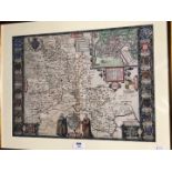
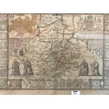
John Speed
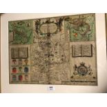
Cambridgeshire Described, hand coloured engraved map for Bassett and Chiswell, c.1676, English text verso, 40 x 53cm
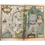
After Hondius
China, hand coloured engraved map, late 17th or early 18th century, double page, with English text verso, loose, 40.5 x 47cmPartial tear to lower ...
CARY (John)
Cary's New Map of England and Wales with Part of Scotland, 1794, 4to, engraved throughout, coloured general map, others with outline hand colour, ...
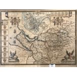
Braun and Hogenberg,
Nordovicum Angliae Civitas, hand coloured engraved plan of Norwich, c.1600, Latin text verso, 31.5 x 44cm
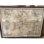
John Speed
Kent, double page engraved hand coloured map, for G. Humble, some surface wear to lower right corner, 37.5 x 50cm
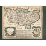
John Speed,
Cambridgeshire Described, hand coloured engraved map, published by Bassett and Chiswell, c.1676, 39 x 53cm
A bundle of engravings and maps,
late 18th century, including T. Kitchin and topographical plates from a history of geography work, some rather frayed and worn
Braun and Hogenberg
Cantebrigia [Cambridge] engraved double page plan, circa 1600, 36 x 49cmCondition report: double glazed, Latin text verso, damage to along centre ...
John Speed
Flintshire, engraved coloured map for Sudbury and Humbel, 1610, some damage and retouching to lower corners, 38 x 50.5cm; Domus Senatoria Antwerpi...
Richard Blome,
a 17th Century map of Kent, hand coloured, 26.5 x 33cms (plate), together with a map of Surrey, c. 1715, 14.5 x 21.5cms (plate), both unframed.
Norden and Speed
Midle-Sex described, hand coloured engraved map of Middlesex, late 17th century, probably laid down, few crease marks to centrefold, 39 x 51cm
John Speed
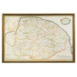
Huntington Both Shire and Shire Towne, hand coloured engraved map for George Humbell, late 17th century, 38 x 51cm (toned); Lincolnshire, publishe...
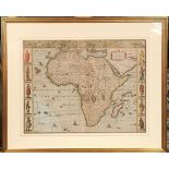
John Speed
Africae described, hand coloured map of Africa, for G. Humble, dated '1626' [but later?], 39 x 51cm (slight damage to lower left sea area)Note: Th...
John Senex
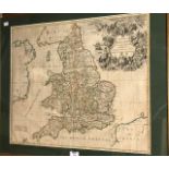
A New Map of England, 18th century engraving with outline hand colour, 51 x 61cmCondition report: some nibbling to lower left bottom edge ...[mor...
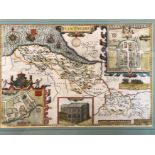
John Speed
Oxfordshire, hand coloured engraved map for Sudbury and Humble, c.1627, English text verso, 38 x 52cmCondition report: slight restoration upper le...
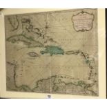
West Indies.
A New Map of the West Indian Islands, hand coloured engraving for Laurie and Whittle, 1795, 49 x 57.5cmCondition report: a little creasing vertica...
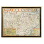
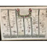
VIGNOLES (Charles) Map of the Midlands Counties Railway, 10 folding linen backed map sheets with hand colour, and 4 cross section plans, engraved ...
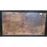
depicting twin hemispheres, with corner decorations, by Ann Horsnail, some fading of colour and age darkening, 39 x 73cm
John Speed
Cambridgeshire Described, engraved map for Bassett and Chiswell, c.1676, 45 x 59cm (some fading and foxing)
John Speed
The Countye Palatine of Chester, engraved map for Sudbury and Humble, early 17th century, with faded hand colour, some foxing and age toning, 41 x...
John Speed
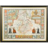
Warwickshire, hand coloured engraved map for Sudbury and Humble, early 17th century, slightly age toned, 41 x 53cm
John Ogilby
The Road from Exeter to Truroe, pl. 69, hand coloured engraving, 38 x 50cm; three others, plates 22, 41 and 57 (2 with slight worming, possibly st...
Emanuel Bowen
Map of Cambridgeshire, mid 18th century, foxing, 72 x 55cm; John Bodger, a plan printed on silk of Whittlesea Mere (damaged), 47 x 67cm; Jan Janss...
A General History of the Robberies and Murders of the most notorious Pyrates... with the remarkable Actions and Adventures of the two Female Pyrat...
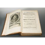
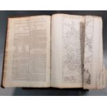
CAMDEN (William)
Camden's Britannia Newly Translated into English, London 1695, folio, Gibson edition, portrait frontispiece, 50 double page or folding maps, plate...
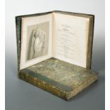
SMITH (John Thomas)
Vagabondiana; or, Anecdotes of Mendicant Wanderers through the Streets of London. 1817, large 4to, half title, coloured armorial title, title with...
lacking title page, c.1800, folio, with folding maps by T. Kitchin, and plates, some creasing and edge fraying, worn sheep
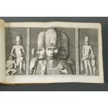
CHARDIN (Sir John)
The Travels of Sir John Chardin into Persia and the East Indies, Through the Black Sea, and the Country of Colchis. To which is added The Coronati...
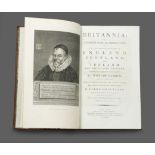
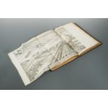
CAMDEN (William)
Britannia or a Chorographical Description of England, Scotland and Ireland, enlarged by Richard Gough, in 3 vols., London: John Nichols 1789, foli...
WINDUS (John)
A Journey to Mequinez; The Residence of the Present Emperor of Fez and Morocco. London 1725, 8vo, six folding plates, subscribers list, occasional...
FORREST (Captain Thomas)
A Voyage to New Guinea and the Moluccas, London 1779, 4to, portrait frontispiece, folding map at the start, plates, maps and plans including foldi...
[Anon] The Fortunate Isles, pp. 4 - 152 [lacking a title and possibly introductory page], 8vo, contemporary half sheep, worn, front cover detached...
MORIER (James)
A Journey through Persia, Armenia and Asia Minor to Constantinople. London 1812, 4to, 2 vols., maps and plates (a few coloured), generally a good ...
NIEBUHR (Carsten)
Voyage en Arabie et en d'autres Pays circonvoisins. Amsterdam and Utrecht 1776-80, 2 vols., 4to, engraved titles, half titles, folding map and 124...
![[BADIAH LEBILICH (Domingo)], "Ali Bey".](https://portal-images.azureedge.net/auctions-2020/srche10210/images/149f14e4-d094-4062-9f7e-ac56011229d7.jpg?w=155&h=155)
Travels of Ali Bey in Morocco, Tripoli, Cyprus, Egypt, Arabia, Syria and Turkey between the Years 1803 and 1807, in 2 vols., London 1816, 4to, pla...
Proceedings of the Expedition to explore the Northern Coast of Africa, from Tripoly Eastward; in MDCCCXXI and MDCCCXXII. First edition, London: Jo...
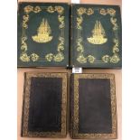
Plate books - British scenery.
FINDEN & BEATTIE. Views of the Ports, Harbours and Watering Places of Gt Britain, in 2 vols., 1842, 4to, 123 plates by Bartlett, (lacking 1 Lighth...
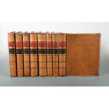
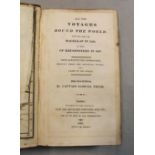
COOK (Captain James)
The Three Voyages, 1773-1784, 4to, 8 vols. (lacking the atlas vol.), folding maps and plates as required to first 2 Voyages, original calf with 19...
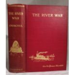
CHURCHILL (Winston Spencer)
The River War, revised edition 1902, 8vo, edited by Col. F Rhodes, inscribed to first blank 'Frank Rhodes from the Author Oct. 30. 02', with maps ...
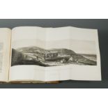
LEAKE (Lt. Col. William Martin)
Travels in the Morea, in 3 vols., London: John Murray 1830, 8vo, first edition, 17 engraved maps and plans, 13 plates of inscriptions, rather brow...
Bookbinding.
Collection of 13 vols., including: PEARSON (D) For the Love of Bookbinding, 2000; CONROY (T) Bookbinders' Finishing Tool Makers 1780-1965; MARKS (...