Refine your search
Sale Section
Estimate
Category
- Books & Periodicals (267)
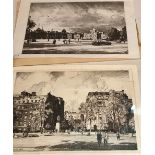
- Prints (132)
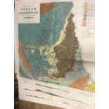
- Maps (48)
- Watercolours (17)
- Arms, Armour & Militaria (11)
- Collectables (8)
- Drawings & Pastels (6)
- Models, Toys, Dolls & Games (5)
- Photographs (5)
- Sculpture (4)
- Sporting Memorabilia & Equipment (4)
- Stamps (4)
- Furniture (3)
- Islamic Works of Art (3)
- Vintage Fashion (3)
- Chinese Works of Art (2)
- Entertainment Memorabilia (2)
- Oil, Acrylic paintings & Mixed Media (2)
- Russian Works of Art (2)
- Taxidermy & Natural History (2)
- Textiles (2)
- Tools (2)
- Cameras & Camera Equipment (1)
- Jewellery (1)
- Kitchenalia (1)
- Salvage & Architectural Antiques (1)
- Scientific Instruments (1)
- Writing Instruments (1)
Filtered by:
- Creator / Brand
- List
- Grid
A subscription to the Price Guide is required to view results for auctions ten days or older. Click here for more information
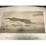

N. Whittock,
Birds-Eye View of the Island, Harbours and Fortifications of Cronstadt, lithograph 1854, c.44 x 64cm (sheet; some staining), and an engraving of t...
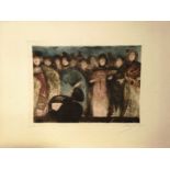
Ricardo Baroja (1871 - 1953)
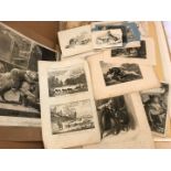
Collection of loose etchings, including 9 duplicate coloured plates of women singing on stage, three others - figure studies in dark or shade, siz...
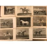
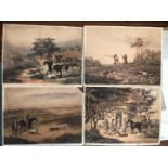
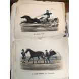
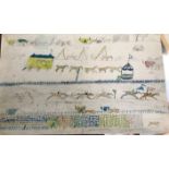
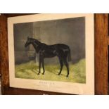
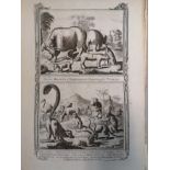
Racehorses,
a group of 130 loose engravings, 19th century, 8vo, after paintings by J F Herring, Harry Hall, Laporte and others, some slightly trimmed and stai...
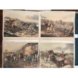
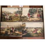
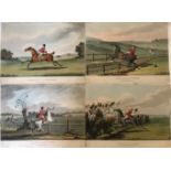
Sutherland after Alken,
Four hunting scenes, coloured aquatints published by Fuller 1818, 29 x 34cm (trimmed and toned)
Reeve after Wolstenholme,
Set of four shooting scenes, coloured aquatints, 19th century, loose (trimmed and toned), 30 x 39cm (4)
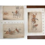
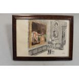
one probably a cartoon for Punch in pen and ink, 17 x 26cm; two in pencil, and one in watercolour dated 1883, 14 x 23cm (loose) (4)
hand coloured aquatints, 29 x 46cm (loose)
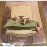
J. Gulston, 19th century,
five watercolours and drawings of Dolly, a spaniel, dated 1852-54, mounted, largest 35 x 27cm; with a female portrait by the same hand, 43 x 30cm,...
Reeve after Wolstenholme,
Four shooting scenes, coloured stipple engravings, c.43 x 55cm, trimmed, loose (4)
After Thomas Worth,
group of seven comical trotting scenes, coloured lithographs by Lipschitz, London, with captions below, edges rather frayed and torn, loose, c. 34...
The Cockney's Misfortune,
series of six hunting scenes, coloured aquatints, published Cambridge 1817, trimmed and loose, 20 x 26.5cm (6)
After James Seymour,
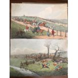
The Chaise Match Run on Newmarket Heath on Wednesday the 29th of August, 1750, coloured engraving originally published by R. Sayer, London, laid d...
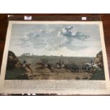
circa second quarter 19th century, showing crowds watching a race, with a circus wagon and further horses and carriages in the background, 28 x 44...
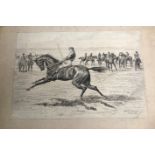
Kenneth Venables,
At the gallops, pen and ink, signed and dated October 1901, 23.5 x 35cm, mounted, unframed
hand coloured lithographs, 19th century, laid to board mounts, probably trimmed, 24.5 x 35cm (3)
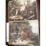
mainly 19th century, of various sizes and dates, some trimmed and mounted, including some later enlarged studies by the Bewick Press, all in varyi...
Three watercolour cartoons with famous painting subjects, signed, largest 20 x 29cm one with Chris Beetles Gallery label verso
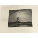
After Turner,
approx. 32 large paper steel engravings, with another by Samuel Prout and an original pen drawing by Arthur Peeters 'Pollok House' dated 1943, 28 ...
The Lacemaker signed 'Stanley Anderson' (lower right); numbered 'Ed:50' and titled to the mount engraving 21 x 16.5cm; The Rake-Makers signed 'Sta...
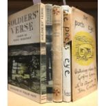
Artist illustrators.
English Scottish and Welsh Landscape, lithographs by John Piper, F. Muller 1944; Soldiers' Verse, lithographs by William Scott, 1945; The Poets Ey...
Three Good Friends, signed and marked 'Ed[ition] 65', titled to the mount in pencil, line engraving, 17 x 27cm

Stephen Gooden (1892-1955)
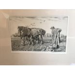
‘Kneeling Ploughman’, line engraving, from ‘The Fables of Jean de la Fontaine’, plate 15.5 x 8.5cms, together with 15 others of the same subject, ...
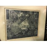
‘The Tea Garden’, wood engraving, signed and numbered 3/50 in pencil to lower margin, in original ebonised frame.

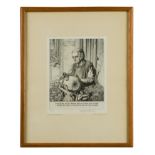
WHISTLER (J A M).
Dodgson (C) ‘The Etchings of James McNeill Whistler’, 1st edition, pub. The Studio, London, 1922, together with a late impression of ‘The Pool’, s...
two engraved sheets with hand colour from the large scale edition by Chapman and Andre, c.46 x 58cm (visible), maple frmaed (2)
After H Lucas Lucas
Bendigo, coloured print published by Fores, 1887, 41 x 54cm (image) in a walnut frame
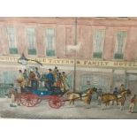
The Cambridge Telegraph, hand coloured aquatint, early 19th century, published by Moore, London, 44 x 55.5cm
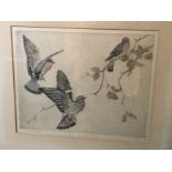
Three pigeons near a branch, coloured aquatint, signed numbered 27/75, 33 x 41cm
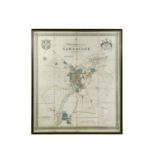
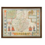
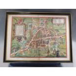
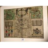
Richard Grey Baker,
New Map of the University and Town of Cambridge, dissected hand coloured large scale engraved plan of Cambridge, 1830, published by T. G. Baker an...
Geological Map of the British Islands, 1912; Maps of England and Wales, Ordnance Survey, by Wedd 1913; Durham and Northumberland, folded; together...
Leonard Russell Squirrel,
three Calendarium Londinense etchings, c.1948, each c.17.5 x 24cm, trimmed and loose (without the text below) (3)
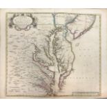
John Senex
A New Map of Virginia, Maryland, and the Improved Parts of Pennsylvania & New Jersey, double page engraving 1719, with outline hand colour, few te...
John Speed
Cambridgeshire Described, hand coloured engraved map for Bassett and Chiswell, c.1676, English text verso, 40 x 53cm
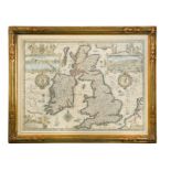
John Speed
The Kingdome of Great Britain and Ireland, hand coloured engraving for Bassett and Chiswell, c.1676, 40 x 52cm
After Hondius
China, hand coloured engraved map, late 17th or early 18th century, double page, with English text verso, loose, 40.5 x 47cmPartial tear to lower ...
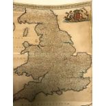
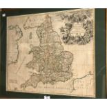
CARY (John)
Cary's New Map of England and Wales with Part of Scotland, 1794, 4to, engraved throughout, coloured general map, others with outline hand colour, ...
Braun and Hogenberg,
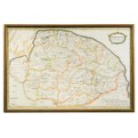
Nordovicum Angliae Civitas, hand coloured engraved plan of Norwich, c.1600, Latin text verso, 31.5 x 44cm
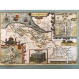
John Speed
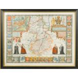
Kent, double page engraved hand coloured map, for G. Humble, some surface wear to lower right corner, 37.5 x 50cm
Topography including the Fens,
Historic Notices Fotheringhay, 1821; Excursions in the County of Norfolk, 1818 with the rare supplement of 1826, and additional map of Norwich; to...
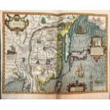
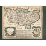
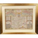
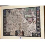
John Speed,
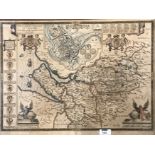
Cambridgeshire Described, hand coloured engraved map, published by Bassett and Chiswell, c.1676, 39 x 53cm
A bundle of engravings and maps,
late 18th century, including T. Kitchin and topographical plates from a history of geography work, some rather frayed and worn
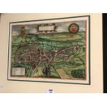
Braun and Hogenberg
Cantebrigia [Cambridge] engraved double page plan, circa 1600, 36 x 49cmCondition report: double glazed, Latin text verso, damage to along centre ...
John Speed
Flintshire, engraved coloured map for Sudbury and Humbel, 1610, some damage and retouching to lower corners, 38 x 50.5cm; Domus Senatoria Antwerpi...
Richard Blome,
a 17th Century map of Kent, hand coloured, 26.5 x 33cms (plate), together with a map of Surrey, c. 1715, 14.5 x 21.5cms (plate), both unframed.
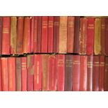
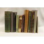
Collection of guides in original red cloth covers, a few with dust jackets; also others by Murray, Terry etc. (c.70 vol.)
Norden and Speed
Midle-Sex described, hand coloured engraved map of Middlesex, late 17th century, probably laid down, few crease marks to centrefold, 39 x 51cm
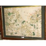
A folder of mixed county maps,
mainly 18th and 19th century and mostly by Morden, with a few larger GB maps by Pigot, Wyld and De Wit; also a world map by Weller (framed), a col...
John Speed
Huntington Both Shire and Shire Towne, hand coloured engraved map for George Humbell, late 17th century, 38 x 51cm (toned); Lincolnshire, publishe...
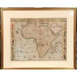
John Speed
Africae described, hand coloured map of Africa, for G. Humble, dated '1626' [but later?], 39 x 51cm (slight damage to lower left sea area)Note: Th...
John Senex
A New Map of England, 18th century engraving with outline hand colour, 51 x 61cmCondition report: some nibbling to lower left bottom edge ...[mor...
John Speed
Oxfordshire, hand coloured engraved map for Sudbury and Humble, c.1627, English text verso, 38 x 52cmCondition report: slight restoration upper le...
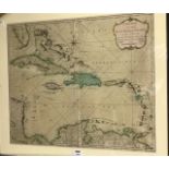
West Indies.
A New Map of the West Indian Islands, hand coloured engraving for Laurie and Whittle, 1795, 49 x 57.5cmCondition report: a little creasing vertica...

John Speed
The Kingdome of Great Britain and Ireland, hand coloured engraving for Bassett and Chiswell, c.1676, 38 x 51cm (areas of brown staining and damage)
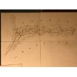
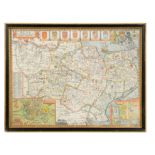
VIGNOLES (Charles) Map of the Midlands Counties Railway, 10 folding linen backed map sheets with hand colour, and 4 cross section plans, engraved ...
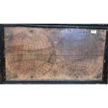
depicting twin hemispheres, with corner decorations, by Ann Horsnail, some fading of colour and age darkening, 39 x 73cm
Maps and plans of London.
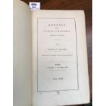
Report by the General Board of Health on the Supply of Water to the Metropolis, HMSO 1850, folio, with two large maps of London and various other ...
John Speed
Cambridgeshire Described, engraved map for Bassett and Chiswell, c.1676, 45 x 59cm (some fading and foxing)
John Speed
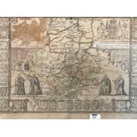
The Countye Palatine of Chester, engraved map for Sudbury and Humble, early 17th century, with faded hand colour, some foxing and age toning, 41 x...