
Filtered by:
- Show only bulk lots,
- Category
- List
- Grid
A subscription to the Price Guide is required to view results for auctions ten days or older. Click here for more information
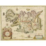

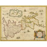
Iceland. A Blaeu tinted map, Tabula Islandiae Auctore Georgio Carolo Flandro, 39 x 51 cm See illustrationReportCentre foldReport by NGMap is fra...
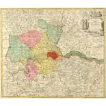
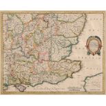
London. A coloured map, Magnae Brittania Metropoleos Londini, 51 x 59 cm See illustration Centre
London. A coloured map, Magnae Brittania Metropoleos Londini, 51 x 59 cm See illustrationCentre fold
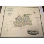
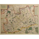
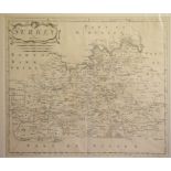
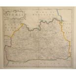
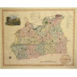
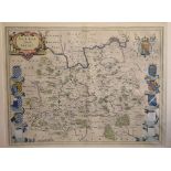
Surrey. A tinted map, Surria Vernacule Surrey, 39.5 x 51 cmCentre fold
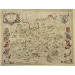
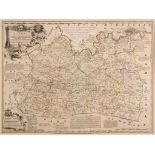
Kent. A John Harris coloured map, A Map of the County of Kent, with a vignette of Dover Castle and
Kent. A John Harris coloured map, A Map of the County of Kent, with a vignette of Dover Castle and Towne and a colourful border of the Kent famil...
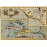
Spanish Americas. An Abraham Ortelius coloured map, Hispaniolae, Cubae, Aliarumque Insularum Circumiacientium, Delineatio, 36 x 50 cm See illust...
England. A Seutter's coloured map, Britanniae sive Angliae Regnum, 58 x 49.5 cm See illustration
England. A Seutter's coloured map, Britanniae sive Angliae Regnum, 58 x 49.5 cm See illustration
England and Wales. From Ortelius' Theatrum Orbis Terrarum, Angliae regni Florentissimi Nova Descriptio Auctore Humfredo Lhuyd Denbygiense, 1573, ...
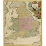
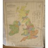
Great Britain and Ireland. A coloured map, A General Map of Great Britain and Ireland with part of
Great Britain and Ireland. A coloured map, A General Map of Great Britain and Ireland with part of Holland, Flanders, France, Agreable to Modern ...
Surrey. A tinted map, Surriae Comitatus Continens In Seoppida Mercatoria VII Centre fold, paper
Surrey. A tinted map, Surriae Comitatus Continens In Seoppida Mercatoria VIICentre fold, paper browned, brown marks to the centre fold
British Isles. A Covens and Mortier's coloured map based on the 1702 De L'Isle map, Les Isles
British Isles. A Covens and Mortier's coloured map based on the 1702 De L'Isle map, Les Isles Britanniques ou sont le Rne d'Angleterre Tire de Sp...
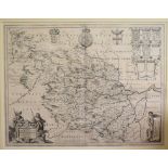
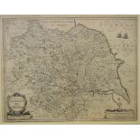
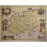
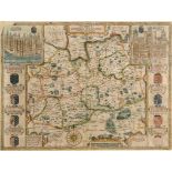
Yorkshire. A Robert Morden coloured map, The West Riding of Yorkshire, 36.5 x 42.5 cm Centre fold
Yorkshire. A Robert Morden coloured map, The West Riding of Yorkshire, 36.5 x 42.5 cmCentre fold
Surrey. A John Seller tinted map, Surrey Actually Surveyd and Delineated by John Seller Hydrographer
Surrey. A John Seller tinted map, Surrey Actually Surveyd and Delineated by John Seller Hydrographer to the King, Additions by P Lea, 43.5 x 52.5...
Ancient British Isles. A Jan Jansson's tinted map, Insularum Britannicarum Acurata Delineatio ex
Ancient British Isles. A Jan Jansson's tinted map, Insularum Britannicarum Acurata Delineatio ex Geographicis Conatibus Abraham Ortelii, 40 x 51 ...
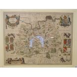
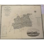
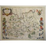
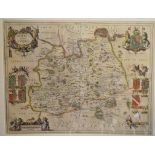
Surrey. A John Speed map, Surrey Described And Divided into Hundreds, with vignettes of Richmont and
Surrey. A John Speed map, Surrey Described And Divided into Hundreds, with vignettes of Richmont and Nonsuch castles, 39 x 52 cm See illustration...
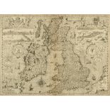
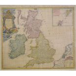
British Isles. A John Speed map, The Kingdome of Great Britaine and Ireland, with vignettes of
British Isles. A John Speed map, The Kingdome of Great Britaine and Ireland, with vignettes of London and Edynburgh, 38.5 x 51.5 cm See illustra...
Yorkshire. A Joan Blaeu map of the West Riding of Yorkshire, Ducatus Eboracensis Pars Occidentalis: The Westriding of Yorke Shire, 39 x 50.5 cmCe...
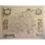
Surrey. An Emanuel Bowen tinted map, An Accurate Map of the County of Surrey, Divided into Hundreds,
Surrey. An Emanuel Bowen tinted map, An Accurate Map of the County of Surrey, Divided into Hundreds, Printed for T Bowles... and Mess Bakewell & ...
Surrey. A tinted map, Surriae Comitatus Continens In Seoppida Mercatoria VII, 38.5 x 49 cm Centre
Surrey. A tinted map, Surriae Comitatus Continens In Seoppida Mercatoria VII, 38.5 x 49 cmCentre fold, paper browned
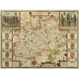
Surrey. A John Speed coloured map, Surrey Described And Divided Into Hundreds, with vignettes of
Surrey. A John Speed coloured map, Surrey Described And Divided Into Hundreds, with vignettes of Richmont and Nonsuch castles, 39.5 x 52.5 cm ...
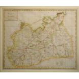
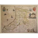
Yorkshire. A map of the county, Provincia Eboracensis Yorke-Shire, 39 x 50 cm
Surrey. A tinted map, Surria Vernacule Surrey, 39 x 51 cmCentre fold
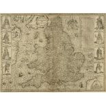
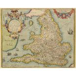
England. A John Speed map, The Kingdome of England, with vignettes of figures, including A Citizen, 38.5 x 51.5 cm See illustrationReportCentre ...
Surrey. An Emanuel Bowen tinted map, An Accurate Map of the County of Surrey, Divided into Hundreds,
Surrey. An Emanuel Bowen tinted map, An Accurate Map of the County of Surrey, Divided into Hundreds, Printed for T Bowles... and Mess Bakewell & ...
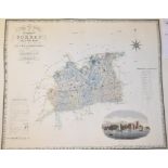
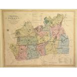
Surrey. A C & I Greenwood coloured map, Map of the County of Surrey from an Actual Survey made in
Surrey. A C & I Greenwood coloured map, Map of the County of Surrey from an Actual Survey made in the Years 1822 & 23, 64 x 80 cm, unframedFold, ...
Surrey. A C & I Greenwood map, Map of the County of Surrey from an Actual Survey made in the Years
Surrey. A C & I Greenwood map, Map of the County of Surrey from an Actual Survey made in the Years 1822 & 23, 64 x 80 cm, unframedOld
Surrey. A C & I Greenwood coloured map, Map of the County of Surrey from an Actual Survey made in
Surrey. A C & I Greenwood coloured map, Map of the County of Surrey from an Actual Survey made in the Years 1822 & 23, 64 x 80 cm, unframedFold
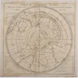
Southern Hemisphere. A Bellin map, Carte De L'Hemisphere Austral, Montrant Les Routes Des Navigateurs Les Plus Celebres Par Le Capitaine Jacques ...
Surrey. An Emanuel Bowen tinted map, An Accurate Map of the County of Surrey; Divided into its
Surrey. An Emanuel Bowen tinted map, An Accurate Map of the County of Surrey; Divided into its Hundreds, mounted, 54 x 72 cm See illustrationFo...
Surrey. An Emanuel Bowen tinted map, An Accurate Map of the County of Surrey; Divided into its
Surrey. An Emanuel Bowen tinted map, An Accurate Map of the County of Surrey; Divided into its Hundreds, mounted, 54 x 72 cmFolded, brown line t...
Surrey. An Emanuel Bowen tinted map, An Accurate Map of the County of Surrey; Divided into its
Surrey. An Emanuel Bowen tinted map, An Accurate Map of the County of Surrey; Divided into its Hundreds, mounted, 54 x 72 cmFolded, some brownin...
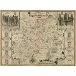
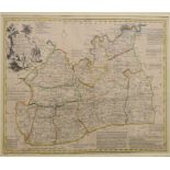
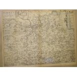
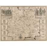
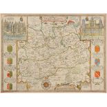
Middlesex. A Richard Seale tinted map, Map of the County of Middlesex, mounted, 53 x 74.5 cm See
Middlesex. A Richard Seale tinted map, Map of the County of Middlesex, mounted, 53 x 74.5 cm See illustrationReportFoldedReport by GHMap does no...
An album of maps and engravings, including Blome, Morden, Lodge, Ramble and others, including
An album of maps and engravings, including Blome, Morden, Lodge, Ramble and others, including Surrey, some coloured or tinted, all unframed
British Isles. Sixty four maps from the 1st County Series, mechanically coloured, including the Isle
British Isles. Sixty four maps from the 1st County Series, mechanically coloured, including the Isle of Man, all unframed, each approx. 26.5 x 3...
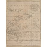
The Pacific. An Emanuel Bowen chart, A New & Accurate Chart of the Discoveries made by the late Capt
The Pacific. An Emanuel Bowen chart, A New & Accurate Chart of the Discoveries made by the late Capt J Cook..... Exhibiting Botany Bay, with the ...
Surrey. A William Kip map, Surrey Olim Sedes Regnorum, no plate number, mounted, 30 x 39 cm Report
Surrey. A William Kip map, Surrey Olim Sedes Regnorum, no plate number, mounted, 30 x 39 cmReport by RBFolded
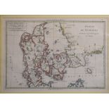
Denmark. A Rigobert Bonne tinted map, Royaume De Danemark, 25 x 36 cm, and two other maps of Denmark, all mounted (3)Report by RBBonne map folded
Surrey. A William Kip tinted map, Surrey Olim Sedes Regnorum, plate no. 9, mounted, 29.5 x 38 cm
Surrey. A William Kip tinted map, Surrey Olim Sedes Regnorum, plate no. 9, mounted, 29.5 x 38 cm
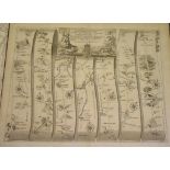
Road Map. A John Ogilby road map, The Road from London to St. Neotts, and another, The Road from
Road Map. A John Ogilby road map, The Road from London to St. Neotts, and another, The Road from London to Southampton, both unframed, 40.5 x 50 c...
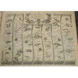
Road Map. A John Ogilby road map, The Road from Exeter to Truroe, and another, The Road from London to Weymouth, both unframed, 40.5 x 50 cmReport...
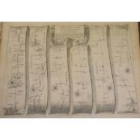
Road Map. A John Ogilby road map, The Road from London to Barwick, and another, The Road from London
Road Map. A John Ogilby road map, The Road from London to Barwick, and another, The Road from London to Bath & Wells, both unframed, 40.5 x 50 cmR...
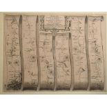
Road Map. A John Ogilby road map, The Road from London to Portsmouth, mounted, 33.5 x 43.5 cm, and
Road Map. A John Ogilby road map, The Road from London to Portsmouth, mounted, 33.5 x 43.5 cm, and another (2)Report by RBOne browned
Surrey. A Robert Morden map, Surrey, mounted, 37 x 43 cm, and another (2) Report by RB Both folded
Surrey. A Robert Morden map, Surrey, mounted, 37 x 43 cm, and another (2)Report by RBBoth folded
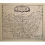
Suffolk. A Robert Morden map, Suffolk, mounted, 38 x 44 cm, another, Surrey, mounted, 37 x 43 cm,
Suffolk. A Robert Morden map, Suffolk, mounted, 38 x 44 cm, another, Surrey, mounted, 37 x 43 cm, and another map of Surry, mounted (3)Report by R...
Surrey. A Robert Morden map, Surrey, mounted, 36 x 42 cm, and another, tinted, mounted, 37 x 43
Surrey. A Robert Morden map, Surrey, mounted, 36 x 42 cm, and another, tinted, mounted, 37 x 43 cm (2)Report by RBBoth folded
Surrey. A John Heywood map, A Map of Surry, Engraved from an Actual Survey with Improvements, 36.5 x
Surrey. A John Heywood map, A Map of Surry, Engraved from an Actual Survey with Improvements, 36.5 x 44 cm, a tinted map of Sussex, mounted, 36 x ...
Surrey. A coloured map, New Map of the County of Surrey: Divided into Hundreds, Containing the
Surrey. A coloured map, New Map of the County of Surrey: Divided into Hundreds, Containing the District Divisions and either Local Arrangements ef...
Surrey. A Thomas Dix coloured map, A New Map of the County of Surrey, Divided into Hundreds, with
Surrey. A Thomas Dix coloured map, A New Map of the County of Surrey, Divided into Hundreds, with a vignette of Kew Palace, mounted, 38 x 48 cm, a...
Durham. A Robert Morden map, Episcopaius Dunelmensis Vulgo The Bishoprick of Durham, mounted, 37.5 x
Durham. A Robert Morden map, Episcopaius Dunelmensis Vulgo The Bishoprick of Durham, mounted, 37.5 x 43.5 cmFolded, a little faint especially to ...
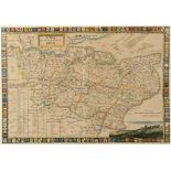
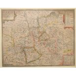
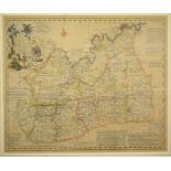
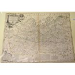
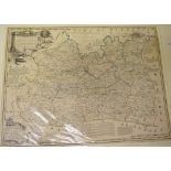
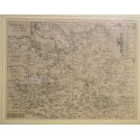
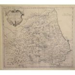
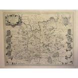
South East England. A Henrici Hondy tinted map, Warwicum, Northamtonia, Huntingdonia, Canrabrigia,
South East England. A Henrici Hondy tinted map, Warwicum, Northamtonia, Huntingdonia, Canrabrigia, Suffolcia, Oxonium, Buckinghamia, Bedfordia, H...
Surrey. A Willem Blaeu map, Surria Vernacule Surrey, mounted, 40 x 52 cmFolded
Surrey. A Jan Jansson map, Surria Vernacule Surrey, mounted, 39.5 x 52 cmFolded
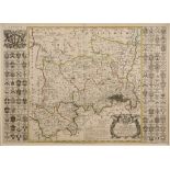
Cardiganshire. A Jan Jansson tinted map, Cardiganensis Comitatus; Anglis Cardigan Shire, mounted,
Cardiganshire. A Jan Jansson tinted map, Cardiganensis Comitatus; Anglis Cardigan Shire, mounted, 39.5 x 52 cm See illustrationFolded, some brown...
Surrey. A Willem Blaeu coloured map, Surria Vernacule Surrey, mounted, 39.5 x 51 cmFolded
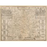
Surrey. A John Speed map, Surrey Described And Divided Into Hundreds, with vignettes of Richmont and
Surrey. A John Speed map, Surrey Described And Divided Into Hundreds, with vignettes of Richmont and Nonsuch castles, mounted, 39 x 52.5 cm See ...
Surrey. A Petri Schenk Gerardi Valk coloured map, Surria Vernacule Surrey, mounted, 39 x 50.5 cm
Surrey. A Petri Schenk Gerardi Valk coloured map, Surria Vernacule Surrey, mounted, 39 x 50.5 cm
Surrey. A John Speed map, Surrey Described And Divided Into Hundreds, with vignettes of Richmont and
Surrey. A John Speed map, Surrey Described And Divided Into Hundreds, with vignettes of Richmont and Nonsuch castles, mounted, 39 x 52 cm See il...
Surrey. A Willem Blaeu coloured map, Surria Vernacule Surrey, mounted, 40 x 52 cmFolded
Surrey. A John Speed coloured map, Surrey Described And Divided Into Hundreds, with vignettes of
Surrey. A John Speed coloured map, Surrey Described And Divided Into Hundreds, with vignettes of Richmont and Nonsuch castles, mounted, 39 x 52 c...
Surrey. A Jan Jansson coloured map, Surria Vernacule Surrey, mounted, 39 x 51 cmFolded
Surrey. A John Speed coloured and red ruled map, Surrey Described And Divided Into Hundreds, with
Surrey. A John Speed coloured and red ruled map, Surrey Described And Divided Into Hundreds, with vignettes of Richmont and Nonsuch castles, moun...