Refine your search
Filtered by:
- Sale Section,
- Category,
- Item Type
- List
- Grid
A subscription to the Price Guide is required to view results for auctions ten days or older. Click here for more information
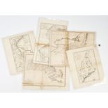

Five (5) 18th century Maps by Samuel Lewis: Maine, Massachusetts, Pennsylvania, New York and New Jersey, from The General Atlas for Carey €™s Edi...
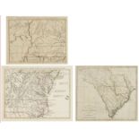
Three (3) Southern Maps, including two (2) Antonio Zatta 1778, one (1) South Carolina 1796. 1st-2nd items: Two (2) Antonio Zatta (Italian, fl. 175...
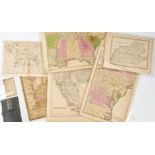
Group of six (6) mid-19th century maps. 1st item: MAP OF TENNESSEE AND KENTUCKY by G.W. Boynton & Co., showing railroads and canals. 9 3/4" x 12 5...
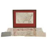
Butler, Frederick: A MODERN ATLAS TO ACCOMPANY THE SYSTEM OF GEOGRAPHY AND HISTORY COMBINED; undated, circa 1825. Wethersfield: Deming & Francis, ...
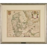
Early Map of Denmark
Matthaus Merian, DANIA REGUM, hand-colored map of Denmark and Scandinavia from Neuwe Archontologica Cosmica by Johann Gottfried, 1638. Two (2) dec...
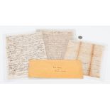
Three (3) archival documents pertaining to early Pennsylvania, including land document signed by John Penn (1729-1795), last governor of colonial ...