Filtered by:
- Category
- List
- Grid
A subscription to the Price Guide is required to view results for auctions ten days or older. Click here for more information
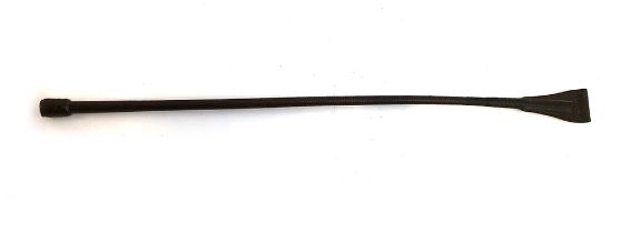

A cutting whip, probably by Swain Adeney & Brigg, with silver plaque to pommel, inscribed 'Riding
A cutting whip, probably by Swain Adeney & Brigg, with silver plaque to pommel, inscribed 'Riding House Department of His Majesty's Ordnance', 72c...
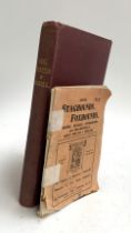
WATHEN, David (ed. and pub.), 'Harehunters All (Late Jellydogs All), One Hundred Articles concerning
WATHEN, David (ed. and pub.), 'Harehunters All (Late Jellydogs All), One Hundred Articles concerning Beagles and other Hare-Hunting Hounds which a...
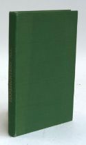
HARVEY, Lt-Col J.R., 'Deer Hunting in Norfolk from the Earliest Times', Norwich 1910. Burgundy board
HARVEY, Lt-Col J.R., 'Deer Hunting in Norfolk from the Earliest Times', Norwich 1910. Burgundy boards. A few pages detached. Comes with a small pa...
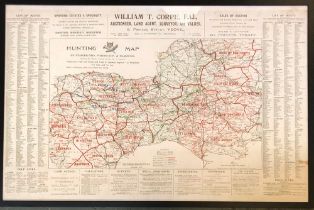
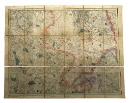
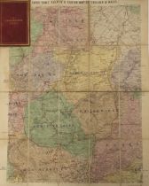
Five reproduction hunt maps, two of the Holderness Hunt, 64x80cm and 66x81cm, The Tynedale Hunt,
Five reproduction hunt maps, two of the Holderness Hunt, 64x80cm and 66x81cm, The Tynedale Hunt, 63x62cm, 'Hunting Map of Staghounds, Foxhounds an...
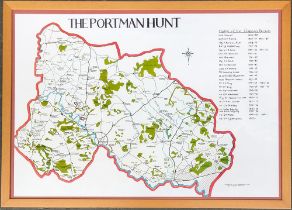
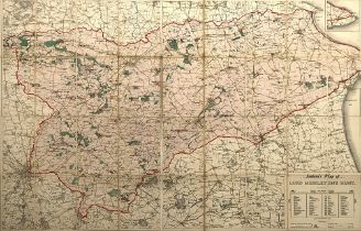
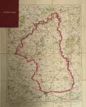
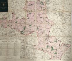
A map of the Portman Hunt country with a list of masters from 1858-1892 (1990), framed and glazed
A map of the Portman Hunt country with a list of masters from 1858-1892 (1990), framed and glazed
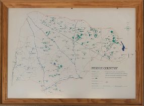
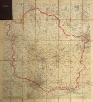
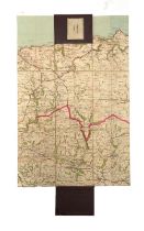
A framed and glazed map fo the Fernie Hunt country, 1980, 49x69cm
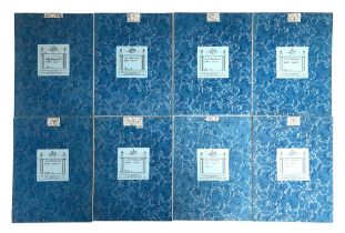
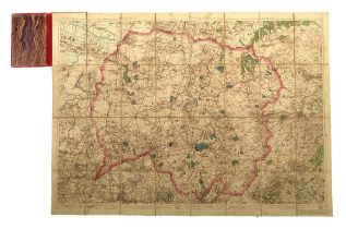
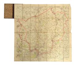
Old Berkeley West Hunt, hunt map in eight parts, by Sifton, Praed & Co Ltd, 'The Map House'
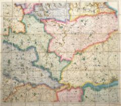
A 19th century map of the Meynell Hunt, c.1834, published by Edward Stanford, 26 & 27 Cockspur St.
A 19th century map of the Meynell Hunt, c.1834, published by Edward Stanford, 26 & 27 Cockspur St. Charing Cross
An early 20th century linen backed map of the Blackmore Vale hunt, published by Edward Stanford,
An early 20th century linen backed map of the Blackmore Vale hunt, published by Edward Stanford, 26 & 27 Cockspur St. Charing Cross
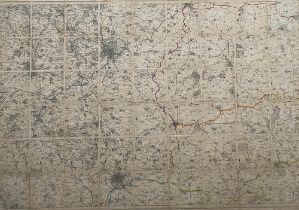
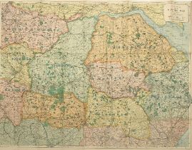
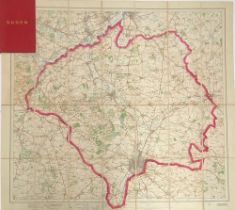
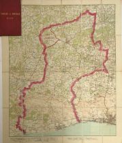
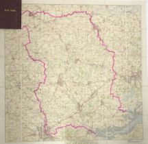
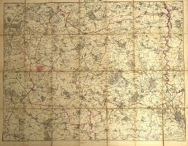
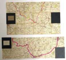
A linen backed hunt map of Rutland and Leicestershire, showing Nottingham and Leicester, Ordnance
A linen backed hunt map of Rutland and Leicestershire, showing Nottingham and Leicester, Ordnance Survey of England (3rd ed.), sheet 125, 126 & 12...
Ootacamund Hunt map, linen backed, Malabar & Nilgiri Districts, seasons 1908-11, second edition c.
Ootacamund Hunt map, linen backed, Malabar & Nilgiri Districts, seasons 1908-11, second edition c.1930, with cloth boards, 123x100cm
Fitzwilliam Hunt map, c.1835, linen backed with marbled covers and slip case, by Edward Stanford
Fitzwilliam Hunt map, c.1835, linen backed with marbled covers and slip case, by Edward Stanford 53 Charing Cross, 84x91cm
A 19th century hunt map, showing 20 miles round York, linen backed with marbled boards, slip case,
A 19th century hunt map, showing 20 miles round York, linen backed with marbled boards, slip case, c.1898, by Edward Stanford, Geographer to His M...
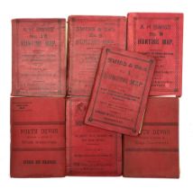
A set of linen backed hunt maps by A H Swiss, Devonport, including: 'South Devon hunt map, including
A set of linen backed hunt maps by A H Swiss, Devonport, including: 'South Devon hunt map, including a portion of East Cornwall', 66x92cm; 'The Ha...
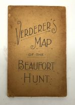
'Verderer's Map of the Beaufort Hunt', linen backed, 60x75cm
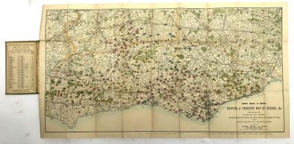
A hunt map, 'Hunting and Tourist's Map of Sussex' by John Beal & Sons, linen backed, 49x90cm
A hunt map, 'Hunting and Tourist's Map of Sussex' by John Beal & Sons, linen backed, 49x90cm
A 19th century hunt map, 'Jackson's Map of the Lord Middleton's Hunt', 69x107cm
A linen backed hunt map, by A H Swiss, Devonport, No.15,, showing the meets of nine packs of
A linen backed hunt map, by A H Swiss, Devonport, No.15,, showing the meets of nine packs of hounds to include the Rufford and the Badsworth, 78x1...
A line backed hunt map of the Bedale Hunt country, by Edward Stanford, Geographer to His Majesty,
A line backed hunt map of the Bedale Hunt country, by Edward Stanford, Geographer to His Majesty, 12, 13 & 14 Long Acre WC, with marbled ends and ...
A line backed hunt map of the Zetland Hunt country, by Edward Stanford, Geographer to His Majesty,
A line backed hunt map of the Zetland Hunt country, by Edward Stanford, Geographer to His Majesty, 12, 13 & 14 Long Acre WC, with marbled ends and...
A line backed hunt map of the Puckeridge Hunt country, by Edward Stanford, Geographer to His
A line backed hunt map of the Puckeridge Hunt country, by Edward Stanford, Geographer to His Majesty, 12, 13 & 14 Long Acre WC, with marbled ends ...
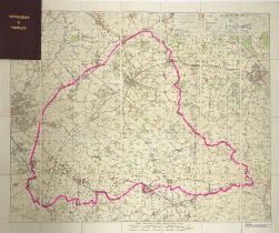
A linen backed hunt map of the Quorn Hunt country, by Edward Stanford, Geographer to His Majesty,
A linen backed hunt map of the Quorn Hunt country, by Edward Stanford, Geographer to His Majesty, 12, 13 & 14 Long Acre WC, with red cloth cover, ...
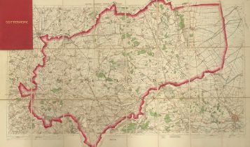
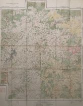
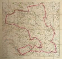
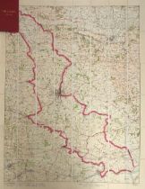
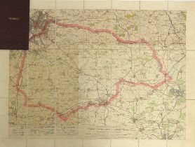
A linen backed hunt map of the Cottesmore Hunt country, by Edward Stanford, Geographer to His
A linen backed hunt map of the Cottesmore Hunt country, by Edward Stanford, Geographer to His Majesty, 12, 13 & 14 Long Acre WC, with marbled ends...
A linen backed hunt map of the Grafton Hunt country, by Edward Stanford, Geographer to His Majesty, 12, 13 & 14 Long Acre WC, with marbled ends an...
A linen backed hunt map of the Crawley & Horsham Hunt country, by Edward Stanford, Geographer to His
A linen backed hunt map of the Crawley & Horsham Hunt country, by Edward Stanford, Geographer to His Majesty, 12, 13 & 14 Long Acre WC, with red c...
A linen backed hunt map of the Whaddon Chase country, by Edward Stanford, Geographer to His Majesty,
A linen backed hunt map of the Whaddon Chase country, by Edward Stanford, Geographer to His Majesty, 12, 13 & 14 Long Acre WC, with red cloth cove...
A linen backed hunt map of the York and Ainsty (South) hunt country, by Edward Stanford, Geographer to His Majesty, 12, 13 & 14 Long Acre WC, with...
A linen backed hunt map of the Atherstone hunt country, mounted by Stanfords, Long Acre London, with
A linen backed hunt map of the Atherstone hunt country, mounted by Stanfords, Long Acre London, with marbled ends and Morocco cover, 86x78cm
A linen backed hunt map of the East Essex hunt country, mounted by Stanfords, Long Acre London, with
A linen backed hunt map of the East Essex hunt country, mounted by Stanfords, Long Acre London, with marbled ends and red cloth cover, 77x77cm
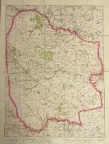
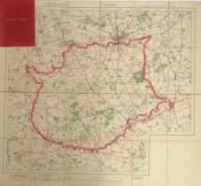
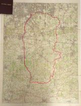
A linen backed hunt map of the Fernie hunt country, mounted by Stanfords, Long Acre London, with
A linen backed hunt map of the Fernie hunt country, mounted by Stanfords, Long Acre London, with marbled ends and Morocco cover, 52x69cm
A linen backed hunt map of the Newmarket & Thurlow hunt country, mounted by Stanfords, Long Acre
A linen backed hunt map of the Newmarket & Thurlow hunt country, mounted by Stanfords, Long Acre London, with marbled ends and Morocco cover, 62x7...
A linen backed hunt map of the Old Surrey & Burstow hunt country, mounted by Stanfords, Long Acre
A linen backed hunt map of the Old Surrey & Burstow hunt country, mounted by Stanfords, Long Acre London, with marbled ends and Morocco cover, 107...
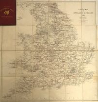
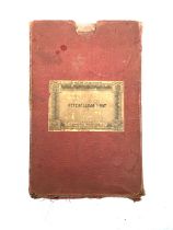
A linen backed hunt map, 'The Field Hunting Map' of England and Wales, c.1880, with marbled ends and
A linen backed hunt map, 'The Field Hunting Map' of England and Wales, c.1880, with marbled ends and red cloth boards, 68x65cm
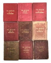
A set of nine small linen backed fox hunting maps of various counties, by J & C Walker, published by
A set of nine small linen backed fox hunting maps of various counties, by J & C Walker, published by Longman Hurst; Stafforshire; Sussex; Buckingh...
A linen backed hunt map of the Heythrop Hunt country, by Edward Stanford, Geographer to His Majesty,
A linen backed hunt map of the Heythrop Hunt country, by Edward Stanford, Geographer to His Majesty, 12, 13 & 14 Long Acre WC; together with a mi...
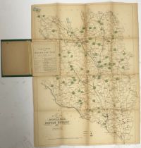
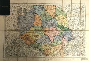
A map of the Meath & Ward Hunting district 1878, by Hodges Foster & Figgis, Dublin, to include a
A map of the Meath & Ward Hunting district 1878, by Hodges Foster & Figgis, Dublin, to include a pamphlet with the places of meeting of the Meath ...
Two double sided maps of the North Cotswold Hunt country and Croome Hunt country, by Sifton, Praed &
Two double sided maps of the North Cotswold Hunt country and Croome Hunt country, by Sifton, Praed & Co. Ltd; together with an OS 1 inch map of th...
A double sided map of the Exmoor Hunt country by Sifton, Praed & Co. Ltd, 47x31cm
A linen backed hunt map, 'Jackson's Map of the York & Ainsty Hunt', 96x83
A linen backed hunt map of Hertfordshire, by George Philip & Son Ltd, 32 Fleet Street, 74x106cm;
A linen backed hunt map of Hertfordshire, by George Philip & Son Ltd, 32 Fleet Street, 74x106cm; together with Lawrence's Hunting Map round Rugby;...
A linen backed hunt map of the Cambridgeshire Hunt country, by Edward Stanford, Geographer to His
A linen backed hunt map of the Cambridgeshire Hunt country, by Edward Stanford, Geographer to His Majesty, 12, 13 & 14 Long Acre WC; together with...
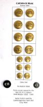
A collection of hunt buttons: Cattistock Hunt, formed 1860, from a coat owned by the late Col. H. C.
A collection of hunt buttons: Cattistock Hunt, formed 1860, from a coat owned by the late Col. H. C. Batten, joint master 1939-1960
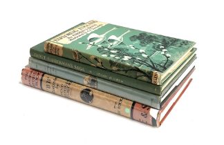
WATKINS-PITCHFORD, D.J. ('BB'): 'The Countryman's Bedside Book', Eyre and Spottiswoode, 2nd imp.,
WATKINS-PITCHFORD, D.J. ('BB'): 'The Countryman's Bedside Book', Eyre and Spottiswoode, 2nd imp., Jan 1942; also, 'The Autumn Road to the Isles', ...
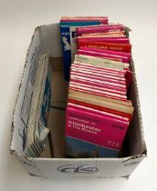
A quantity of Ordnance Survey land range maps
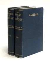
HEATH-ROBINSON, William: 'The Works of Rabelais' (2 vols.) in good condition. Blue cloth with a
HEATH-ROBINSON, William: 'The Works of Rabelais' (2 vols.) in good condition. Blue cloth with a few marks. No loss. Generally white, bright and sq...
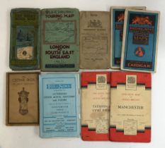
A small quantity of vintage OS and other maps
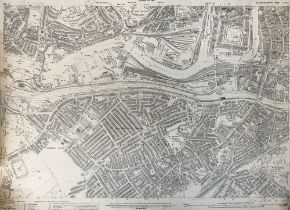
Two maps 1:2500 maps of Bristol Southwall Ward, Gloucestershire sheet LXXV.4 and LXXVI.1, 74x104cm
Two maps 1:2500 maps of Bristol Southwall Ward, Gloucestershire sheet LXXV.4 and LXXVI.1, 74x104cm