Filtered by:
- Category,
- Item Type
- List
- Grid
A subscription to the Price Guide is required to view results for auctions ten days or older. Click here for more information
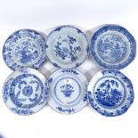

A group of Chinese blue and white plates, including 18th and 19th century examples, all A/F, largest
A group of Chinese blue and white plates, including 18th and 19th century examples, all A/F, largest diameter 24cm (6)
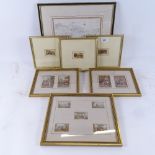
A 19th century framed map of Kent, height 32cm overall, 5 miniature Baxter prints in single frame,
A 19th century framed map of Kent, height 32cm overall, 5 miniature Baxter prints in single frame, and other framed miniature prints
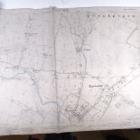
A set of 4 1897 Board of Agriculture Ordnance Survey Second Edition Sussex West sheet maps
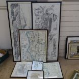
7 various reproduction maps, including Sussex
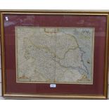
A 19th century Antique hand coloured map of Yorkshire, to include the German Ocean and part of
A 19th century Antique hand coloured map of Yorkshire, to include the German Ocean and part of West Moorland, by John Speede, framed, 60cm x 73cm
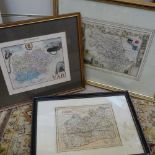
3 Antique coloured maps, to include France, Yorkshire West Ridge and Surrey, framed
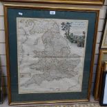
An 18th century hand coloured pocket map of England and Wales, by Bowles's, framed, 78cm x 69cm
An 18th century hand coloured pocket map of England and Wales, by Bowles's, framed, 78cm x 69cm
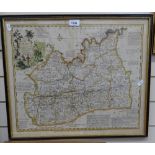
An 18th century hand coloured map, part of Middlesex, plate no. 34, 48cm x 56cm