Filtered by:
- Category,
- Item Type
2 items
- List
- Grid
A subscription to the Price Guide is required to view results for auctions ten days or older. Click here for more information
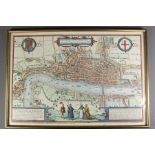

After Braun & Hogenberg Map of London, first printed in 1572, approx 50.5 x 35 cms, frame and glazed. ...[more]
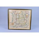
Antique map of Wales, England and Scotland, engraved by William Hole 1637, from the original map by Christopher Saxton 1579 approx 37 w x 33 cms h...