Refine your search
Filtered by:
- Category,
- Item Type
- List
- Grid
A subscription to the Price Guide is required to view results for auctions ten days or older. Click here for more information
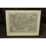

John Speede Map of Hartfordshire
John Speede Map of Hartfordshire - uncoloured, Hartford shire described the situations at Hartford and the most ancient town of St Albans with suc...
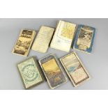
Selection of Seven Maps
Selection of seven maps; including Philips "Authentic Map of Palestine" (mounted on cloth) published by George Philip & Son, 32, Fleet Street, Lon...
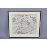
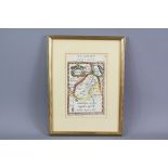
Thomas Bowyer Antique Map
Thomas Bowyer antique map - the hand-coloured map depicting the region of Napthali, showing the region north of the Sea of Galilea, showing variou...
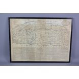
Antique Maps
Antique Maps - including Britannia plate 37 strip road map, from London to Carlisle, via Darlaston, Newcastle, Brewerton, Holmes Chapel, Lostock G...
Antique Maps
Antique Maps - including two Middle Eastern maps, Sidney Hall 'Palestine' published by Longman Rees Orme Brown & Green approx 49 x 57 cms framed a...
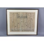
Thomas Bowles and John Bowles Antique Map of The Holy Land or Land of Promise, approx 58 x 43 cms, framed and glazed, with key relating to Cities ...