Filtered by:
- Show only bulk lots,
- Sale Section,
- Item Type
- List
- Grid
A subscription to the Price Guide is required to view results for auctions ten days or older. Click here for more information
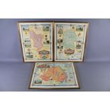

Three Post War Colour Print Maps by Cartographer Ernest Clegg (1876-1954) The maps depicting the counties of Derbyshire, Wiltshire and Northern Ir...
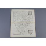
Richard Blome Three Antique Maps. This lot includes Mapp of Bedfordshire - with it's Hundred, copper plate, portrait view with foolscap watermark ...
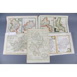
Emanuel Bowen and Alexander Hogg Antique Maps. This lot includes Hartfordshire - Divided into Hundreds, landscape view, hand-coloured circa 1767, ...
Herbert Moll, T. Kitchin and John Wilkes Antique Maps. This lot includes two maps by John Ellis 'A Modern Map of Bedfordshire' circa 1766 from the...
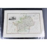
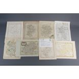
A Folio of Antique 18th and 19th Century Maps. This lot includes the maps of counties of Hertfordshire, Bedfordshire, Buckinghamshire by Pigot, Fi...
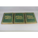
A. Garran Sydney 1886 Picturesque 1st Edition Atlas of Australasia in Three Volumes. First Atlas and Survey of the Australian Continent. Decorativ...
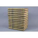
The Plays of George Bernard Shaw Pocket Edition in Twelve Volumes, printed in Great Britain by R. & P. Clark, Limited Edinburgh 1926. ...[more]
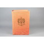
A 1952 Burkes Peerage
Burkes Peerage 1952. "Genealogical and Heraldic History of the Landed Gentry", founded 1836 by John Burke and Sir Bernard Burke, edited by L.G. Pi...
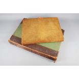
A 1922 "The Times Atlas"
A 1922 "The Times Atlas & Gazetteer of the World". Selfridge Edition, published by The Times, Printing House Square, London EC.4. The Atlas with a...