
Filtered by:
- Category,
- Item Type
- List
- Grid
A subscription to the Price Guide is required to view results for auctions ten days or older. Click here for more information
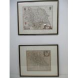

A Blaeu map of Yorkshire with inset crests, 15 1/2" x 19 1/2" and a Robert Morden map of Northamptonshire, 14" x 16 1/4", each hand coloured in do...
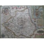
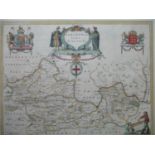
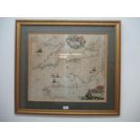
A map of The Bishoprick and Citie of Durham, possibly by John Speed with an inset plan of Durham,
A map of The Bishoprick and Citie of Durham, possibly by John Speed with an inset plan of Durham, hand coloured, 15" x 20", in a double sided glaz...
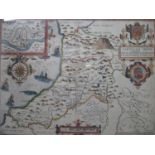
A John Speen map of Pembrokeshire with inset plans of Pembroke and Saint Davi's by John Sudbury
A John Speen map of Pembrokeshire with inset plans of Pembroke and Saint Davi's by John Sudbury and George Humble, hand coloured, 15" x 20", in a ...
A Joannem Janssonium map of Buckinghamshire and Bedfordshire with inset crests, hand coloured, 16" x
A Joannem Janssonium map of Buckinghamshire and Bedfordshire with inset crests, hand coloured, 16" x 20", in a double sided glazed frame
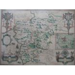
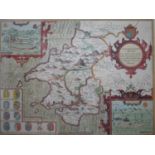
A John Speed map of Merionethshire Wales with inset plan of Harlech and crests, sold in Popes Head
A John Speed map of Merionethshire Wales with inset plan of Harlech and crests, sold in Popes Head Alley by George Humble, hand coloured - 15" x 2...
A Johannes Blaeu map of Berkshire with inset crests, hand coloured, 15" x 19 1/2" in a double
A Johannes Blaeu map of Berkshire with inset crests, hand coloured, 15" x 19 1/2" in a double sided glazed frame
A John Speed map of Cardiganshire Wales with inset plan of Cardigan and crests, sold in Popes Head
A John Speed map of Cardiganshire Wales with inset plan of Cardigan and crests, sold in Popes Head Alley by John Sudbury and George Humbell, hand ...
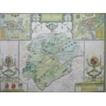
A John Speed map of Rutlandshire with inset plans of Oukham and Stanford, sold by Thomas Basett in
A John Speed map of Rutlandshire with inset plans of Oukham and Stanford, sold by Thomas Basett in Fleetstreet and Richard Chiswell in St Pauls C...
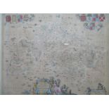
Frederick de Wit - Map of Canals (shipping routes) of England and Wales, with coloured border,
Frederick de Wit - Map of Canals (shipping routes) of England and Wales, with coloured border, vignettes and ships, 19 1/2" x 23", framed and glaz...
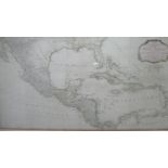
An Edition of Monsr Danville 'A New and Complete Map of the West Indies Comprehending All the Coasts
An Edition of Monsr Danville 'A New and Complete Map of the West Indies Comprehending All the Coasts and Islands Known by that Name', 18 1/2" x 34...