Refine your search
Filtered by:
- Sale Section,
- Item Type
- List
- Grid
A subscription to the Price Guide is required to view results for auctions ten days or older. Click here for more information


Ioannem Iansonium, map engraving, "Champagne Comitatus Campania", with English text verso, 58.5cm
Ioannem Iansonium, map engraving, "Champagne Comitatus Campania", with English text verso, 58.5cm x 50cm
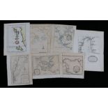
Collection of maps depicting coastlines, canals and rivers, to include "Canal de Noel", "A Map of
Collection of maps depicting coastlines, canals and rivers, to include "Canal de Noel", "A Map of the coast and country about Sierra Lione and She...
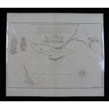
Dunbar, map engraving "A DRAUGHT OF PORTLAND THE SHAMBLES AND THE RACE OF PORTLAND", 62cm x 53cm
Dunbar, map engraving "A DRAUGHT OF PORTLAND THE SHAMBLES AND THE RACE OF PORTLAND", 62cm x 53cm
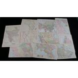
Collection of maps, to include Canada, Canada (Western Provinces), Egypt, Palestine, Australia,
Collection of maps, to include Canada, Canada (Western Provinces), Egypt, Palestine, Australia, Asia, Egypt/Nubia with Abyssinia, Africa, Turkey a...
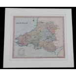
Henry Teesdale, coloured map engraving, South Wales, mounted, the map 42.5cm x 35cm
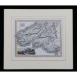
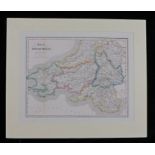
Coloured map engraving, South Wales, circa 1842, with depiction of Oystermouth Castle & Harbour,
Coloured map engraving, South Wales, circa 1842, with depiction of Oystermouth Castle & Harbour, mounted, the map 26cm x 20.5cm ...[more]
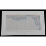
C.F. Cruchley, coloured map engraving, Swansea Bay, circa 1860, mounted, the map 47cm x 20.5cm
C.F. Cruchley, coloured map engraving, Swansea Bay, circa 1860, mounted, the map 47cm x 20.5cm
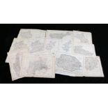
Collection of twenty British county maps, to include The Dispatch Atlas, Berkshire, Cambridgeshire, Cheshire, Devonshire (North and South division...
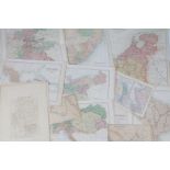
World maps to include North and South Australia, Turkey in Asia, Central America, Greece and the
World maps to include North and South Australia, Turkey in Asia, Central America, Greece and the Aegean, Austrian Dominions, Prussia, Holland & Be...
Coloured map engraving, "South Wales engraved for Roscoe's wanderings & excursions in the principality", mounted, the map 39cm x 30.5cm ...[more]
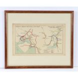
Coloured map engraving, Aberavon, Margam, Pont-Y-Rhyll & Port Talbot, Briton Ferry, Cardonnel, Court
Coloured map engraving, Aberavon, Margam, Pont-Y-Rhyll & Port Talbot, Briton Ferry, Cardonnel, Court Sart & Neath, showing the railway lines and s...