Refine your search
Sale Section
Remove filter- Maps & Prints (6)
Estimate
Category
Remove filter- Books & Periodicals (6)
Filtered by:
- Sale Section,
- Category,
- Item Type
- List
- Grid
A subscription to the Price Guide is required to view results for auctions ten days or older. Click here for more information
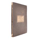

ARROWSMITH, Aaron - Eton College Ancient Atlas : consisting of Twenty-Six Maps, with Plans of Ancient Rome and Athens : 26 hand coloured maps, 2 u...

DONEGAL : Illustrated Handbook of the Scenery and Antiquities of South- Western Donegal : illust,
DONEGAL : Illustrated Handbook of the Scenery and Antiquities of South- Western Donegal : illust, org. cloth, 8vo, 1872. With - 8 folding maps of ...
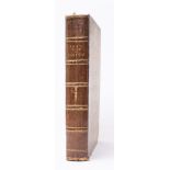

GENTLEMAN'S MAGAZINE : Vol.
GENTLEMAN'S MAGAZINE : Vol. XXVII, 17 ex 22 copper engraved plates and maps, half calf worn, 8vo, 1757. With - Vol. XXIX, & The Royal Magazine, Vo...
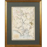
PLYMOUTH : "The Environs of Plymouth, Stonehouse, and Devonport," hand coloured map, 395 x 270 mm,
PLYMOUTH : "The Environs of Plymouth, Stonehouse, and Devonport," hand coloured map, 395 x 270 mm, published by William Wood of Devonport, 1868. A...
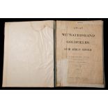
WITWATERSRAND GOLDFIELDS : "An Atlas of the Witwatersrand Goldfields in the South African Republic,
WITWATERSRAND GOLDFIELDS : "An Atlas of the Witwatersrand Goldfields in the South African Republic, compiled under the direction of C. S. Goldman...