Refine your search
Sale Section
Estimate
Category
- Books & Periodicals (347)
- Prints (65)
- Arms, Armour & Militaria (35)
- Maps (33)
- Musical Instruments & Memorabilia (8)
- Sporting Memorabilia & Equipment (7)
- Furniture (6)
- Photographs (6)
- Coins (5)
- Collectables (5)
- Stamps (5)
- Models, Toys, Dolls & Games (4)
- Watercolours (4)
- Textiles (3)
- Oil, Acrylic paintings & Mixed Media (2)
- Sculpture (2)
- Taxidermy & Natural History (2)
- Cameras & Camera Equipment (1)
- Classic Cars, Motorcycles & Automobilia (1)
- Ethnographica & Tribal Art (1)
- Metalware (1)
- Russian Works of Art (1)
- Salvage & Architectural Antiques (1)
- Scientific Instruments (1)
- Vintage Fashion (1)
Filtered by:
- Item Type
- List
- Grid
A subscription to the Price Guide is required to view results for auctions ten days or older. Click here for more information
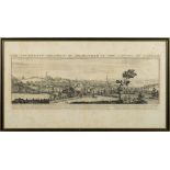

BUCK S & N - The South West Prospect of Birmingham, in the County of Warwick: large panoramic copper-engraving, size 770 x 240 mm, f & g, 1731. W...
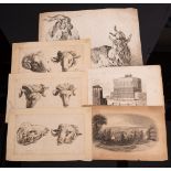
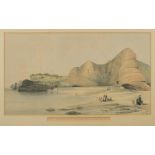
![BUCK, Samuel & Nathaniel - 4 [smaller size] copper engraved prospects. Richborow-Castle.](https://portal-images.azureedge.net/auctions-2021/bearne10092/images/6fe9147f-05af-4e28-87b0-ac690105cebd.jpg?w=155&h=155)
BUCK, Samuel & Nathaniel - 4 [smaller size] copper engraved prospects. Richborow-Castle. Saltwood Castle. Sandown Castle. Richmond Green, size 35...
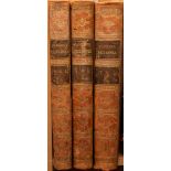
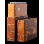
CAMDEN, William - Britannia : or, a Chorographical Description of the flourishing Kingdoms of England, Scotland, and Ireland ... 3 vols, portrait ...
CARICATURES: 4 hand coloured prints, size 330 x 225, published by S. W. Fores, 'Folio of Caricatures Rent Out For The Evening', Some damage and tw...
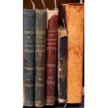
CARTO-BIBLIOGRAPHY : Chubb, Thomas, The Printed Maps in the Atlases of Great Britain and Ireland.
CARTO-BIBLIOGRAPHY : Chubb, Thomas, The Printed Maps in the Atlases of Great Britain and Ireland. A Bibliography, 1579-1870.Original cloth, stout ...
CARTO-BIBLIOGRAPHY : Shirley, Rodney W, Early Printed Maps of the British Isles 1477-1650 : cloth in d/w, 4to, Antique Atlas Publications, 1991. W...
CARTO-BIBLIOGRAPHY : Shirley, Rodney W, The Mapping of the World. Early printed world maps 1472-1700 : cloth in d/w, stout folio, Holland Press, 1...
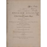
CARY, John - Cary's New Map of England and Wales, with part of Scotland : ... (etc), maps with org. hand colouring, in original red morocco wall...
CIPRIANI, J.
CIPRIANI, J. B : ' The Languishing Fair, ' coloured mezzotint, 290 x 200mm (to plate marks) engraved by J. K. Sherwin, published by E. Wyatt, 1787...
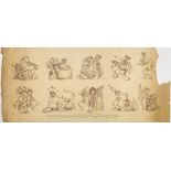
DANCE OF DEATH : ' Newton's Dances of Death,' copper engravings on three sheets, depicting 30 macabre caricatures, 'Invented drawn and Etch'd by R...
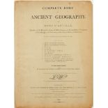
D'ANVILLE, Jean Baptiste - A Complete Body of Ancient Geography. By Mons. D'Anville ... neatly engraved on thirteen plates : published by Robert L...
DEVON : a large number of prints of Devon and Exeter, including many lithographs of Spreat's,
DEVON : a large number of prints of Devon and Exeter, including many lithographs of Spreat's, Churches (some in duplicate), etc. With the remains ...
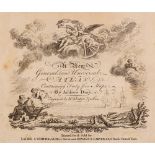
DURY, Andrew - A New General and Universal Atlas. Containing Forty Five Maps ... Engraved by Mr.
DURY, Andrew - A New General and Universal Atlas. Containing Forty Five Maps ... Engraved by Mr. Kitchen and others : Engraved title-page, dedicat...
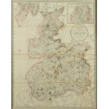
EBDEN, William : Laurie's New Map of the County Palatine of Lancaster, Divided into Hundreds the Mail Direct & Principal Cross Roads ... (etc). Ha...
Eric Gill [1882-1940] -Epiphany; nativity scene:-wood engraving 1930number 387 in the edition of 400 on paperimage 4 x 6.5cm.
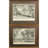
EXETER : A pair of uncoloured lithographs by William Spreat, ' View of the Clarence Hotel at Exeter.
EXETER : A pair of uncoloured lithographs by William Spreat, ' View of the Clarence Hotel at Exeter.' and ' Northernhay, Exeter.' size 290 x 195 m...
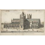
EXETER CATHEDRAL : 2 large eighteenth century copper plates by Bickham, 570 x 90mm (one laid down),
EXETER CATHEDRAL : 2 large eighteenth century copper plates by Bickham, 570 x 90mm (one laid down), 2 seventeenth copper plates by William Hollar,...
GREENWOOD, C & J/ Pringle, George - Map of the County of Somerset, from an actual survey made in the years 1820 & 1821:, large scale map with full...
HUNTING : 12 Comical hand coloured prints, approx. size 340 x 240mm, published by Fores, Piccadilly, 1886.
JARDIN, Karel Du : four engravings of sheep and goats with 2 other smaller prints.
JOHNSTON, Alex.
JOHNSTON, Alex. Keith - Handy Royal Atlas : 45 double-page maps with outline colouring, half morocco boards detached, folio, 1868. With two modern...
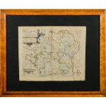
KIP, William : Hertfordiae - hand coloured map, size 345 x 280mm, f & g in a birds-eye maple frame,
KIP, William : Hertfordiae - hand coloured map, size 345 x 280mm, f & g in a birds-eye maple frame, 1637. ...[more]
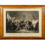
![KNIGHT, Charles : [1743-1826] after H.](https://portal-images.azureedge.net/auctions-2021/bearne10092/images/102c888c-e374-495a-9cda-ac690105d80c.jpg?w=155&h=155)
KNIGHT, Charles : [1743-1826] after H. Singleton- Two coloured engravings titled, "British Plenty" & " Scarcity in India,"published 1794 by C.Knig...
LEWIS, S - A Topographical Dictionary : 48 maps with original outline hand colouring, DISBOUND, 4to,
LEWIS, S - A Topographical Dictionary : 48 maps with original outline hand colouring, DISBOUND, 4to, maps drawn by R. Creighton, engraved by J & C...
LEWIS, S (publisher) - A Map of England and Wales Divided into Counties, Parliamentary Divisions & Dioceses: ... [etc] 3 ex. 4 parts. WITH - Dugda...
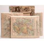
MAP JIGSAWS : 4 jigsaws published by George Philip, The London Geographical Institute, 1900 ? With - Shirley, Rodney W, Printed Maps of the Britis...
![Marcel Schuette [19/20th Century]- Ypres before The Great War,:- etching, signed and dated 1929,](https://portal-images.azureedge.net/auctions-2021/bearne10092/images/16f49181-26ac-4630-bb24-ac690105da56.jpg?w=155&h=155)
Marcel Schuette [19/20th Century]- Ypres before The Great War,:- etching, signed and dated 1929,
Marcel Schuette [19/20th Century]-Ypres before The Great War,:- etching, signed and dated 1929, inscribed and titled and numbered 45/150, 34 x 51c...
MOLL, Herman - A New Description of England and Wales: 44 ex. ? county maps, half calf worn oblong folio, lacks all before the map of Cornwall whi...
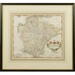
MORDEN, Robert - Devonshire : hand coloured map, size 415 x 355 mm, some foxing, f & g in an attractive Hogarth frame, first edition, 1695. ...[...
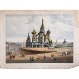
MOSCOW : ' Basilique De Saint Basile,' hand coloured lithograph, size 340 x 250 mm, Lemercier,
MOSCOW : ' Basilique De Saint Basile,' hand coloured lithograph, size 340 x 250 mm, Lemercier, some short closed tears without loss one impinges ...
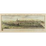
NEW YORK : large panoramic hand coloured engraving, by Charles Mottram [1807-1876] after John William Hill, published 1855 by F & G.W. Smith, Beek...
ORDNANCE SURVEY : ...
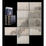
ORDNANCE SURVEY : ... CORNWALL and parts of West Devon - large uncoloured map folding in to 84 sections in 10 sheets mounted on linen, in attracti...
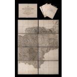
ORDNANCE SURVEY : The second part of the general survey of England and Wales. Containing the whole of DEVON and a proportion of the adjoining coun...

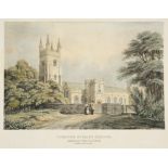
OXFORD : View of the High Street, hand coloured aquatint by J. Farington, published by J & J.
OXFORD : View of the High Street, hand coloured aquatint by J. Farington, published by J & J. Boydell, size 320 x 220mm, f & g.1793, With another ...
PEROIDCALS : The Queen, (1879). I L N, (1858). I L N, ( 1859 ). I L N, (1866). Art Journal Illustrated Catalogue, ( 1851 ). all folio, various bin...
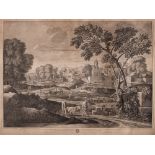
POUSSIN, Nicholas : ...
POUSSIN, Nicholas : ... (1594-1665) , Leading painter in the French Baroque style, although he spent most of the time working in Rome. Most of his...
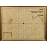
PRICE, John - A Chart of the Chops of the Channel, to the South of Scilly Islands; containing the West Coast of Cornwall and the Scilly Islands: h...

REDOUTE, P. J: A pair of hand coloured botanical studies, size 290 x 220mm, f & g, c1830s.
REMBRANDT Harmenszoon van Rijn : (1606 - 1669) ... The Three Trees, etching (later impression in reverse), 280 x 205 mm. With other prints etc inc...
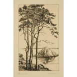
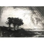
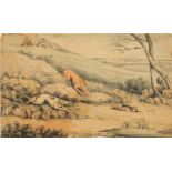
![Rowland Hilder [1905-1993]- The Passing Shower,](https://portal-images.azureedge.net/auctions-2021/bearne10092/images/0063c23d-61ba-415b-b34e-ace500b9f4f6.jpg?w=155&h=155)
Rowland Hilder [1905-1993]-The Passing Shower,:-soft ground etching with aquatintsigned in pencil in the bottom margin, numbered 44/175,image size...

SIEGE OF LUCKNOW : 15 tinted lithograph prints on 12 sheets by Clifford Henry Mecham, single sheets size 360 x 240mm, in good order except for som...
SPEED, John - The Theatre of the Empire of Great-Britain:... Together with a Prospect of the most Famous Parts of the World, viz. Asia, Africa, E...
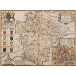
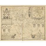
SPEED, John - Devonshire With Excester Described : hand coloured map, published by John Sudbury & John Humble, size 505 x 370 mm, framed and doubl...
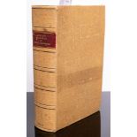
SPEED, John - Historie of Great Britaine..... : rebound in hessian by Foyle, folio, some edge wear to title-page with a small repair without loss ...
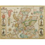
SPEED, John - The Kingdome of Scotlande: hand coloured map, size 510 x 385 mm, published by Thomas Bassett and Richard Chiswell, English text on v...

SPEED, John - The Mape of Hungari, hand coloured map, size 510 x 390 mm, published by George Humble,
SPEED, John - The Mape of Hungari, hand coloured map, size 510 x 390 mm, published by George Humble, English text on verso, in a Hogarth frame, do...
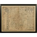
SPEED, John - Wiltshire : uncoloured map, size 515 x 390mm, published by John Sudbury & George Humble, English text on verso, LAID DOWN, f & g, c...
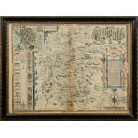
SPEED, John - Wiltshire : hand coloured map, published by John Sudbury & John Humble, size 505 x 475mm, pronounced staining to centre fold. 'old' ...
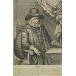
SPEED, John : Copper engraved portrait print of John Speed, size 295 x 190 mm, in a good quality Hogarth frame, 1629.* A scarce print of this fa...
SPEED, John : twenty-one maps of Great Britain Counties. Most are in a very fragile state or are quite defective. For a serious restoration projec...
SPREAT,
SPREAT, W : 'Line of The South Devon Railway from Dawlish Sands to Hole Head ' With - ' Line of The Railway across The Warren at Langstone Cliff [...
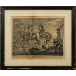
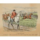
Sr. Hudibras his passing Worth.
Sr. Hudibras his passing Worth. The Manner how he sally'd forth: 18th century copper engraving, 335 x 265 mm, f & g, Printed for Robert Sayer, c1...
STANFORD'S Atlas of New Zealand.
STANFORD'S Atlas of New Zealand. The Provinces of Nelson and Marlborough with the adjacent parts of Wellington and Canterbury : large coloured fol...
STUBBS, George : ' Shooting,' Plates 1 & 2, large copper engravings 530 x 390mm, some damage at the edges and plate one with a rather long rust m...