Filtered by:
- Sale Section,
- Category
- List
- Grid
A subscription to the Price Guide is required to view results for auctions ten days or older. Click here for more information

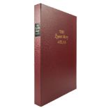
FOLIO SOCIETY : The Queen Mary Atlas, original red calf in original solander box, with Commentary by Peter Barber, maps, folio, limited 1000 copie...
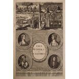
JOSEPHUS, Flavius - The Works : Translated by Sir Roger L'Estrange, prints, maps, full calf, folio,
JOSEPHUS, Flavius - The Works : Translated by Sir Roger L'Estrange, prints, maps, full calf, folio, 1702.
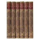
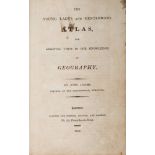
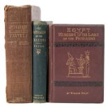
ROLLIN, M - The Ancient History of the Egyptians, Carthaginians, Assyrians, Babylonians, Medes and Persians, Grecians, and Macedonians : 6 vols, m...
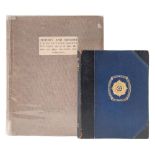
MACHINE GUN CORPS - History and memoir of the 33rd Battalion Machine Gun Corps and of the 19th,
MACHINE GUN CORPS - History and memoir of the 33rd Battalion Machine Gun Corps and of the 19th, 98th, 100th and 248th M.G. Companies : illust, map...
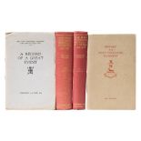
WYRALL, Everard - The West Yorkshire Regiment in the War 1914-1918 : 2 vols, illust, maps, org.
WYRALL, Everard - The West Yorkshire Regiment in the War 1914-1918 : 2 vols, illust, maps, org. cloth, tall 8vo, no date. With 2 pamphlets on the ...
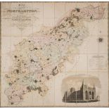
GREENWOOD,
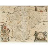
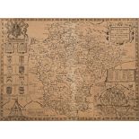
GREENWOOD, C & J - Map of the County of Northampton from an Actual Survey made in the Years 1825 & 1826 : large folding hand coloured map mounted ...
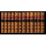
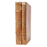
HASTED, Edward - The History and Topographical Survey of the County of Kent : 12 vols, half calf attractively rebacked with contrasting labels, 33...
LIVINGSTONE, David - Missionary Travels in South Africa : 2 folding maps, org. cloth spine torn, 8vo, 1857. With 2 other travel books.(3)
LYSONS, D & S - Magna Britannia ... DEVONSHIRE : 2 vols, maps, plates, cont diced calf worn on spines, 4to, 1822.
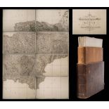
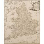
ORDNANCE SURVEY : The Second Part of the General Survey of England and Wales Containing the whole
ORDNANCE SURVEY : The Second Part of the General Survey of England and Wales Containing the whole of Devon ... (etc), sheets 20, 21, 22, 23, 24, 2...
RUSSELL P.
RUSSELL P. & PRYCE, Owen - England Displayed : 2 vols bound in 1, County maps and plates, reverse calf very worn, folio, 1769. ...[more]
SHAPTER, Thomas - The History of the Cholera in Exeter in 1832 : fold map, org. cloth, 8vo, 1849.
SHAPTER, Thomas - The History of the Cholera in Exeter in 1832 : fold map, org. cloth, 8vo, 1849. With - Baker, George, An Inquiry Concerning the ...
TEMPLE, Sir Richard - Oriental Experiences : 5 maps, illust, full calf, 8vo, John Murray, 1883.
TEMPLE, Sir Richard - Oriental Experiences : 5 maps, illust, full calf, 8vo, John Murray, 1883. With - Brassey, Mrs, A Voyage in the 'Sunbeam' Our...
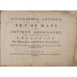
ATLAS : Geographia Antiqua : Being a Complete Set of Maps of Ancient Geography. Beautifully Engraved from Cellarius - 33 maps, calf backed boards,...
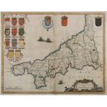
BLAEU, Jan - Cornwall : hand coloured map, 490 x 385 mm, Latin text, f & g, c1645. ...[more]
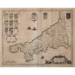
BLAEU, Jan - Cornwall : uncoloured map, 490 x 385 mm, Latin text, c1645.
BLAEU, Jan - Leicestrensis Comitatus. Leicesteshire : hand coloured map, 490 x 380 mm, English text, f & g, c1645 [or later].
CORNWELL, James - A School Atlas : uncol. map frontis, 27 maps with outline colouring, org. cloth lacks spine, 8vo, c1871. With 3 others.(4)
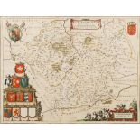
JANSSON, Jan - Devoniae Descriptio. The Description of Devon-Shire : hand coloured map, 490 x 385 mm, German text on verso, f & g, c1644 [or later...
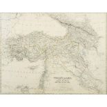
JOHNSTON, Keith - Turkey in Asia Minor : map coloured in outline, 575 x 435 mm, f & g, c1880s.
JOHNSTON, Keith - Turkey in Asia Minor : map coloured in outline, 575 x 435 mm, f & g, c1880s.
WITHDRAWN (COMBINED WITH LOT 308) ( KITCHEN, T ) A Map of England and Wales : uncoloured map,
WITHDRAWN (COMBINED WITH LOT 308)( KITCHEN, T ) A Map of England and Wales : uncoloured map, 490 x 380 mm, f & g, laid down, c 1750.

KITCHEN, Thomas & Jefferys, Thomas - Devonshire : hand coloured map, 130 x 110 mm, f & g, 1749.
KITCHEN, Thomas & Jefferys, Thomas - Devonshire : hand coloured map, 130 x 110 mm, f & g, 1749. With an Archer map of Devon, and a 19th cent. copy...
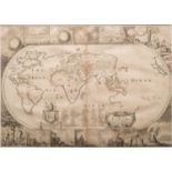
Moxon, Joesph - A Map of all the Earth : World map surrounded with scenes from the Bible, interestingly California is shown as an island, 445 x 31...
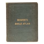
MURPHY, William - The Bible Atlas : a series of maps illustrating the Old and New Testaments,
MURPHY, William - The Bible Atlas : a series of maps illustrating the Old and New Testaments, 24 maps with outline colouring, org. cloth, small 4t...
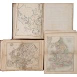
PAYNE, Frances - An Atlas of Europe with short descriptions : 13 maps in manuscript,with outline colouring, half calf, 4to, 1836. With worn copies...
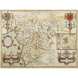
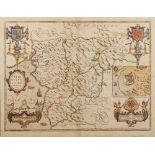
SPEED, John - Merionethshire Described : hand coloured map, 510 x 380 mm, English text on verso,
SPEED, John - Merionethshire Described : hand coloured map, 510 x 380 mm, English text on verso, George Humble, f & g, 1610 [or later].
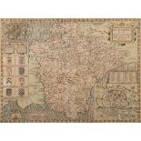
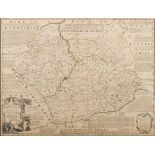
SPEED, John - Devonshire with Excester Described : hand coloured map, 510 x 380 mm, John Sudbury & George Humble, English text, f & g, c1610 ...[...
SPEED, John - Devonshire with Excester Described : uncoloured map, 510 x 380 mm, John Sudbury & George Humble, age toning, centre fold prominent, ...
SPEED, John - Merionethshire Described : hand coloured map, 510 x 380 mm, Bassett & Chiswell,
SPEED, John - Merionethshire Described : hand coloured map, 510 x 380 mm, Bassett & Chiswell, English text on verso, oak frame, c1670s.
![SPEED, John - Sussex Described : hand coloured map, 500 x 385 mm, George Humble, [English text],](https://portal-images.azureedge.net/auctions-2019/bearne10072/images/74e4de69-bc2f-4100-8631-a9ec00fbc27a.jpg?w=155&h=155)
SPEED, John - Sussex Described : hand coloured map, 500 x 385 mm, George Humble, [English text],
SPEED, John - Sussex Described : hand coloured map, 500 x 385 mm, George Humble, [English text], f & g, c1610 (or later).