Filtered by:
- Sale Section
- List
- Grid
A subscription to the Price Guide is required to view results for auctions ten days or older. Click here for more information
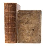

BIBLE : The Holy Bible containing the Old Testament and the New, calf, 4to, lacks at the rear all after 32pp of Psalm, Oxford, 1712. With an incom...
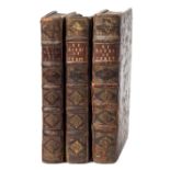
RODRIGUEZ, Alphonsus - The Practice of Christian Perfection : 3 vols, calf, 4to, London, 1697.
RODRIGUEZ, Alphonsus - The Practice of Christian Perfection : 3 vols, calf, 4to, London, 1697.
![After Franscois Nicholas Martinet [18th Century]- four ornithological lithographs,:- Pie Male,](https://portal-images.azureedge.net/auctions-2019/bearne10072/images/b462646c-68b7-463b-98bd-a9ec00fb7e0c.jpg?w=155&h=155)
After Franscois Nicholas Martinet [18th Century]- four ornithological lithographs,:- Pie Male,
After Franscois Nicholas Martinet [18th Century]- four ornithological lithographs,:- Pie Male, Le Coq de Roche D'Amerique, La Poule de Virgine, La...
After Pecheux & Gatine-Bouquetiere sur la place de la Cathedrale a Rouen,:-hand coloured engraving, together with eight similar, each sheet size 3...
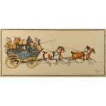
ALDIN, Cecil : a pair of coaching prints, 645 x 290 mm, Lawrence & Jellico, f & g.
A pair of prints by George Baxter The Great Exhibition:, arch mounted, framed and glazed.
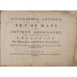
ATLAS : Geographia Antiqua : Being a Complete Set of Maps of Ancient Geography. Beautifully Engraved from Cellarius - 33 maps, calf backed boards,...
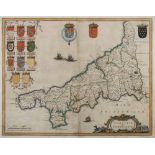
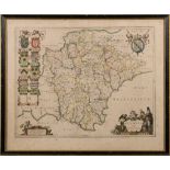
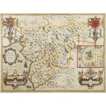
BLAEU, Jan - Cornwall : hand coloured map, 490 x 385 mm, Latin text, f & g, c1645. ...[more]
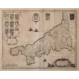
BLAEU, Jan - Cornwall : uncoloured map, 490 x 385 mm, Latin text, c1645.
BLAEU, Jan - Devon : hand coloured map, 490 x 390 mm, f & g, c1645. ...[more]
BLAEU, Jan - Leicestrensis Comitatus. Leicesteshire : hand coloured map, 490 x 380 mm, English text, f & g, c1645 [or later].
BLOME, Richard - A Mapp of Devon Shire With it's Hundreds : hand coloured map, 310 x 255 mm, 1673.
BLOME, Richard - A Mapp of Devon Shire With it's Hundreds : hand coloured map, 310 x 255 mm, 1673. With Dawson's plan of Exeter (1835); Badeslade ...
BLOME, Richard - A Mapp of Devonshire with it's Hundreds : uncoloured map, 330 x 270 mm, f & g,
BLOME, Richard - A Mapp of Devonshire with it's Hundreds : uncoloured map, 330 x 270 mm, f & g, 1673. With a pair of aquatints in verre eglomise m...
![CAMDEN'S Britannia : [Gibson edition], 44 folding county maps, 6 other maps, 9 plates of coins,](https://portal-images.azureedge.net/auctions-2019/bearne10072/images/57b530b5-689f-4699-a6ab-a9ec00fb7634.jpg?w=155&h=155)
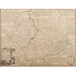
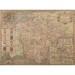
CAMDEN'S Britannia : [Gibson edition], 44 folding county maps, 6 other maps, 9 plates of coins,
CAMDEN'S Britannia : [Gibson edition], 44 folding county maps, 6 other maps, 9 plates of coins, calf worn, folio, short tears mainly to margins, o...

CHINESE CULTURAL REVOLUTION : 'Advance Bravely' silk screen propaganda poster, 750 x 510 mm, f & g,
CHINESE CULTURAL REVOLUTION : 'Advance Bravely' silk screen propaganda poster, 750 x 510 mm, f & g, c 1960s.
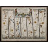
COLLINS, Sir Greenville - Torbay : hand coloured chart, 570 x 450 mm, f & g, c1690s. ...[more]
CORNWELL, James - A School Atlas : uncol. map frontis, 27 maps with outline colouring, org. cloth lacks spine, 8vo, c1871. With 3 others.(4)
DE FER, N - Partie Orientale D' Afrique : hand coloured map, 325 x 220 mm, attractively f & g, 1705.
DE FER, N - Partie Orientale D' Afrique : hand coloured map, 325 x 220 mm, attractively f & g, 1705.
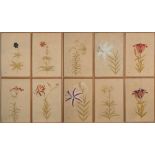
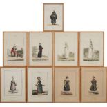
English School 19/20th Century- Varieties of Lily,:- a set of ten watercolours each 38 x 26cm.
English School 19/20th Century-Varieties of Lily,:-a set of ten watercolourseach 38 x 26cm. [10]Provenance. Ugbrooke House, Chudleigh, Devon.
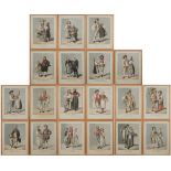
European School 19th Century-The Swiss Cantons,:-a set of 19 hand coloured soft ground coloured etchingseach sheet size 34 x 27cm. [19]Provenance....
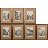
EXETER : a rare set of seven lithographs by Henry Besley, 215 x 130 mm, uniformly f & g, circa.
EXETER : a rare set of seven lithographs by Henry Besley, 215 x 130 mm, uniformly f & g, circa. mid-nineteenth cent.* David Edmund collection (7) ...
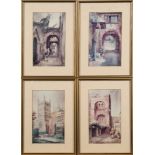
EXETER : Endacott, Sidney, Exeter Cathedral and the Bishop's Palace, 220 x 130 mm, limited edition of 8 photographs after watercolours, f & g. Wit...
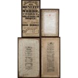
EXETER THEATRE ROYAL : Four Playbills including three printed on satin, f & g, 19th cent. * David Edmund collection ...[more]
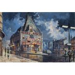
EXETER THEATRE ROYAL : Original watercolour of Exeter Theatre Royal by the scenic artist G. Sinclair, 520 x 355 mm, f & g, 1961. With a copy of th...
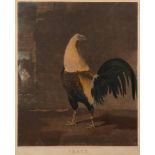
FIGHTING COCKS : a pair of mixed media coloured prints, 480 x 390 mm, C. Turner after B Marshall - 'War' and 'Peace'. f & g, [pub] J. Moore, 1851....
FORES, S.
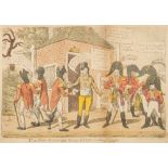
FORES, S.W - The New Military Road to York by Way of Frome : hand coloured caricature print, 350 x 230 mm, laid down on card, 1807.
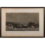
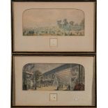
FORES'S Coaching Incidents : Flooded. From a Picture by C. C. Henderson, hand coloured aquatint engraved by J. Harris, 595 x 325 mm, 1845. With on...
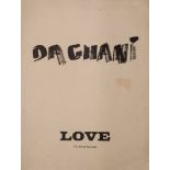
GOTCH, Linnet : 5 proof engravings (various sizes), c1970s - together with Daghani Love - ten brush drawings (660 x 505 mm). & 2 others.. ...[mor...
GREENWOOD,
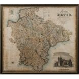
GREENWOOD, C & J - Map of the County of Devon : hand coloured map with vignette of Exeter Cathedral in the lower corner, 700 x 615 mm, f & g,1839....
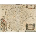
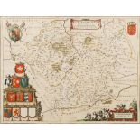
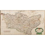
JANSSON, Jan - Devoniae Descriptio. The Description of Devon-Shire : hand coloured map, 490 x 385 mm, German text on verso, f & g, c1644 [or later...
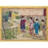
Japanese woodblocks : a collection of six coloured prints.
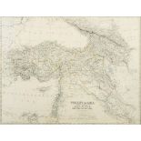
JOHNSTON, Keith - Turkey in Asia Minor : map coloured in outline, 575 x 435 mm, f & g, c1880s.
JOHNSTON, Keith - Turkey in Asia Minor : map coloured in outline, 575 x 435 mm, f & g, c1880s.
![Joseph Pennell [1860-1926]-The Venetian lagoon:etching, 10 x 21cm, f & g.](https://portal-images.azureedge.net/auctions-2019/bearne10072/images/0c83d481-9608-427b-9809-a9fc01108440.jpg?w=155&h=155)
Joseph Pennell [1860-1926]-The Venetian lagoon:etching, 10 x 21cm, f & g.
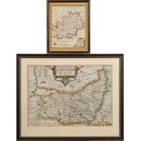
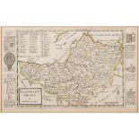
KIP, William - Suffolk : hand coloured map, 370 x 270 mm, f & g, c1673. With Morden's map of Ireland, and one other.(3)
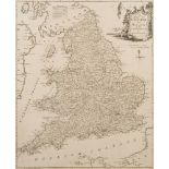
WITHDRAWN (COMBINED WITH LOT 308) ( KITCHEN, T ) A Map of England and Wales : uncoloured map,
WITHDRAWN (COMBINED WITH LOT 308)( KITCHEN, T ) A Map of England and Wales : uncoloured map, 490 x 380 mm, f & g, laid down, c 1750.

KITCHEN, Thomas & Jefferys, Thomas - Devonshire : hand coloured map, 130 x 110 mm, f & g, 1749.
KITCHEN, Thomas & Jefferys, Thomas - Devonshire : hand coloured map, 130 x 110 mm, f & g, 1749. With an Archer map of Devon, and a 19th cent. copy...
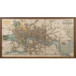
LONDON : Darton, William - An Entire New Plan of the Cities of London & Westminster, & Borough of Southwark ... (etc), hand coloured folding (now ...
MOLL, Herman - Somersetshire : map with original outline hand colouring, 310 x 185 mm, f & g, c1720.
MOLL, Herman - Somersetshire : map with original outline hand colouring, 310 x 185 mm, f & g, c1720. With - Morden, Robert, Hertfordshire, hand co...
MORDEN, Robert - Devon : hand coloured map, 420 x 355 mm, f & g, c1695. *Note nicely framed and coloured
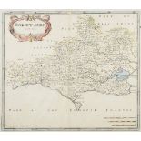
MORDEN, Robert - Dorsetshire : hand coloured map, 420 x 360 mm, f & g, c1695.
MORDEN, Robert - Kent : hand coloured map, 640 x 350 mm, stained oak frame, c1695.
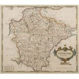
MORDEN, Robert - Somersetshire : hand coloured map, 420 x 360 mm, nicely f & g, c1695.
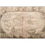
Moxon, Joesph - A Map of all the Earth : World map surrounded with scenes from the Bible, interestingly California is shown as an island, 445 x 31...
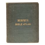
MURPHY, William - The Bible Atlas : a series of maps illustrating the Old and New Testaments,
MURPHY, William - The Bible Atlas : a series of maps illustrating the Old and New Testaments, 24 maps with outline colouring, org. cloth, small 4t...
OGILBY, John - Exeter to Dorchester & Plymouth to Dartmouth : hand coloured road map, 450 x 315 mm,
OGILBY, John - Exeter to Dorchester & Plymouth to Dartmouth : hand coloured road map, 450 x 315 mm, f & g, c1675. With 2 others. ...[more]
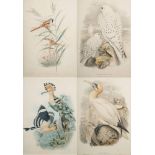
ORNITHOLOGICAL PRINTS : Upupa Epops, Calamophilus Biarmicus, Sula Bassana, Falco Candicans, 4 hand tinted lithographs, f & g. ...[more]
![ORTELIUS, Abraham - Fezzae et Marocchi Regna Africae Celeberrima : [ Morocco ], hand coloured map,](https://portal-images.azureedge.net/auctions-2019/bearne10072/images/18741291-a1c7-4bd7-8fc2-a9ec00fb63ea.jpg?w=155&h=155)
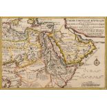
ORTELIUS, Abraham - Fezzae et Marocchi Regna Africae Celeberrima : [ Morocco ], hand coloured map,
ORTELIUS, Abraham - Fezzae et Marocchi Regna Africae Celeberrima : [ Morocco ], hand coloured map, 495 x 380 mm, f & g, c 1640s. ...[more]
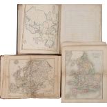
PAYNE, Frances - An Atlas of Europe with short descriptions : 13 maps in manuscript,with outline colouring, half calf, 4to, 1836. With worn copies...
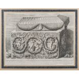
PIRANESI : Grand Urna Di Perfido - copper engraved print, 650 x 480 mm, f & g, n.d. ...[more]
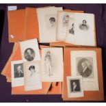
PORTRAITS : a collection of mainly 18th and 19th century prints.
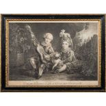
PRINT - Peint Par Drouais Le Fils Et Grave Par Beauvarlet, copper engraving, f & g. ...[more]
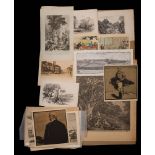
PRINTS : A folio of miscellaneous prints etc. ...[more]
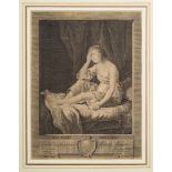
PRINTS : Cupidon ou L'Amour, La Vertu Irresque, Arion sauve par un dauphin, 3 copper engravings,
PRINTS : Cupidon ou L'Amour, La Vertu Irresque, Arion sauve par un dauphin, 3 copper engravings, f & g. ...[more]
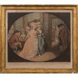
SMITH, J.R - 'The Promenade at Carlisle House' : hand coloured engraving, 395 x 320 mm, f & g, 1781.
SMITH, J.R - 'The Promenade at Carlisle House' : hand coloured engraving, 395 x 320 mm, f & g, 1781. (1) ...[more]
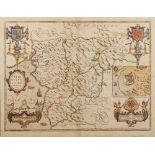
SPEED, John - Merionethshire Described : hand coloured map, 510 x 380 mm, English text on verso,
SPEED, John - Merionethshire Described : hand coloured map, 510 x 380 mm, English text on verso, George Humble, f & g, 1610 [or later].
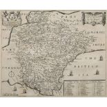
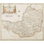
SPEED, John - Devonshire with Excester Described : hand coloured map, 510 x 380 mm, John Sudbury & George Humble, English text, f & g, c1610 ...[...
SPEED, John - Devonshire with Excester Described : uncoloured map, 510 x 380 mm, John Sudbury & George Humble, age toning, centre fold prominent, ...
SPEED, John - Merionethshire Described : hand coloured map, 510 x 380 mm, Bassett & Chiswell,
SPEED, John - Merionethshire Described : hand coloured map, 510 x 380 mm, Bassett & Chiswell, English text on verso, oak frame, c1670s.
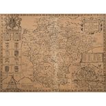
![SPEED, John - Sussex Described : hand coloured map, 500 x 385 mm, George Humble, [English text],](https://portal-images.azureedge.net/auctions-2019/bearne10072/images/74e4de69-bc2f-4100-8631-a9ec00fbc27a.jpg?w=155&h=155)
SPEED, John - Sussex Described : hand coloured map, 500 x 385 mm, George Humble, [English text],
SPEED, John - Sussex Described : hand coloured map, 500 x 385 mm, George Humble, [English text], f & g, c1610 (or later).