Refine your search
Sale Section
Remove filter- Maps, Documents, Printed Ephemera etc. (10)
Estimate
Category
Remove filter- Collectables (10)
Filtered by:
- Sale Section,
- Category,
- Item Type
- List
- Grid
A subscription to the Price Guide is required to view results for auctions ten days or older. Click here for more information
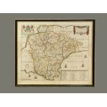

MAP OF DEVON.
MAP OF DEVON. An original 17th century framed 'Mapp (sic) of Devon Shire' by Richard Blome. 25.5 x 31.5cm. Please note that all items in this auc...
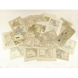
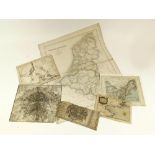
MAPS & PLANS.
MAPS & PLANS. Various maps & plans, mostly of the Home Counties, many hand coloured. Including, The Road from London to Rye & several drawn and en...
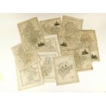
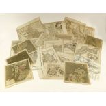
MAPS ETC.
MAPS ETC. A mid 19th century map of Holland & Belgium by Swanston, printed by McPherson. Also, an 18th century plan of Paris, a plan of the city o...
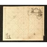
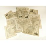
ANTIQUE MAP.
ANTIQUE MAP. An antique map of the Isles of Scilly c.1700, 'Humbly dedicated and presented by Capt. Greenvile Collins Hydrographer to the King, 16...
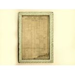
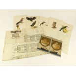
ST. AUSTELL FOUNDRIES.
ST. AUSTELL FOUNDRIES. A Victorian list of prices of materials delivered at St. Blazey & St. Austell foundry & hammer works by West & Sons. Showin...
SHIPPING LINES.
SHIPPING LINES. Six Union Castle Line R.M.M.V. Winchester Castle menus, all c.1937. Also, a Canadian Pacific, S.S. Montrose list of passengers fro...
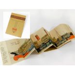
CUNARD AQUITANIA.
CUNARD AQUITANIA. A Cunard Aquitania souvenir, unfolding to show a cut-out, cross section of the ship. To the reverse, coloured illustrations of t...