Filtered by:
- Category
- List
- Grid
A subscription to the Price Guide is required to view results for auctions ten days or older. Click here for more information
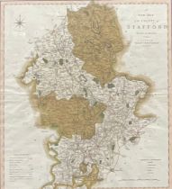

A New Map of the County of Stafford, Divided into Hundreds, printed for C Smith, No.172 Strand,
A New Map of the County of Stafford, Divided into Hundreds, printed for C Smith, No.172 Strand, January 6th 1801, 54cm x 48cm
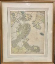
America - Davies, B R, an engraved and coloured map, Boston with Charlestown and Roxbury, published by George Cox, London, Jan 1st 1852, 38cm x 30...
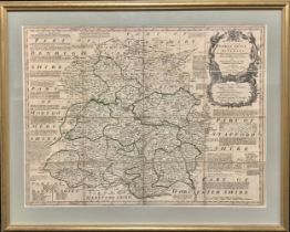
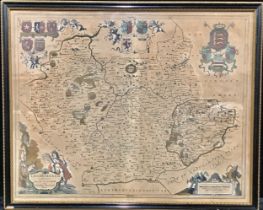
Emanuel Bowen (1694 - 1767), an engraved and coloured map, An Accurate Map of Shropshire Divided
Emanuel Bowen (1694 - 1767), an engraved and coloured map, An Accurate Map of Shropshire Divided Into Its Hundreds...., 54cm x 72cm
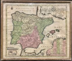
Georg Matthaus Seutter (1678 - 1757), an engraved and coloured two-page map, Spain and Portugal,
Georg Matthaus Seutter (1678 - 1757), an engraved and coloured two-page map, Spain and Portugal, Hispania Augustiniana...., 53cm x 63cm
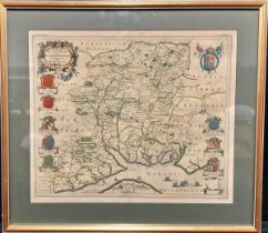
Jan Jansson, an engraved and coloured two-page map, Leicestershire, Leicestrensis Comitatus cum
Jan Jansson, an engraved and coloured two-page map, Leicestershire, Leicestrensis Comitatus cum Rutlandiae vulgo Leicester & Rutlandshire, 45.5cm ...
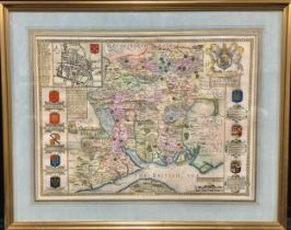
Johannes Blaeu (1596 - 1673), an engraved and coloured two-page map, Hampshire, Hantonia Sive
Johannes Blaeu (1596 - 1673), an engraved and coloured two-page map, Hampshire, Hantonia Sive Southantonenensis Vulgo Hantshire, 44cm x 52.5cm
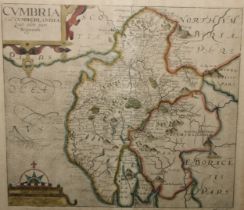
Johannes Kip (c.1652 - 1722), an engraved two-page coloured map, Cumbria, Cvmbria Sive Cvmberlandia..., derived from Saxton, 31.5cm x 36cm
John Speed (1551 or 52 - 1629), an engraved and coloured two-page map, Hampshire, Hantshire
John Speed (1551 or 52 - 1629), an engraved and coloured two-page map, Hampshire, Hantshire Described and Divided, 40cm x 52cm
![Robert Morden (1650 - 1703), an engraved and coloured two-page map, Darbyshire (sic) [Derbyshire],](https://portal-images.azureedge.net/auctions-2023/bamfor10894/images/d294b6d9-4d2f-4227-a9a6-b09a0126d31e.jpg?h=210)
Robert Morden (1650 - 1703), an engraved and coloured two-page map, Darbyshire (sic) [Derbyshire],
Robert Morden (1650 - 1703), an engraved and coloured two-page map, Darbyshire (sic) [Derbyshire], 37cm x 43cm
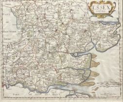
Robert Morden (c.1650 - 1703), an engraved and coloured two-page map, Essex, 36cm x 43cm
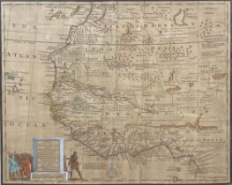
West Africa - Emmanuel Bowen (1694 - 1767), an engraved and coloured two-page map, A New & Accurate Map of Negroland and the Adjacent Countries; a...
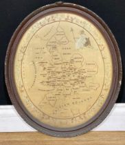
A George III needlework map sampler, England and Wales, by Elizabeth Fryer, Chatteris, worked with
A George III needlework map sampler, England and Wales, by Elizabeth Fryer, Chatteris, worked with the counties, within a meandering oval border o...
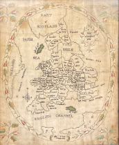
A George III oval needlework map sampler, England and Wales, worked with the counties and seated
A George III oval needlework map sampler, England and Wales, worked with the counties and seated Britannia, within a meandering border of ribbon-t...