Filtered by:
- Lots with images only,
- Category,
- Item Type
- List
- Grid
A subscription to the Price Guide is required to view results for auctions ten days or older. Click here for more information
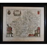

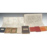
Blaeu, Johannes, an engraved and coloured two-page map, Wigorniensis comitatus et comitatus
Blaeu, Johannes, an engraved and coloured two-page map, Wigorniensis comitatus et comitatus Warwicensis nec non Coventrae libertas, Worcester, War...
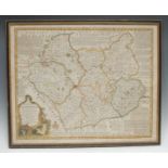
Emanuel Bowen (1694 -1767), by and after, An Accurate Map of the Counties of Leicester & Rutland [...], London: Printed for John Bowles [...], 1st...
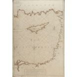
Joseph Roux (1725-1793), a large nautical map, Feuille X, I de Cypre, from Carte de la mer Mediterranee en douze feuilles, 84cm x 57cm
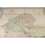
Local Interest - J. Dower, after Phillips (J.) and W.F. Hutchings, A Map of the County of Stafford, Divided into Hundreds & Parishes, From an accu...
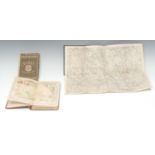
Local Interest - The Ordnance Map of Ashbourn (sic, Ashbourne) and the Neighbourhood, No. LXXII,
Local Interest - The Ordnance Map of Ashbourn (sic, Ashbourne) and the Neighbourhood, No. LXXII, Printed from one in Electrotype, Tower of London:...
Miscellaneous UK - James Wyld (1812-1887), by and after, Wyld's New Plan of London and its Vicinity,
Miscellaneous UK - James Wyld (1812-1887), by and after, Wyld's New Plan of London and its Vicinity, London: Published by James Wyld, Geographer t...
![Cartography - [Cary (John)] and Paterson (Daniel): three titles contemporaneously bound as one in](https://portal-images.azureedge.net/auctions-2020/bamfor10701/images/16e411e4-f4bf-4ace-80b0-ac5d00d53d4d.jpg?w=155&h=155)
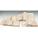
Cartography - [Cary (John)] and Paterson (Daniel): three titles contemporaneously bound as one in
Cartography - [Cary (John)] and Paterson (Daniel): three titles contemporaneously bound as one in a travelling sammelband, comprising Cary's Trave...
![Cartography - [Cary (John)], Cary's Survey of the High Roads from London [...], On a Scale of one](https://portal-images.azureedge.net/auctions-2020/bamfor10701/images/17c890b2-2829-40ab-a76a-ac5d00d53df7.jpg?w=155&h=155)
Cartography - [Cary (John)], Cary's Survey of the High Roads from London [...], On a Scale of one
Cartography - [Cary (John)], Cary's Survey of the High Roads from London [...], On a Scale of one Inch to a Mile [...], London: Printed for J. Car...
Cartography - A New and Accurate Description of the Present Great Roads and the Principal Cross
Cartography - A New and Accurate Description of the Present Great Roads and the Principal Cross Roads of England and Wales [...], London: Printed ...
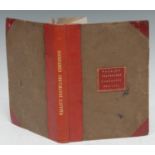
Cartography - Wallis's New Pocket Edition of the English Counties, or Traveller's Companion, in
Cartography - Wallis's New Pocket Edition of the English Counties, or Traveller's Companion, in which are carefully laid Down all the Direct & Cro...