Filtered by:
- Category,
- Creator / Brand
- List
- Grid
A subscription to the Price Guide is required to view results for auctions ten days or older. Click here for more information
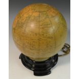

Cartography - an illuminated Phillips' British Empire Globe, the glass lamp applied with paper gores, 25cm high overall
Edward Weller, by and after, Bacon's Popular...Edward Weller, by and after, Bacon's Popular Map of England and Wales, published by G W Bacon & Co,...
Charles Smith (fl.
Charles Smith (fl. 1804), Smith's New Map of England and Wales with Part of Scotland, Including the Turnpike, and principal Cross Roads, the Cours...
George Vertue FSA (1684-1756), after Ralph (Radulph) Algus (c. 1540-1621), Civitas Londinum Ano Dni MDLX, Vertue Soc, Antiq. Lond. excudit 1737, [...
John Andrews (1736-1809), A New Physical, Historical, & Political Map, of England and Wales,
John Andrews (1736-1809), A New Physical, Historical, & Political Map, of England and Wales, From actual Surveys, & Astronomical Observations of t...
John Cary (c.
John Cary (c. 1754 - 1835), Cary's Reduction of his Large Map of England and Wales, with Part of Scotland; Comprehending the whole of the Turnpike...
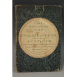
John Cary (c.
John Cary (c. 1754 - 1835), Cary's Reduction of his Large Map of England and Wales, with Part of Scotland; Comprehending the whole of the Turnpike...
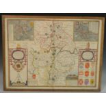
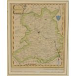
John Speed (1552-1629), by and after, a two-page map, The Counti (sic) of Warwick the Shire Towne (sic) and Citie (sic) of Co:ventre (sic) describ...
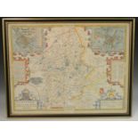
John Speed (1552-1629), by and after, two-page map, The Countie (sic) of Nottingham described,
John Speed (1552-1629), by and after, two-page map, The Countie (sic) of Nottingham described, The Shire Townes (sic) Situation and the Earls Ther...
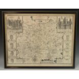
Local Interest - Christopher Greenwood (1786-1855) and John Greenwood (fl.1821-1840), A Map of the County of Derby, From an Actual Survey made in ...
Local Interest - Ordnance Survey, two parts laid on linen as one, North Staffordshire and part of Derbyshire, including The Potteries, Macclesfiel...
Local Interest, Transport - Ordnance Survey, three parts laid on linen as one, incorporating Staffordshire, Derbyshire and Nottinghamshire, with B...
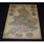
![Wales - Thomas Dix, Surveyor, [of] North Walsham (fl.](https://portal-images.azureedge.net/auctions-2020/bamfor10685/images/07f1c8e0-23dd-4f04-9ae4-ac0200e75eca.jpg?w=155&h=155)
Wales - Thomas Dix, Surveyor, [of] North Walsham (fl. 1820), A New Map of North Wales divided into its Six Counties or Shires, London: William Dar...
A large collection of Admiralty charts, flat folded charts 41 x 28in (104 x 71cm) on laid paper,
A large collection of Admiralty charts, flat folded charts 41 x 28in (104 x 71cm) on laid paper, covering British Isles, Norway, Canadian east coa...
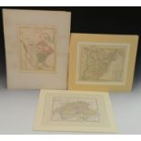
B Smith, an engraved coloured map, The United States of America, Confirmed by Treaty 1783, from C Smith's New General Atlas 1808, 24.5cm x 30cm; a...
John Speed (1552-1629), by and after, a two-page map, Surrey, Described and Divided into Hundreds,
John Speed (1552-1629), by and after, a two-page map, Surrey, Described and Divided into Hundreds, [London]: John Sudbury and George Humble, [n.d....
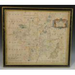
John Speed (1552-1629), by and after, two-page map, Stafford Countie (sic) and Towne (sic) with the ancient Citie (sic) Lichfeild (sic, Lichfield)...
Alex Hogg, A New Map of Shropshire, Drawn from the Latest Authorities, 21cm x 16.5cm
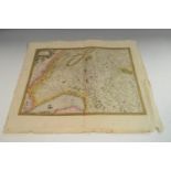
Gerard Mecator, a two-page coloured map, Das Wiflispur Gergov Switzerland Mercator Hondius 1623,
Gerard Mecator, a two-page coloured map, Das Wiflispur Gergov Switzerland Mercator Hondius 1623, 36cm x 47.5cm
John Ogilby (1600 - 1676), a two page map, The Roads from Exeter Com. Devon to Dorchester and From Plimouth (sic) to Dartmouth Com. Devon, no.94 f...
Robert Morden (1650 - 1703), a two page coloured map, Worcestershire, sold by Abel Swale Awnsham & John Churchill, 36.5cm x 42.5cm ...[more]
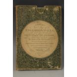
![Cartography - [Cary (John)], Cary's Survey of the High Roads from London [...](https://portal-images.azureedge.net/auctions-2020/bamfor10685/images/a86a1a9d-ea2a-46d0-b713-ac0200e76dce.jpg?w=155&h=155)
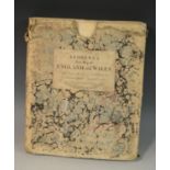
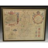
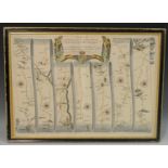
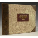
Cartography - [Cary (John)], Cary's Survey of the High Roads from London [...], On a Scale of one Inch to a Mile; Wherein Every Gentleman's Seat, ...
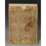
![Cartography - [Jefferys (Thomas)], Jefferys's Itinerary; or Travellers Companion, through England,](https://portal-images.azureedge.net/auctions-2020/bamfor10685/images/28a6d111-0bca-43f1-8151-ac0200e76e50.jpg?w=155&h=155)
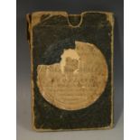
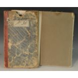
Cartography - [Jefferys (Thomas)], Jefferys's Itinerary; or Travellers Companion, through England,
Cartography - [Jefferys (Thomas)], Jefferys's Itinerary; or Travellers Companion, through England, Wales, and Part of Scotland, Containing All the...
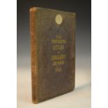
Cartography - Reynolds's Travelling Atlas of England: with All the Railways and Stations, Accurately Laid Down, Constructed from the Surveys of th...
Cartography - Senex (John, F.R.S.
Cartography - Senex (John, F.R.S.), The Roads through England delineated; or, Ogilby's Survey, Revised, Improved, and Reduced to a Size portable f...
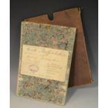
Cartography, Topography and Bibliography - Margary (Ivan D): Roman Ways in the Weald, first edition,
Cartography, Topography and Bibliography - Margary (Ivan D): Roman Ways in the Weald, first edition, London: Phoenix House Ltd, 1948, ochre cloth,...
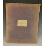
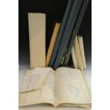
![Gaultier (Abbé [Aloïsius Édouard Camille]), A Complete Course of Geography,](https://portal-images.azureedge.net/auctions-2020/bamfor10685/images/4e174cd2-6417-4872-bdc4-ac0200e77632.jpg?w=155&h=155)
Gaultier (Abbé [Aloïsius Édouard Camille]), A Complete Course of Geography, By Means of Instructive Games [...], A New Edition, Corrected, Improve...