Refine your search
Filtered by:
- Sale Section,
- Category
- List
- Grid
A subscription to the Price Guide is required to view results for auctions ten days or older. Click here for more information

A New Map of the Country Twenty Miles Round (sic) London, Printed for Carington Bowles in St.
A New Map of the Country Twenty Miles Round (sic) London, Printed for Carington Bowles in St. Paul's Church Yard, London [n.d., c. 1780], copperpl...
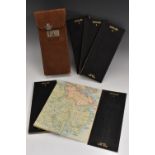
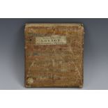
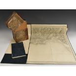
A set of four early 20th century maps, Scotland in 4 parts, Holland's Patent Duplex, printed and laid on canvas, floppy leather boards, tan leathe...
Astronomy and Cartography - Johann Gabriel Doppelmayr (1677 - 1750), by and after, astronomical chart, Ephemerides Motuum Coelestium Geometricae, ...
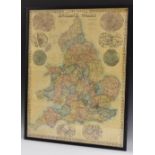
Edward Weller, by and after, Bacon's Popular Map of England and Wales, published by G W Bacon & Co,
Edward Weller, by and after, Bacon's Popular Map of England and Wales, published by G W Bacon & Co, London, 85cm x 66cm ...[more]
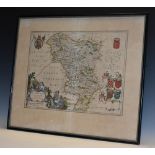
Joan Blaeu (1596 - 1673), by and after, a two-page map, Darbiensis Comitatvs, Vernacul Darbie Shire (sic, Derbyshire), proto-Baroque cartouche and...
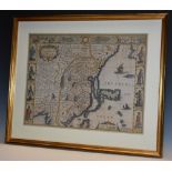
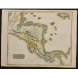
John Speed (1551/52 - 1629), by and after, two-fold map, The Kingdome (sic) of China, newly augmented by J.S., 1626, Are to be fold (sic) by Tho: ...
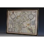
John Speed (1551/52 - 1629), by, two-fold map, Cumberland and the Ancient Citie Carlile (sic,
John Speed (1551/52 - 1629), by, two-fold map, Cumberland and the Ancient Citie Carlile (sic, Carlisle) Described with Many Memorable Antiquities ...
Wales - Major-General Thomas Frederick Colby FRS FRSE FGS FRGS (1784 - 1852), by and after,
Wales - Major-General Thomas Frederick Colby FRS FRSE FGS FRGS (1784 - 1852), by and after, a set of six Ordnance Survey maps: South Wales, Nos. 3...