Filtered by:
- Category
- List
- Grid
A subscription to the Price Guide is required to view results for auctions ten days or older. Click here for more information
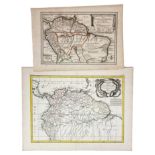

AMERICA -- "CARTE de la Terre Ferme de la Gyuana et du Pays des Amazones". Par., M. Bonne, 1771. Engr. map, cold. in outlines. 330 x 430 mm. -- "L...
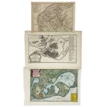
AMERICA -- COLOMBIA/CARTAGENA -- "PLAN des villes, forts, port, rade, et environs de Cartagena". Par., N. de Fer, 1705. Handcold. bird's eye plan ...
AMERICA -- COLOMBIA/CARTAGENA -- "PLAN van de haven van Carthagena". (Amst., Tirion, 1765). Handcold. engr. map. 180 x 315 mm. -- "CARTAGENA in Te...
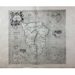
ASIA -- SRI LANKA/CEYLON -- "ASIÆ XII Tab.". N.d. (1584). Plain engr. map depicting Sri Lanka (Taprobana) from Ptolemy's 'Geographia' by G. Mercat...
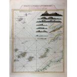
ATLANTIC -- "CHART, A, of the Maderas and Canary Islands, from the draughts and Memoirs of Cap.tn George Glas; (…)" - "CHART of the Açores (Hawks)...
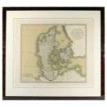
DENMARK -- "A NEW MAP OF THE KINGDOM OF DENMARK, Comprehending North and South Jutland, Zeeland, Fyen, Laaland and part of Holstein". London, J. C...
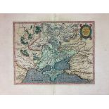
DENMARK -- "REGNUM DANIÆ cum Insulis et conterminis Terris, (…) per E.I. Dahlberg". (Stockholm
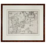
DENMARK -- "REGNUM DANIÆ cum Insulis et conterminis Terris, (…) per E.I. Dahlberg". (Stockholm), 1660. Engr. map by Cordier. 300 x 390 mm. Framed,...
EASTERN EUROPE -- "CARTE NOUVELLE DES ROYAUMES DE GALIZIE et Lodomerie avec le District de Bukowine". Augsburg, T.C. Lotter, n.d. (c. 1760). Spars...
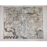
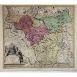
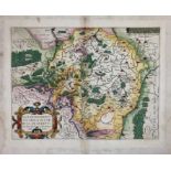
EASTERN EUROPE -- "MARAVANIÆ seu Moraviæ Marchionatus. Singulari fide ac diligentia chorographice de
EASTERN EUROPE -- "MARAVANIÆ seu Moraviæ Marchionatus. Singulari fide ac diligentia chorographice delineatus". (Antwerp, G. de Jode, 1593). Plain ...
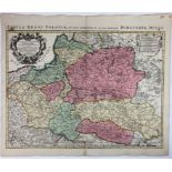
EASTERN EUROPE -- "MORAVIÆ NOVA et post omnes priores accur. delineatio. Auctore I.A. Comenio". (Amst.), N.J. Vischer, 1633. Cold. engr. map of Mo...
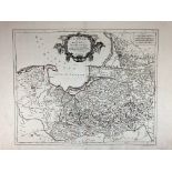
EASTERN EUROPE -- POLAND -- "CARTE DE LA POLOGNE AUTRICHIENNE Contenant la Russie Rouge et la partie méridionale du Palatinat de Cracovie, etc. Dr...
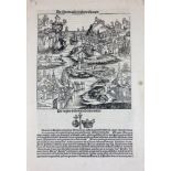
EASTERN EUROPE -- POLAND -- "DE SARMACIA REGIONE EUROPE. De Regno Polonie et eius initio". (Nuremberg, 1493). Plain woodcut with a bird’s eye view...
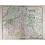
EASTERN EUROPE -- POLAND -- "LA PRUSSE divisée en Prusse Royale, et Prusse Ducale (…) par le Sr. Robert Géog.". Venice, Fr. Santini, (1778). Engr....
EASTERN EUROPE -- POLAND -- "LE ROYAUME DE POLOGNE". Venice, Fr. Santini, (c. 1776). Engr. map, sparsely cold. in outlines. 500 x 615 mm.
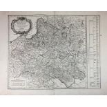
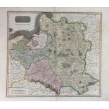
EASTERN EUROPE -- POLAND -- "LES ÉTATS DE LA COURONNE DE POLOGNE, sous les quels sont compris la Grand et la Petite Pologne, le Grand Duché de Lit...
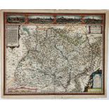
EASTERN EUROPE -- POLAND -- "LI PALATINATI CRACOWIA, Lekzyca, Sieradz, Sandomir, e Lublino." - "LI
EASTERN EUROPE -- POLAND -- "LI PALATINATI CRACOWIA, Lekzyca, Sieradz, Sandomir, e Lublino." - "LI PALATINATI di POSNANIA, Gniesno, Brzesc, Kalisz...
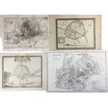
EASTERN EUROPE -- POLAND -- "PIANTA DI CRACOVIA". (Florence, 1831). Engr. plan of Krakow by G. Carini after Mostowski. 310 x 490 mm. (Multi folded...
EASTERN EUROPE -- POLAND -- "POLAND AS DIVIDED". (Lond., (etc.), 1817). Engr. cold. map by J. & G. Menzies, taken from Thomson's 'New general atla...
EASTERN EUROPE -- POLAND -- "POLONIA ET SILESIA". (Amst., Mercator/Hondius, 1613-16). Engr. map
EASTERN EUROPE -- POLAND -- "POLONIA ET SILESIA". (Amst., Mercator/Hondius, 1613-16). Engr. map in cont. colouring w. gold heightened cartouche in...

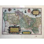
EASTERN EUROPE -- POLAND -- "POLONIA Regnum, et Silesia Ducatus". (Amst.), W.J. Blaeu, (1635-38
EASTERN EUROPE -- POLAND -- "POLONIA Regnum, et Silesia Ducatus". (Amst.), W.J. Blaeu, (1635-38). Plain engr. map of Poland w. 2 fine coats of arm...
EASTERN EUROPE -- POLAND -- "POLONIÆ finitimarumque locorum descriptio auctore Wenceslao Godreccio P
EASTERN EUROPE -- POLAND -- "POLONIÆ finitimarumque locorum descriptio auctore Wenceslao Godreccio Polono". (Antwerp, A. Ortelius, 1581). Engr. ma...
EASTERN EUROPE -- POLAND -- "REGNI POLONIÆ Ducatus Mazoviæ et Province Cujaviæ, Descriptio emendata
EASTERN EUROPE -- POLAND -- "REGNI POLONIÆ Ducatus Mazoviæ et Province Cujaviæ, Descriptio emendata". Amst., R. & J. Ottens, (c. 1720). Engr. map ...

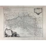
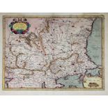
EASTERN EUROPE -- POLAND -- "REGNI POLONIÆ et Ducatus Lithuaniæ, Voliniæ, Podoliæ, Ucraniæ, Prussiæ
EASTERN EUROPE -- POLAND -- "REGNI POLONIÆ et Ducatus Lithuaniæ, Voliniæ, Podoliæ, Ucraniæ, Prussiæ, Livoniæ et Curlandiæ descriptio". Amst., F. d...
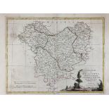
EASTERN EUROPE -- POLAND -- "TABULA REGNI POLONIÆ, Ducatus Lithuaniæ, &c ad usum Seren. Burgundiæ Ducis". Amst., Covens & Mortier, (c. 1730). Engr...
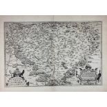
EASTERN EUROPE -- "REGNI BOHEMIÆ DESCRIPTIO". (Antwerp, A. Ortelius, 1570). Plain engr. map w. 2 large cartouches in left and right lower corner. ...
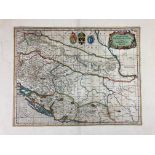
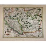
EASTERN EUROPE -- "SCLAVONIA, CROATIA, BOSNIA cum Dalmatiæ parte". (Amst., Mercator/Hondius, c
EASTERN EUROPE -- "SCLAVONIA, CROATIA, BOSNIA cum Dalmatiæ parte". (Amst., Mercator/Hondius, c. 1650). Engr. map in cont. colouring. 360 x 460 mm....
EASTERN EUROPE -- UKRAINE -- "TAURICA CHERSONESUS. Nostra ætate Przecopsca et Gazara dicitur. Per
EASTERN EUROPE -- UKRAINE -- "TAURICA CHERSONESUS. Nostra ætate Przecopsca et Gazara dicitur. Per Gerardum Mercatorem". (Amst., Mercator/Hondius, ...
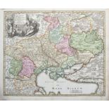
EASTERN EUROPE -- UKRAINE -- "UKRANIA quæ et Terra Cosaccorum cum vicinis Walachiæ, Moldaviæ
EASTERN EUROPE -- UKRAINE -- "UKRANIA quæ et Terra Cosaccorum cum vicinis Walachiæ, Moldaviæ, (etc.)". Nuremberg, J.B. Homann, n.d. (c. 1720). Eng...
EASTERN EUROPE -- "WALACHIA, Servia, Bulgaria, Romania". (Amst., Mercator/Hondius, 1623). Cold. engr
EASTERN EUROPE -- "WALACHIA, Servia, Bulgaria, Romania". (Amst., Mercator/Hondius, 1623). Cold. engr. map. 353 x 475 mm. V.d. Krogt I, 7602:1.1. l...
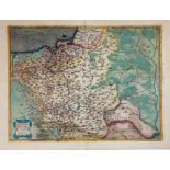
FRANCE -- "PROVINCIA/PROVENCE Auctore Petro Joanne Bompario". Amst., W.J. & J. Blaeu, n.d. (=1631). Cold. engr. map w. 3 coats of arms, scale indi...
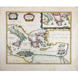
ITALY -- "ÆNEÆ TROIANI Navigatio Ad Virgilii Sex priores Æneidos". (Amst., J. Janssonius, c. 1652). Engr. map in cont. colouring. 353 x 500 mm. (A...
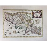
ITALY -- "NOVA & ACCURATA TUSCIÆ Antiquæ Descriptio Autore Ab. Ortelio". (Amst., J. Janssonius
ITALY -- "NOVA & ACCURATA TUSCIÆ Antiquæ Descriptio Autore Ab. Ortelio". (Amst., J. Janssonius, c. 1652). Engr. map by P. Kæarius in cont. colouri...
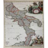
ITALY -- "NOVISSIMA & EXACTISSIMA Totius Regni Neapolis Tabula (…)". Nuremberg, J.B. Homann, n.d. (c
ITALY -- "NOVISSIMA & EXACTISSIMA Totius Regni Neapolis Tabula (…)". Nuremberg, J.B. Homann, n.d. (c. 1710). Engr. map in cont. colouring of the S...
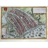
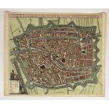
LOW COUNTRIES -- AMSTERDAM -- "AMSTELREDAMUM, nobile inferioris Germaniæ oppidum". (Cologne, Braun &
LOW COUNTRIES -- AMSTERDAM -- "AMSTELREDAMUM, nobile inferioris Germaniæ oppidum". (Cologne, Braun & Hogenberg, late 16th c.). Cold. engr. plan in...
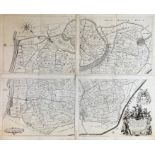
LOW COUNTRIES -- "CAERTE (…) DES RINGHS VAN PUTTEN, nae de meetinge gedaen by D. Schellincx Lantmeter inden jare 1617. Volgens het Origineel nombe...
LOW COUNTRIES -- "FRANEKER". 1598. Etched plan of the city in bird's eye perspective by P. Bast, cold. by hand, w. lots of details, 3 coats of arm...
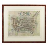
LOW COUNTRIES -- LEIDEN -- "LUGDUNI BATAVORUM VULGO LEYDEN sic ultimo amplificati delineatio". (Amst
LOW COUNTRIES -- LEIDEN -- "LUGDUNI BATAVORUM VULGO LEYDEN sic ultimo amplificati delineatio". (Amst., F. de Wit, ±1700). Cold. engr. plan in bird...
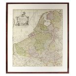
LOW COUNTRIES -- "NIEUWE KAART van de XVII Nederlandsche Provincien waar in aangewezen worden de landen door den Koning van Vrankryk geconquesteer...
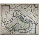
LOW COUNTRIES -- NIEUWKOOP -- "KAART (…) van de Gecombineerde Nieukoopsche Plas, en Plassen onder
LOW COUNTRIES -- NIEUWKOOP -- "KAART (…) van de Gecombineerde Nieukoopsche Plas, en Plassen onder Amstelland en het Sticht, (…) weegens het Bedyke...

LOW COUNTRIES -- "NOVUS XVII INFERIORIS GERMANIÆ PROVINCIARUM TYPUS de integro multis in locis emendatus à Guliel. Blaeu". Amst., W. Blaeu, (1662)...
LUXEMBURG -- "LUTZENBURGENSIS DUCATUS VERISS. DESCRIPT. Iacobo Surhonio Montano auctore". N.d., firs
LUXEMBURG -- "LUTZENBURGENSIS DUCATUS VERISS. DESCRIPT. Iacobo Surhonio Montano auctore". N.d., first h. 17th c. Cold. engr. map by P. Kærius take...
PORTUGAL -- "PORTUGALLIÆ quæ olim Lusitania, noviisima et exactissima desriptio, Auctore Vernando Al
PORTUGAL -- "PORTUGALLIÆ quæ olim Lusitania, noviisima et exactissima desriptio, Auctore Vernando Alvaro Secco, & de integro emendata, anno 1600"....
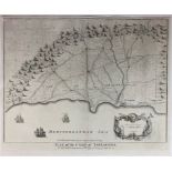
SPAIN -- "ANDALUZIA continens Sevillam et Cordubam". Plain engr. map, 2 dec. cartouches and 2 coats of arms. 380 x 500 mm. V.d. Krogt II, 6110:2. ...
SPAIN -- "PLAN OF THE CAMP OF TARRAGONA" - "AN EXACT DRAUGHT of the Bay and Harbour of Vigo" - "PLAN OF THE CITY AND CASTLE OF ALICANT, besieged b...
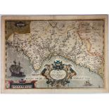
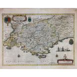
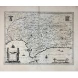
SPAIN -- "VALENTIÆ REGNI, olim Contestanorum Si Ptolemaeo, Edentanorum Si Plinio Credimus Typus
SPAIN -- "VALENTIÆ REGNI, olim Contestanorum Si Ptolemaeo, Edentanorum Si Plinio Credimus Typus". (Antwerp, Ortelius, n.d. (between 1584 and 1592)...