Filtered by:
- Category,
- Item Type
- List
- Grid
A subscription to the Price Guide is required to view results for auctions ten days or older. Click here for more information
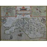

John Speede, "Glamorgan Shyre,
John Speede, "Glamorgan Shyre, with the sittuations of the chiefe towne cardyff and ancient Landaffe described"A hand coloured double glazed map, ...
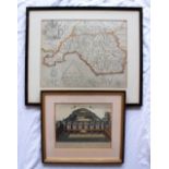
After Christopher Saxton and Guliemus Hole Glamorgan A later hand coloured map 27 x 34cm Together
After Christopher Saxton and Guliemus HoleGlamorganA later hand coloured map27 x 34cmTogether with a print of St Thomas's Hospital
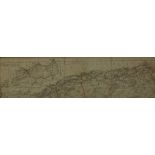
A War and Navy department Map of Maroc-Algerie-Tunisie, 20 x 76cm
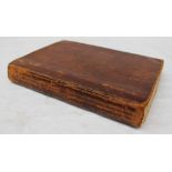
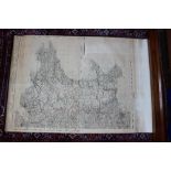
Cary (John). [New and Correct English Atlas: being a New Set of County Maps from actual surveys...
Cary (John). [New and Correct English Atlas: being a New Set of County Maps from actual surveys..., 1787], advertisement leaf, contents leaf, 46 e...
A mid 20th century Ordnance Survey map of Wales, Half Inch to One Statute Mile, with delineations in red, contained within a plinth which is 211cm...