Filtered by:
- Category
- List
- Grid
A subscription to the Price Guide is required to view results for auctions ten days or older. Click here for more information
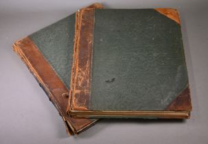

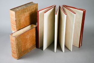
Maps of the Society of the Diffusion of Useful Knowledge, 2 vol., 218 engraved maps (including 51
Maps of the Society of the Diffusion of Useful Knowledge, 2 vol., 218 engraved maps (including 51 city plans and 6 celestial maps, 6 hand-coloured...
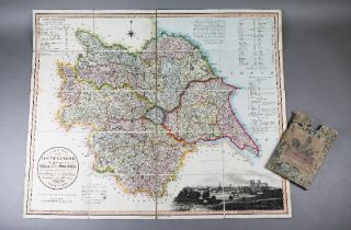
A George IV linen-backed folding map of Yorkshire by Thomas Dix, pub. William Darton, London 1820,
A George IV linen-backed folding map of Yorkshire by Thomas Dix, pub. William Darton, London 1820, 61 x 73 cm, in marbled board case
An early Victorian linen-backed large folding map of The County of Southampton (Hampshire), by C & J
An early Victorian linen-backed large folding map of The County of Southampton (Hampshire), by C & J Greenwood, pub: Greenwood, Pringle & Co, Lond...
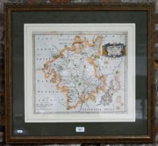
An 18th century County map engraving by Robert Morden, Worcestershire, 36.5 x 42 cm, mounted, framed
An 18th century County map engraving by Robert Morden, Worcestershire, 36.5 x 42 cm, mounted, framed and glazed
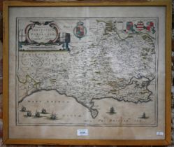
Two 17th century County map engravings 'Dorsestria' (Dorset), 38.5 x 51 cm, and 'Glocestria' (
Two 17th century County map engravings 'Dorsestria' (Dorset), 38.5 x 51 cm, and 'Glocestria' (Gloucestershire), 41 x 50.5 cm (2 - both framed and ...