Filtered by:
- Category
- List
- Grid
A subscription to the Price Guide is required to view results for auctions ten days or older. Click here for more information
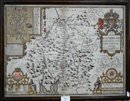

A 17th century county map engraving by John Speed, 'The Countie Westmorland and Kendale the Cheif
A 17th century county map engraving by John Speed, 'The Countie Westmorland and Kendale the Cheif Towne Described', 39 x 52 cm, framed and glazed ...
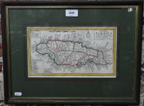
An 18th century map engraving of Jamaica 'Insula Jamaica in suas Parochias divisa', 15.5 x 28 cm,
An 18th century map engraving of Jamaica 'Insula Jamaica in suas Parochias divisa', 15.5 x 28 cm, mounted framed and glazed
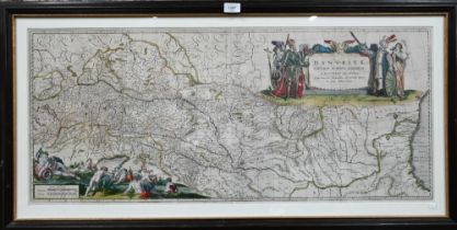
An 18th century map engraving by William Blaeu, 'Danubius Fluvius Europae Maximus', 41.5 x 96.5
An 18th century map engraving by William Blaeu, 'Danubius Fluvius Europae Maximus', 41.5 x 96.5 cm, mounted framed and glazed
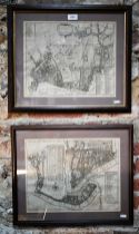
Two 1755 map engravings of London's East End, after John Stow's 1720 survey, 'Shoreditch' and 'St
Two 1755 map engravings of London's East End, after John Stow's 1720 survey, 'Shoreditch' and 'St John's Wapping/St Paul's Shadwell', 29.5 x 36 cm...
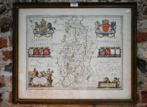
A 17th century county map engraving by Johannes Blaeu, Nottinghamshire, 39 x 50.5 cm, framed with
A 17th century county map engraving by Johannes Blaeu, Nottinghamshire, 39 x 50.5 cm, framed with text to reverse (stain and mould)
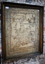
A Georgian silk needlework embroidered map of England and Wales, with Britannia top right; within
A Georgian silk needlework embroidered map of England and Wales, with Britannia top right; within trailing floral border, 64 x 56 cm in glazed gil...