Refine your search
Filtered by:
- Sale Section,
- Creator / Brand
- List
- Grid
A subscription to the Price Guide is required to view results for auctions ten days or older. Click here for more information
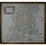

A 17th century county map engraving of Hampshire by Robert Morden, 37 x 42 cm, framed and glazed
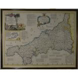
An 18th century county map engraving of Cornwall by Thomas Kitchin, 53 x 70 cm, framed and glazed
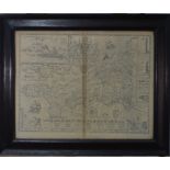
A 17th century county map engraving of Cornwall by John Norden and John Speed, uncoloured, with text on reverse, framed and glazed on both sides, ...
A 17th century county map engraving of Cornwall by John Norden and John Speed, later coloured, with text on reverse, 38.5 x 51 cm impression size,...
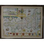
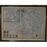
A 17th century county map engraving of Devonshire by John Speede, 39 x 52 cm, with text verso, framed and glazed on both sides
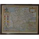
A 17th century county map engraving of Somerset_shire by John Speede, 39 x 52 cm
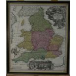
An early 18th century German map engraving of England and Wales, 'Regnum Angliae', by John Baptiste Homann, Nuremberg, 57 x 49 cm, framed and glaz...
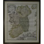
A William III map engraving of Ireland 'Hiberniae Regnum', after Sir William Petty & Nicolas Visscher (Amsterdam), 57 x 48 cm, framed and glazed ...
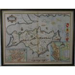
A 17th century county map engraving of 'Wight Island' (Isle of Wight) by John Speed after William White, 39 x 52 cm, with text on reverse, framed ...
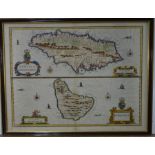
A 17th century map of Jamaica and Barbados by John Speed, 39 x 51 cm, with text on reverse, framed and glazed on both sides