Refine your search
Filtered by:
- Sale Section,
- Item Type
- List
- Grid
A subscription to the Price Guide is required to view results for auctions ten days or older. Click here for more information
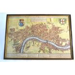

A Pocket Map of London, Westminster and Southwark, 'with ye New Buildings to ye Jear 1739', engraved by Henrick de Leth, Amsterdam, 50 x 33 cmMap ...
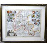
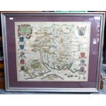
A 17th century county map engraving after Johannes Jansson (1588-1664), Oxonius (Oxfordshire) with Arms of the University Colleges, 48 x 49 cm imp...
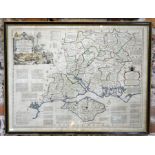
A Victorian steel engraved map of Hampshire and the Isle of White, over-printed with the counties' fox-hunts, to/w an 1805 map of Winchester and a...
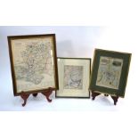
A 17th century map engraving after Saxton & Kip, 'Wiltoniae' (Wiltshire), 29 x 37 cm, framed and glazed, to/w a Robert Morden county map of Hampsh...
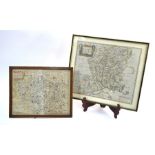
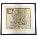
An 18th century map engraving after Thomas Kitchin (1718-84) 'A New Improved Map of Hampshire.....Divided into its Hundreds', 53 x 70 cm, framed a...
A 17th century country map-engraving after Willem & Jan Blaeu (circa 1640), Hantonia (Hampshire), 42 x 51 cm, mounted, framed and glazed ...[more]
A 17th century County map engraving of Hampshire by Robert Morden, 37 x 42 cm, mounted, framed and glazed