Filtered by:
- Show only bulk lots,
- Sale Section,
- Item Type
- List
- Grid
A subscription to the Price Guide is required to view results for auctions ten days or older. Click here for more information
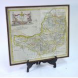

A 17th century County Map engraving after Robert Morden, 'Somersetshire' 37 x 43cm mounted, framed
A 17th century County Map engraving after Robert Morden, 'Somersetshire' 37 x 43cm mounted, framed and glazed
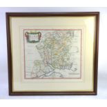
A 17th century map of Hampshire by Robert Morden 37 x 42 cm mounted, framed and glazed
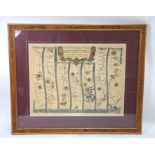
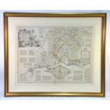
An Ogilby map engraving from The Road from London to Pool (sic), showing the road from Alresford
An Ogilby map engraving from The Road from London to Pool (sic), showing the road from Alresford to Poole, also Poole to Lymington and Winchester ...
An early 19th century map engraving of Southampton by Robert Dawson, Lieutenant Royal Engineers c.
An early 19th century map engraving of Southampton by Robert Dawson, Lieutenant Royal Engineers c.1830, 30 x 23, to/w a smaller Southampton map of...
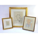
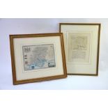
An engraved county map of Hampshire by Thomas Kitchin, 18 x 22.5cm, to/w a 17th century small map of
An engraved county map of Hampshire by Thomas Kitchin, 18 x 22.5cm, to/w a 17th century small map of Hampshire with distances between towns and vi...
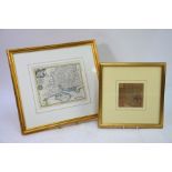
A map engraving of Hampshire with text, John Seller (c. 1700) to/w a steel-engraved Hampshire county
A map engraving of Hampshire with text, John Seller (c. 1700) to/w a steel-engraved Hampshire county map by I. Dower for Moules English Counties, ...
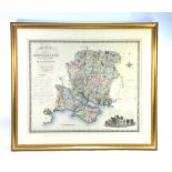
A large George IV map engraving of the 'County of Southampton' by C & I Greenwood, published 1829,
A large George IV map engraving of the 'County of Southampton' by C & I Greenwood, published 1829, 58 x 69 cm, mounted, framed and glazed ...[mor...
An 18th century map engraving of Hampshire by Thomas Kitchin, 54 x 65 cm, mounted, framed and
An 18th century map engraving of Hampshire by Thomas Kitchin, 54 x 65 cm, mounted, framed and glazed