Filtered by:
- Sale Section,
- Item Type
- List
- Grid
A subscription to the Price Guide is required to view results for auctions ten days or older. Click here for more information
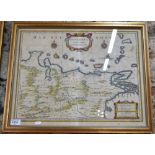

An 18th century Dutch map engraving of Venezuela, by Johannes Janssonius, with printed matter to the reverse, impression, 38 x 50 cm
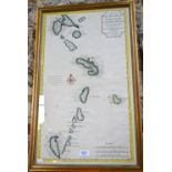
An 18th century French map engraving of the Lesser Antilles, with Grenada shown upside down (in order to fit in the panel!), dated 1717. Impressio...
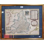
An 18th century map engraving by John Oglsby (sic), England, 38 x 50 cm Condition Report Foxing to top edge, overall rippling
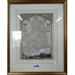
Two 17th century county map engravings, Rutland & Cheshire, by Robert Morden, to/w a 19th century steel engraving of Northumberland and a 1924 Ord...
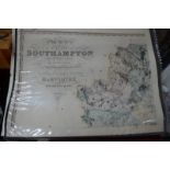
A George IV partial map engraving of Southampton and the Isle of Wight by C & J Greenwood, printed on two folio sheets, 1826